US Time Zone Map | US Map With Different Time Zone

US Time Zone Map | US Map With Different Time Zone is the Map of United States of America. You can also free download United States of America Map images HD Wallpapers for use desktop and laptop. Click Printable Large Map
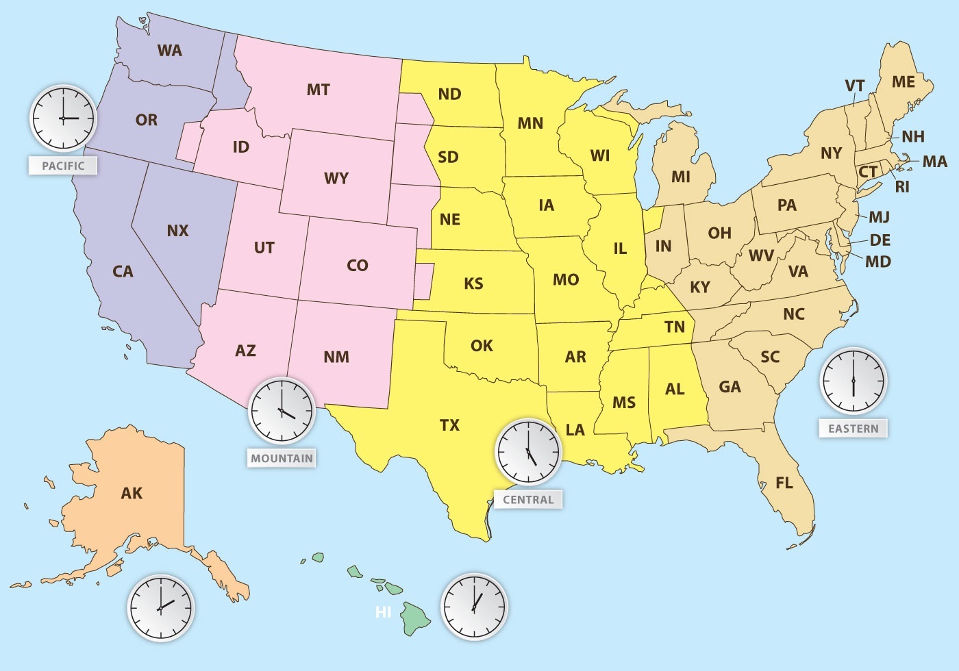
A Time Zone Map is ideally one of 24 spherical lunes (section on the globe in a north/south direction) with equal width, each assigned with one of the 24 hours (one day). Time Zone Map of the USA Is Divided into Nine Standard Time Zones.
From east to west they are Atlantic Standard Time (AST), Eastern Standard Time (EST), Central Standard Time (CST), Mountain Standard Time (MST), Pacific Standard Time (PST), Alaskan Standard Time (AKST), Hawaii-Aleutian Standard Time (HST), Samoa standard time (UTC-11) and Chamorro Standard Time (UTC+10). View Different Time Zone Map And boundaries.
The Different US Time Zone Map and DST observance are regulated by the Department of Transportation.
Large US Time Zone Map

US Time Zone List
| Offset |
Time Zone Abbreviation & Name |
Example City | |
| UTC -10 | HST | Hawaii Standard Time | Honolulu |
| UTC -8 | AKDT | Alaska Daylight Time | Anchorage |
| UTC -7 | PDT | Pacific Daylight Time | Los Angeles |
| MST | Mountain Standard Time | Phoenix | |
| UTC -6 | MDT | Mountain Daylight Time | Salt Lake City |
| UTC -5 | CDT | Central Daylight Time | Chicago |
| UTC -4 | EDT | Eastern Daylight Time | New York |
USA Time Zone Map
Most of the United States observing daylight saving time (DST) for approximately the spring, summer, and fall months. Daylight Saving Time Map of USA begins at 2:00 a.m. local time on the second Sunday in March. On the first Sunday in November areas on Daylight Saving Time return to Standard Time at 2:00 a.m.
Reference:


