Alabama Location Map | Location Map of Alabama

Alabama Location Map | Location Map of Alabama is the Map of Alabama. You can also free download Map images HD Wallpapers for use desktop and laptop. Click Printable Large Map
Alabama is located at a latitude of 32.3182° N and a longitude of 86.9023° W. With GPS coordinates of 32°50′5″N and 86°38′0″W, the geographic center of Alabama points to Chilton County, twelve miles outside of Clanton. The state is located in the southeastern United States between Mississippi and Georgia states.
| State Name | Alabama |
| Area | 135,767 km² |
| Area Ranking | 30 |
| Capital | Montgomery |
| Statehood Year | 1819 |
| Timezones | America/Chicago |
| Postal Abbreviation | AL |
| FIPS # | 01 |
Geography
Land Area: 50,744 sq mi. (131,427 sq km)
Geographic center: In Chilton Co., 12 mi. SW of Clanton
Number of counties: 67
The largest county by population and area: Jefferson, 658,327 (2012); Baldwin, 1,596 sq mi.
State forests: 21 (48,000 ac.)
State parks: 22 (45,614 ac.)
Physical Map of Alabama occupies an area of 135,767 km² (52,420 sq mi). Alabama is six times larger than New Jersey, but it would fit into Texas about five times. Alabama has four borders, each of which separates Alabama from another U.S. state. With Mississippi to the west and Georgia to the east, Alabama is south of Tennessee and north of a small percentage of Florida. The majority of Alabama’s southern border lies along the Gulf of Mexico.
Three of Alabama’s Four Borders Make Contact With Rivers as Well
Chattahoochee River in the east
Perdido River in the south
Tennessee River in the west
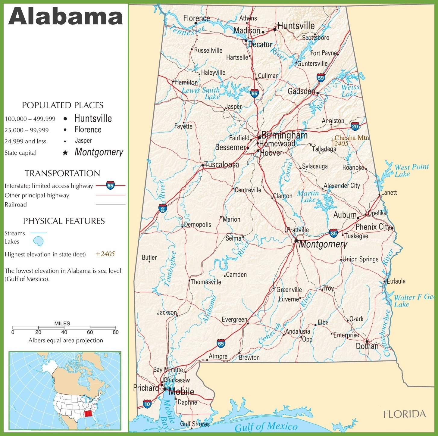
Alabama Road Map | Road Map of Alabama
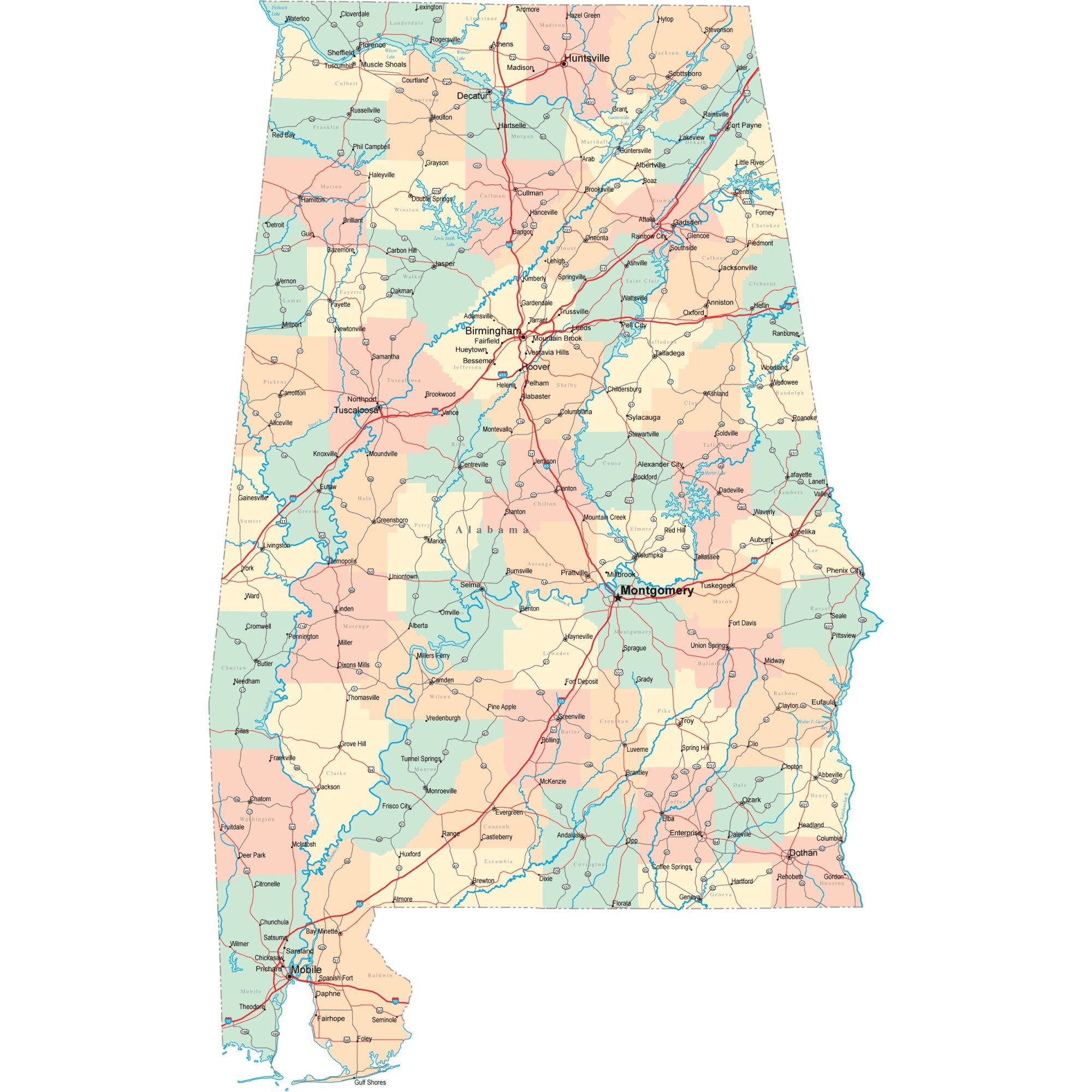
Alabama Highway Map Highway Map of Alabama, Transportation , Physical, populated Large Printable Map