Kentucky Transportation And Physical Map | Large Printable Map

Kentucky Transportation And Physical Map | Large Printable Map is the Map of Kentucky. You can also free download Map images HD Wallpapers for use desktop and laptop. Click Printable Large Map
Map of Kentucky is the 37th most extensive state with an area of 40,409 square miles. It is the 26th most populous state in the United States with 4.46 million people (2019 est.) Frankfort is the official state capital of Kentucky while Louisville is its largest city.
There are six major Interstate highways I-24, I-64, I-65, I-69, I-71, and I-75, and six bypasses and spurs I-165, I-169, I-264, I-265, I-275, and I-471. The busiest airports in the state are Cincinnati/Northern Kentucky International Airport and Louisville International Airport. The national passenger rail system is Amtrak. It provides service to Ashland, South Portsmouth, Maysville, and Fulton.
Kentucky is located in the eastern central section of the United States of America, between Tennessee and the Ohio River. The north-central part of the state is called the Bluegrass region, while the eastern section, the Cumberland Plateau is considered to be part of the Appalachian regions.
In the southeast part lies the somewhat lower Pennyroyal Plateau, north of which is the Western Coalfields. Jackson Purchase occupies the far western areas within the state. Kentucky is the only state that has an exclave, the Kentucky Bend, surrounded by the Mississippi River, and the state of Tennessee on the south.
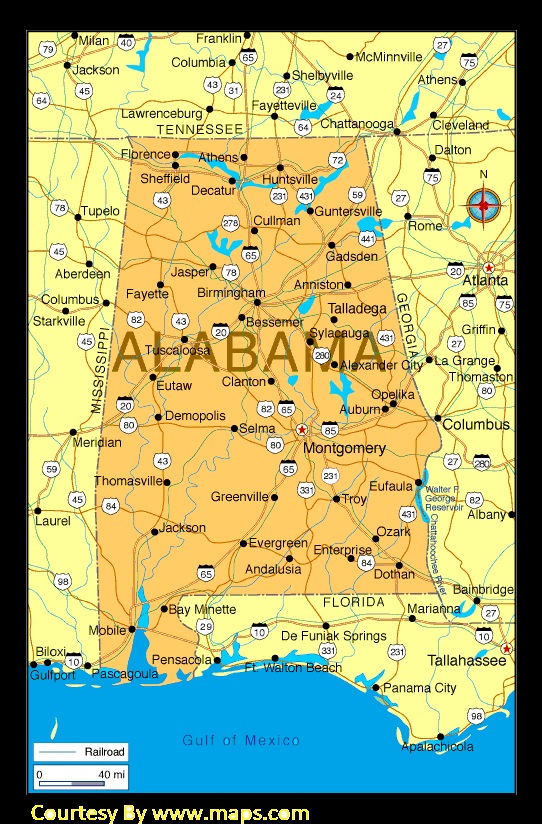
Alabama Large Political Map Political Map of Alabama With Capital , city and River lake
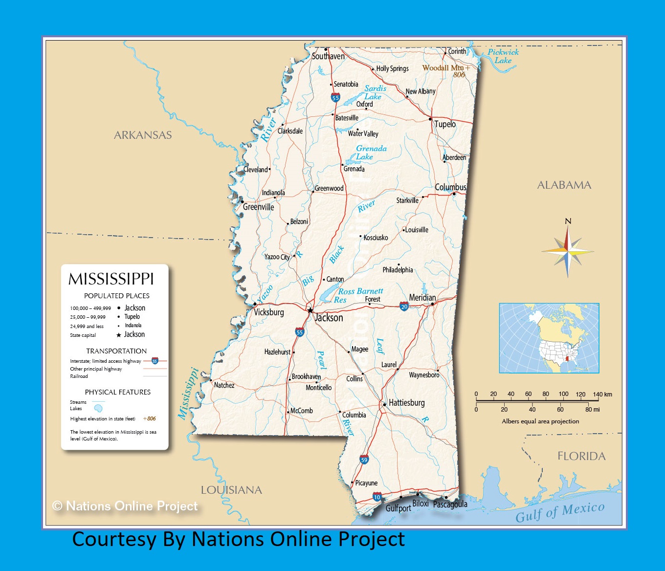
Mississippi Transportation and physical map large printable
| « Kansas Transportation and physical map large printable | Louisiana Transportation and physical map large printable » | |


