Map of Hawaii | Political, Physical, Geographical, Transportation, And Cities Map

Map of Hawaii | Political, Physical, Geographical, Transportation, And Cities Map is the Map of Hawaii. You can also free download Map images HD Wallpapers for use desktop and laptop. Click Printable Large Map
The US state of Hawaii is an island group located in the Pacific Ocean. It is the only U.S. state located outside North America. The state is made up entirely of a group of islands and is the northernmost island group in Polynesia. Map of Hawaii is the 43rd largest state of the country with an area of 10,931 square miles. It is the 40th most populous state of the country comprised of 1,428,557 people.
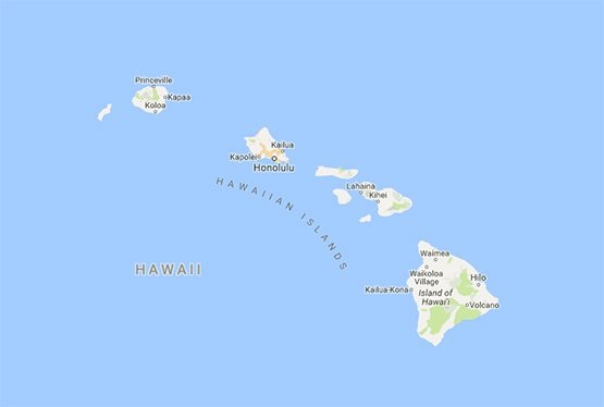
There are 137 islands spread over 1,500 miles (2,400 km) on the Hawaii Map. Niʻihau, Kauaʻi, Oʻahu, Molokaʻi, Lānaʻi, Kahoʻolawe, Maui, and the largest, Hawaiʻi are the main Eight islands on Hawaii Map. Hawaiʻi island is often called the “Big Island” or “Hawaii Island” to avoid confusion with the state.
Honolulu is the State capital of Hawaii as well as its largest city. The island of Oahu is the largest metro of the state. Mauna Kea is a volcano and has a height of 4,205 meters. It is also the highest point in the state. Hawaii is the most recent state to join the union, on August 21, 1959.
Hawaii Fast Facts
- Capital City: Honolulu (pop.) 377,357 (2008 est.)
- Hawaii Population: 1,392,313 (2012 est.) (40th)
- Currency: U.S. Dollar
- Language: English, others
- Largest Cities: (by population) Honolulu, Hilo, Kailua, Kaneohe, Waipahu, Pearl City
- Statehood: August 21, 1959 (50th state)
- Time Zone: UTC−10:00 (Hawaii)
Political Map of Hawaii

Hawaii state is made up entirely of islands and it is located in Oceania. It is the 43rd largest state of the country with an area of 10,931 square miles. The state not shares any land or water border with other states or countries.
The Eight Major islands of Political Map of Hawaii are Niihau (The Forbidden Isle), Kauai (The Garden Isle), Oahu (The Gathering Place), Molokai (The Friendly Isle), Lanai (The Pineapple Isle), Kahoolawe (The Target Isle), Maui (The Valley Isle), and Hawaii (The Big Island). The State capital and largest city is Honolulu.
Physical Map of Hawaii

The US state of Hawaii is an island group located in the Pacific Ocean. It is the only U.S. state located outside North America. The State consists of hundreds of islands spread over a distance of more than 2,400 km (1,500 mi). Hawaii is the only state with Asian plurality and archipelago. The state’s ocean coastline is about 750 miles (1,210 km) long. It is the fourth-longest in the U.S., after the coastlines of Alaska, Florida, and California.
Geography Map of Hawaii

The total area of the Hawaii islands is 28,313 km² (10,932 sq mi). Hawaii, Maui, Niihau, Kauai, Oahu, Molokai, Lanai, and Kahoolawe are the main eight islands of the state. Mauna Kea is the highest mountain in the state. It is a sleeping volcano that rises 4,205 m (13,796 ft) from sea level but measured from its base on the ocean floor to its peak, its height is 10,203 m (33,476 ft) which makes it the highest mountain on Earth.
Hawaii has two outstanding UNESCO World Heritage Sites. The Hawaiʻi Volcanoes National Park has two active superlative volcanoes on the island of Hawaii, Kīlauea and Mauna Loa. Mauna Loa is the world’s largest volcano, and Kīlauea is one of the world’s most active volcanoes.
Geography Statistics
- Land Area: (land) 6,423 sq miles (water) 4,508 sq miles (the number shown for water is over 99% Pacific Ocean territorial waters) (TOTAL) 10,931 sq miles
- Horizontal Width: 95 miles
- Bordering States: (0)
- Counties: (4) Map
- County: (largest by population) Honolulu, 876,156
- Geographic Center: (using the 8 largest islands) 16.5 miles southwest of the southern coastline of Lanai.
- Highest Point: Mauna Kea, 13,796 ft.
- Lowest Point: the Pacific Ocean, 0 ft.
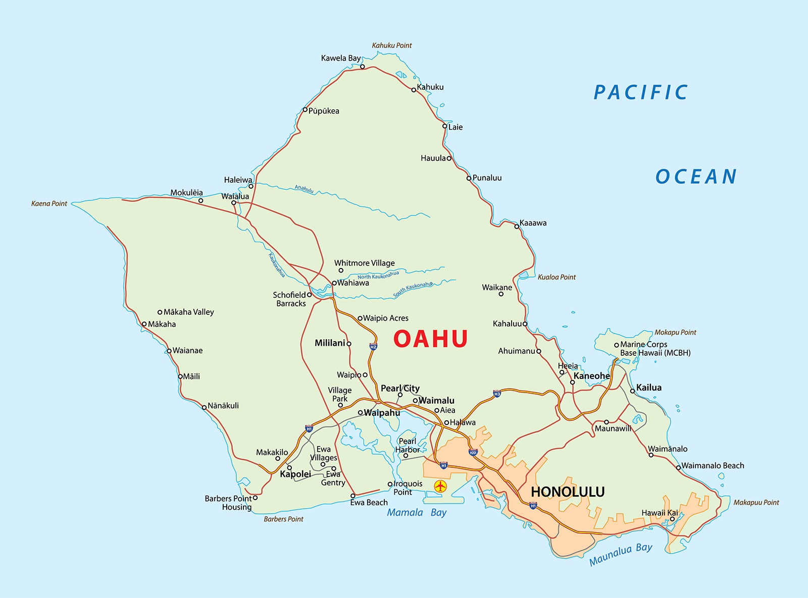
Transportation Map of Hawaii
![]()
A system of state highways encircles each main island. Honolulu International Airport (HNL) is the gateway to Hawaii. It is the major commercial aviation hub of Hawaii. Public transportation connects this airport via routes 19, 20, and 31.
Cities Map of Hawaii

Honolulu is the State capital of Hawaii as well as its largest city. The island of Oahu is the largest metro of the state.
Largest Cities:
Honolulu ( Pop. est. 360,000 in 2018)
East Honolulu (Pop. 50,000)
Pearl City ( Pop. 47,700)
Hilo (Pop. 43,300)
Other Cities And Towns:
Captain Cook, Haleiwa, Hana, Hanalei, Hawi, Honokaa, Honolulu (most populous city, principal port, and capital of Hawaii), Kahului, Kailua, Kailua, Kalaupapa, Kaneohe.
Hawaii Oahu Island Map | Large Printable and Standard Map
Hawaii Interactive Map | Large Printable and Standard Map