City Map of Michigan | Large Printable High Resolution Michigan City Map

City Map of Michigan | Large Printable High Resolution Michigan City Map is the Map of Michigan. You can also free download Map images HD Wallpapers for use desktop and laptop. Click Printable Large Map
The US state of Michigan is located in the Great Lakes and Midwestern regions of the United States. Michigan is the 10th most populous of the 50 United States With approximately 10 million Population. It covers an area of 250,485 km² (96,713 sq mi), making it the 11th largest state in the US. The Michigan City Map Features the Capital of Michigan in Lansing and the largest city is Detroit. Metro Detroit is among the nation’s most populous and largest metropolitan economies.
Michigan Facts
- Capital City: Lansing (pop.) 114,947 (2011 est.)
- Michigan Population: 9,883,360 (2012 est.) (9th)
- Currency: U.S. Dollar
- Language: English, others
- Largest Cities: (by population) Detroit, Grand Rapids, Warren, Sterling Heights, Flint, Lansing
- Statehood: January 26, 1837 (26th state)
Michigan City Map shows that Michigan is well-connected by air, rail, and road. The largest airport in the state is The Detroit Metropolitan Wayne County Airport, followed by The Gerald R. Ford International Airport in Grand Rapids.
Lansing is the state capital of Michigan. Detroit is the largest city in the state and as of 2016, had an estimated population of 672,795. Grand Rapids is the second-largest city in the state.
List of Cities in Michigan:
Detroit (706,585)
Grand Rapids (189,815)
Warren (134,243)
Sterling Heights (129,880)
Ann Arbor (114,925)
Lansing (114,605)
Flint (101,558)
Dearborn (97,114)
Clinton (96,796)
Livonia (95,958)
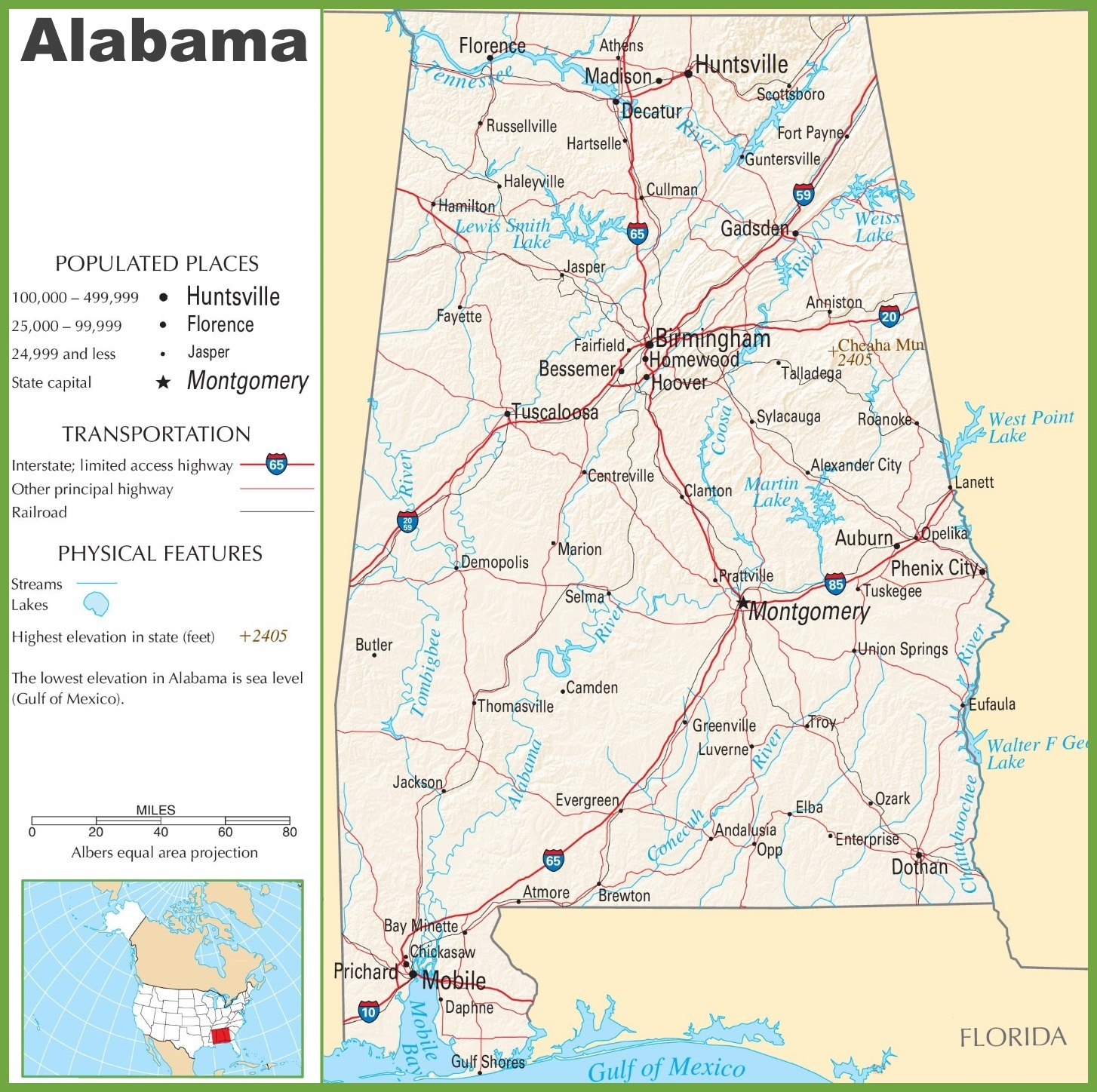
Alabama Large Political Map Political Map of Alabama With Capital , city and River lake
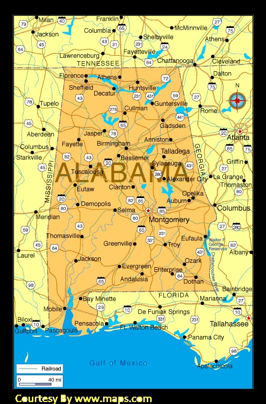
Alabama Large Highway Map | Alabama-City-County-Political Large Highway Printable Map