Michigan Political Map | Large, Printable, High Resolution Standard Map

Michigan Political Map | Large, Printable, High Resolution Standard Map is the Map of Michigan. You can also free download Map images HD Wallpapers for use desktop and laptop. Click Printable Large Map
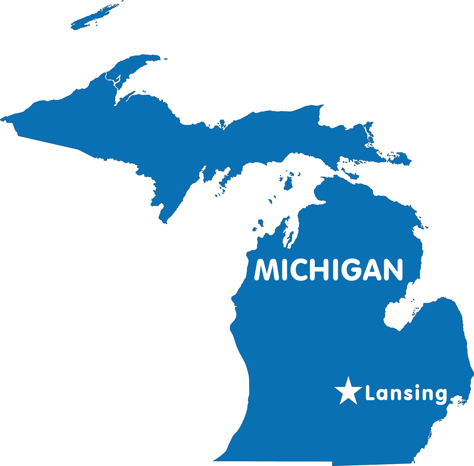
The US state of Michigan is located in the Great Lakes and Midwestern regions of the United States. It is one of the East North Central states of the country. The Map of Michigan covers an area of 250,485 km² (96,713 sq mi), making it the 11th largest state in the US. The Michigan Political Map shares its borders with Indiana, Ohio, Wisconsin, and Ontario, a Canadian province. Michigan has shorelines at four of the five Great Lakes.
Those are Lake Erie, Lake Huron, Lake Michigan, and Lake Superior. The state also shares a water boundary with Minnesota and Illinois. Michigan has a 10 million Population. It is the 10th most populous US state. Lansing is the state capital of Michigan, and its largest city is Detroit.
Michigan Map Facts
- Capital City: Lansing (pop.) 114,947 (2011 est.)
- Michigan Population: 9,883,360 (2012 est.) (9th)
- Currency: U.S. Dollar
- Language: English, others
- Largest Cities: (by population) Detroit, Grand Rapids, Warren, Sterling Heights, Flint, Lansing
- Statehood: January 26, 1837 (26th state)
Michigan Map with Capital

The County Map of Michigan consists of 83 counties. The boundaries of every county have been fixed since 1897. Each county is administered from its respective county seats. Some major counties of the state are Wayne County, Oakland County, Keweenaw County, Ingham County, Eaton County, Allegan County, and Ottawa County. Wayne County is the largest county in the state. It has a population of 1,820,584.
Some key cities of Michigan are Lansing, Ann Arbor, Detroit, and Grand Rapids. The biggest city in Michigan is Detroit. Michigan is known for its education industry, agriculture, and automobile industry. The highest point in Michigan is Arvon, which is 1,979 feet tall. The lowest point in Michigan is Lake Erie, which is 571 feet tall.
Idaho Political Map | Large Printable and Standard Map
Map of Michigan | Political, County, Geography, Transportation, And Cities Map