Wisconsin Transportation and physical map large printable

Wisconsin Transportation and physical map large printable is the Map of Wisconsin. You can also free download Map images HD Wallpapers for use desktop and laptop. Click Printable Large Map
The state of Wisconsin is located in the Great Lakes region of the United States, that has a freshwater coastline on the Lake Michigan, and Lake Superior as well. The Mississippi River marks the border on the western side of the state that is shared by the other states of Minnesota and Iowa. The terrain is mostly hilly, with lowlands near the two great lakes. The highest peak is Timms Hill, found in the Northern Highland, rising to 595 meters. There are numerous smaller lakes in the northern regions as well, while the rivers of Chippewa and Wisconsin river both feed the Mississippi in the west.
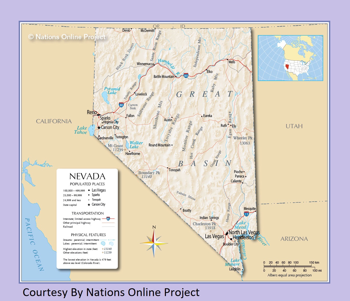
Nevada Transportation and physical map large printable
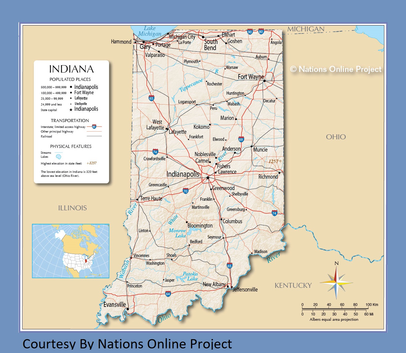
Indiana Transportation and physical map large printable
| « West Virginia Transportation and physical map large printable | Wyoming Transportation and physical map large printable » | |


