Outline Map of South America | Printable Blank Map of South America

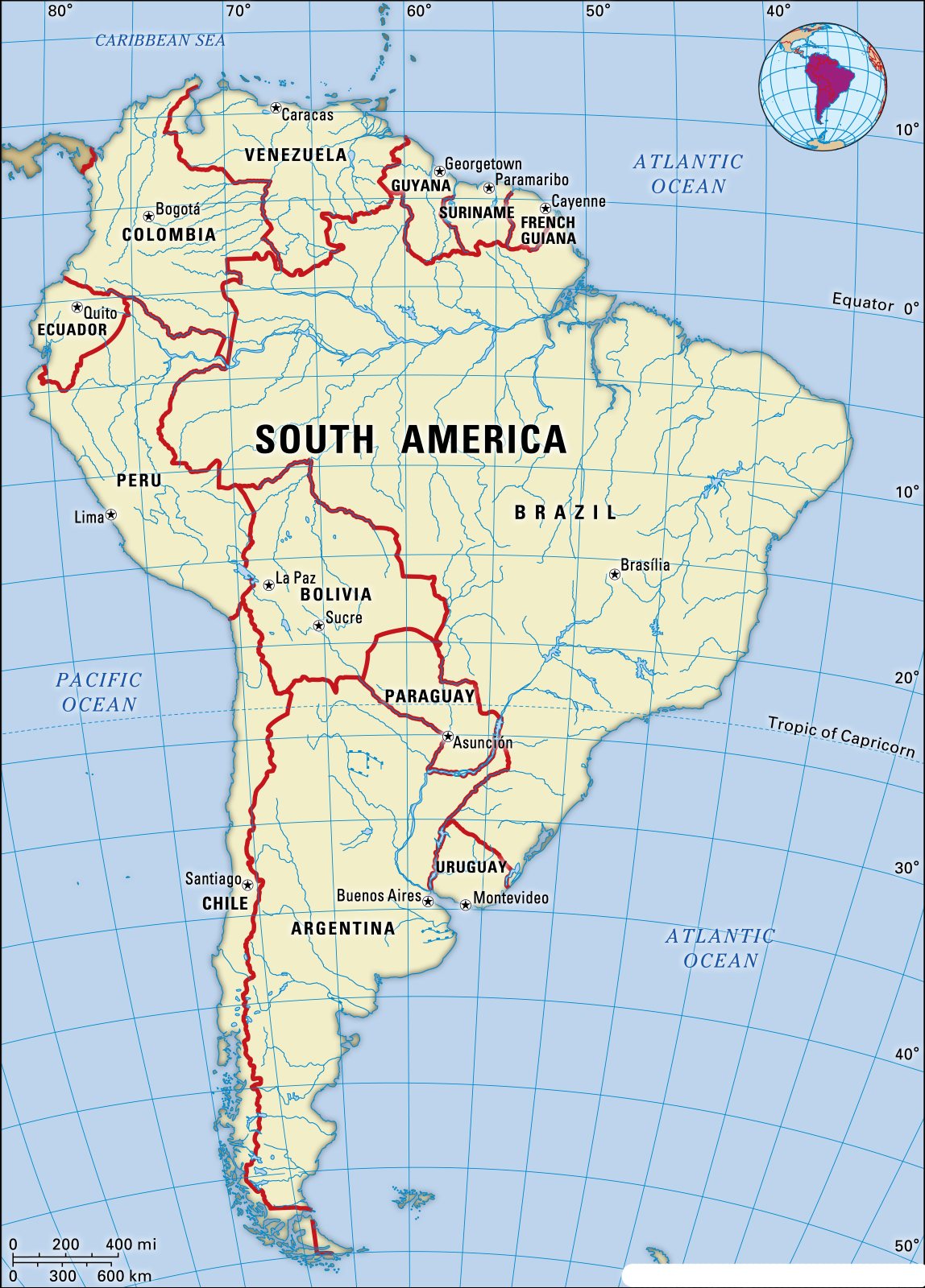
South America is the fourth-largest and the fifth-most populous continent in the world. It has an area of 6,890,000 square miles and comprises a population of 420,458,044 inhabitants, as of 2016. South America has a total of 12 countries and three dependencies. Brazil is the largest country on the continent containing 8,515,799 square kilometers. Blank South America map.
In terms of size, South America is almost twice as big as Europe by land area and is marginally larger than Russia. South America has a coastline that measures around 25,427 km. There are four different time zones in South America: UTC -5, UTC -4, UTC -3, and UTC -2. According to the South America blank map, the Pacific Ocean lies to the west and the Atlantic Ocean to the east. The Caribbean Sea and North America are located to their northwest.
Countries of South America and their Capitals

| S.N. | Country and Territory | Area (Sq. Miles) | Capital |
|---|---|---|---|
| 1 | Brazil | 3,287,611 | Brasília |
| 2 | Argentina | 1,068,302 | Buenos Aires |
| 3 | Peru | 496,226 | Lima |
| 4 | Colombia | 439,735 | Bogotá |
| 5 | Bolivia | 424,164 | La Paz and Sucre |
| 6 | Venezuela | 353,841 | Caracas |
| 7 | Chile | 292,260 | Santiago |
| 8 | Paraguay | 157,047 | Asunción |
| 9 | Ecuador | 109,483 | Quito |
| 10 | Guyana | 83,012 | Georgetown |
| 11 | Uruguay | 68,039 | Montevideo |
| 12 | Suriname | 63,039 | Paramaribo |
| 13 | French Guiana (France) | 35,135 | Cayenne (Préfecture) |
| 14 | Falkland Islands (UK) | 4,700 | Port Stanley |
| 15 | South Georgia and South Sandwich Islands (UK) | 1,194 | King Edward Point |
South America Map Blank

South America’s Main Geographical Features
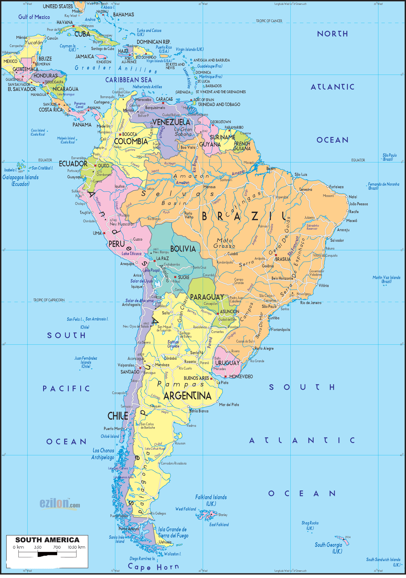
- Amazon rainforest: The Amazon rainforest is the largest rainforest in the world, covering over 5.5 million square kilometers. It is located in northern South America and stretches across several countries, including Brazil, Colombia, Peru, and Venezuela.
- Andes Mountains: The Andes Mountains are the longest mountain range in the world, stretching over 7,000 kilometers along the western coast of South America. They are home to some of the highest peaks in the Americas, including Aconcagua (6,962 meters), the highest mountain in the Western and Southern Hemispheres.
- Atacama Desert: The Atacama Desert is the driest place on Earth, with an average annual rainfall of less than 1 millimeter. It is located in northern Chile and southern Peru.
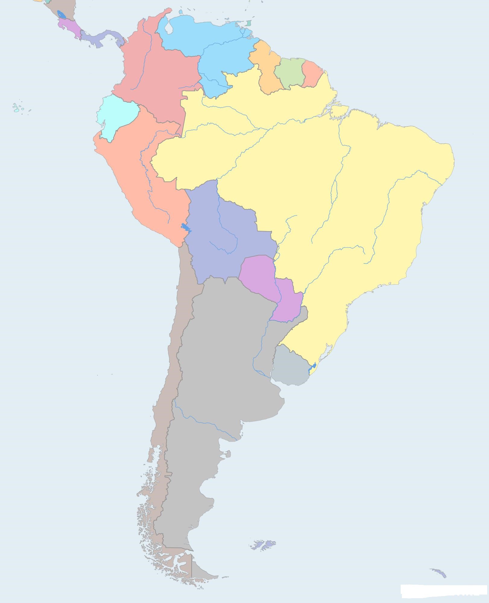
✅Blank Map of Latin America
South America is the fourth largest continent, the southern of the two continents of the Western Hemisphere. South America is connected to North America by the Isthmus of Panama; it is washed on the N by the Caribbean Sea, on the E by the Atlantic Ocean, and on the W by the Pacific Ocean. Outline of South America.
✅Countries In South America?
- Brazil (3,287,086 square miles)
- Argentina (1,073,234 square miles)
- Peru (496,093 square miles)
- Colombia (440,715 square miles)
- Bolivia (424,052 square miles)
Outline Map of South America | Printable Blank Map of South America. You can also free download Map images HD Wallpapers for use desktop and laptop.
Outline Map of South America
The Outline Map of South America reveals the physical landscape of the South American Continent. This Outline of South America is a free resource that is ready to be printed. Whether you are looking for a map with the countries labeled or a numbered blank map, these printable maps of South America are ready to use. They are also perfect for preparing for a geography quiz.
Blank Printable Map of South America
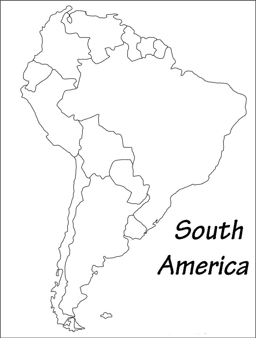
The Blank Printable Map of South America depicts the various nations that comprise the continent. The country boundaries, which separate one nation from the other, are clearly marked on the map. South America is flourishing. The continent's magnificent natural landscape attracts millions of visitors every year, and tourism numbers continue to increase as international flight connections become more available.
Reference:
Map of South America | HD Political Map of South America
Map of South America | Printable Large Attractive HD Map of South America