Baldwin County Map | Printable GIS Rivers Map of Baldwin Alabama

Baldwin County Map | Printable GIS Rivers Map of Baldwin Alabama is the Map of Alabama. You can also free download Map images HD Wallpapers for use desktop and laptop. Click Printable Large Map
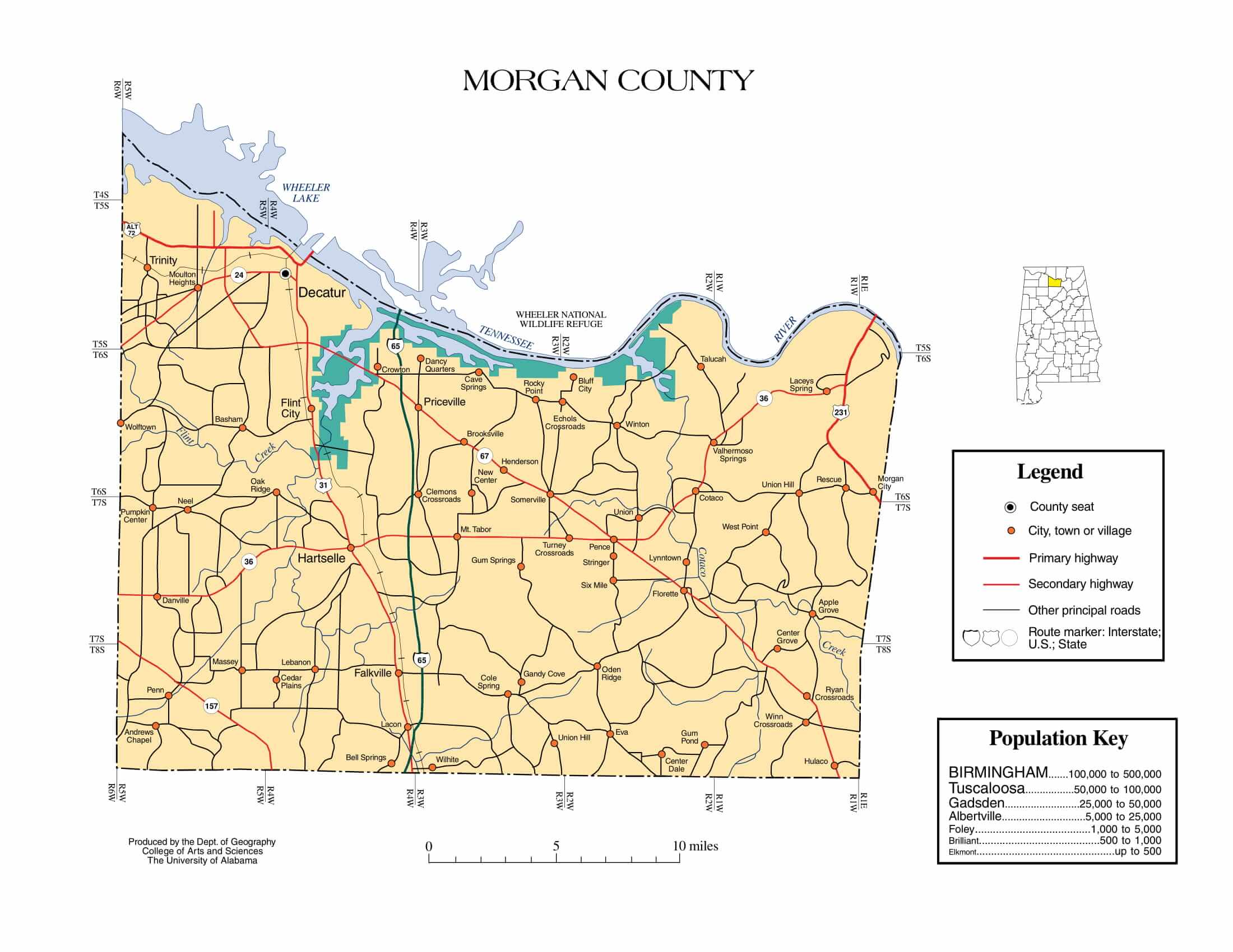
Morgan County Map | Printable Gis Rivers map of Morgan Alabama
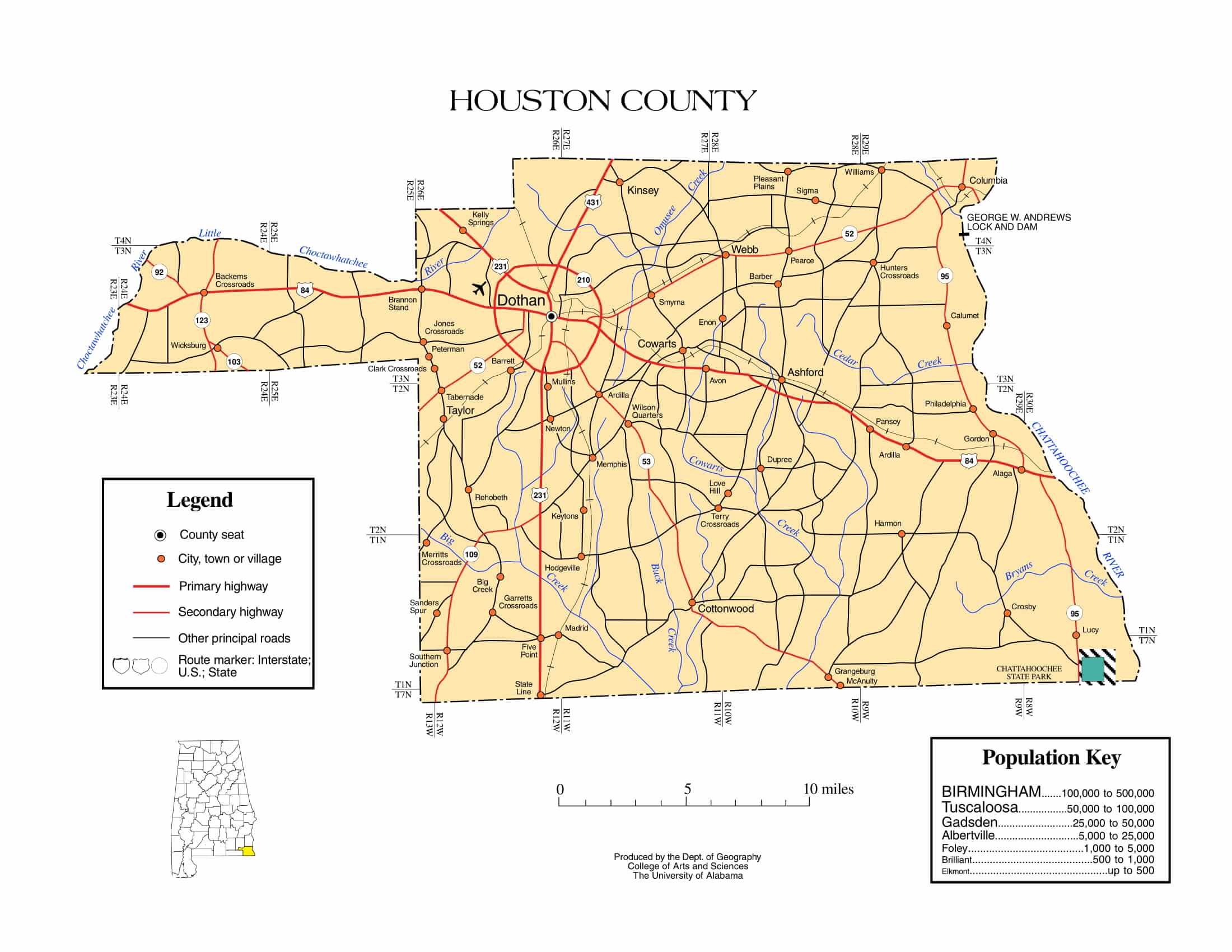
Houston County Map | Printable Gis Rivers map of Houston Alabama
Baldwin County is one of the important counties in Alabama. It is located in the southwestern part of the state, on the Gulf coast. Baldwin County Map has a total area of 2,027 square miles (5,250 km2). 1,590 square miles of this area (4,100 km2) is land and 437 square miles (1,130 km2) (21.6%) is water. It is the largest county by area in Alabama. According to 2019, the county population is approximately 223,234 and The county seat is Bay Minette.

Baldwin County Profile
- Country: United States
- State: Alabama
- Founded: December 21, 1809
- Named for: Abraham Baldwin
- Seat: Bay Minette
- Largest city: Daphne
- Area-
• Total: 2,027 sq mi (5,250 km2)
• Land: 1,590 sq mi (4,100 km2)
• Water: 437 sq mi (1,130 km2) 21.6% - Population (2010)-
• Total: 182,265
• Estimate (2019): 223,234
• Density: 137/sq mi (53/km2) - Time zone: UTC−6 (Central)
• Summer (DST) UTC−5 (CDT)
The county is larger than the US state of Rhode Island. The U.S. federal government designates Baldwin County as the Daphne-Fairhope-Foley, AL Metropolitan Statistical Area. Major highways of the state are Interstate 10, Interstate 65, U.S. Highway 31, U.S. Highway 90, U.S. Highway 98.


