Map of Idaho | Political, Physical, Geographical, Transportation, And Cities Map

Map of Idaho | Political, Physical, Geographical, Transportation, And Cities Map is the Map of Idaho. You can also free download Map images HD Wallpapers for use desktop and laptop. Click Printable Large Map
Idaho is a landlocked mountainous state Located in the Pacific Northwest region of the United States. Map of Idaho is the 14th largest state with an area of 83,569 square miles (216,440 km2). With a population of approximately 1.7 million, Idaho is also the 39th most populous state in the country. The state is 7th least densely populated of the 50 U.S. states. Idaho shares borders with Montana, Nevada, Oregon, Utah, Washington, Wyoming, and Canada.
In the early 19th century, Idaho was part of the Oregon Country. The area was located between the United States and the United Kingdom. The United States was successful in gaining undisputed jurisdiction over the area in 1846. On July 3, 1890, Idaho became the 43rd state of the United States. Lewiston was the first territorial capital then moved to Boise in 1865.
Idaho Fast Facts
- Capital City: Boise (pop. 202,832) (2008 est.)
- Idaho Population: 1,595,728 (2012 est.) (39th)
- Currency: U.S. Dollar (conversion rates)
- Language: English, others
- Largest Cities: (by population) Boise, Nampa, Pocatello, Idaho Falls, Meridian, Coeur d’Alene
- Statehood: July 3, 1890 (43rd state)
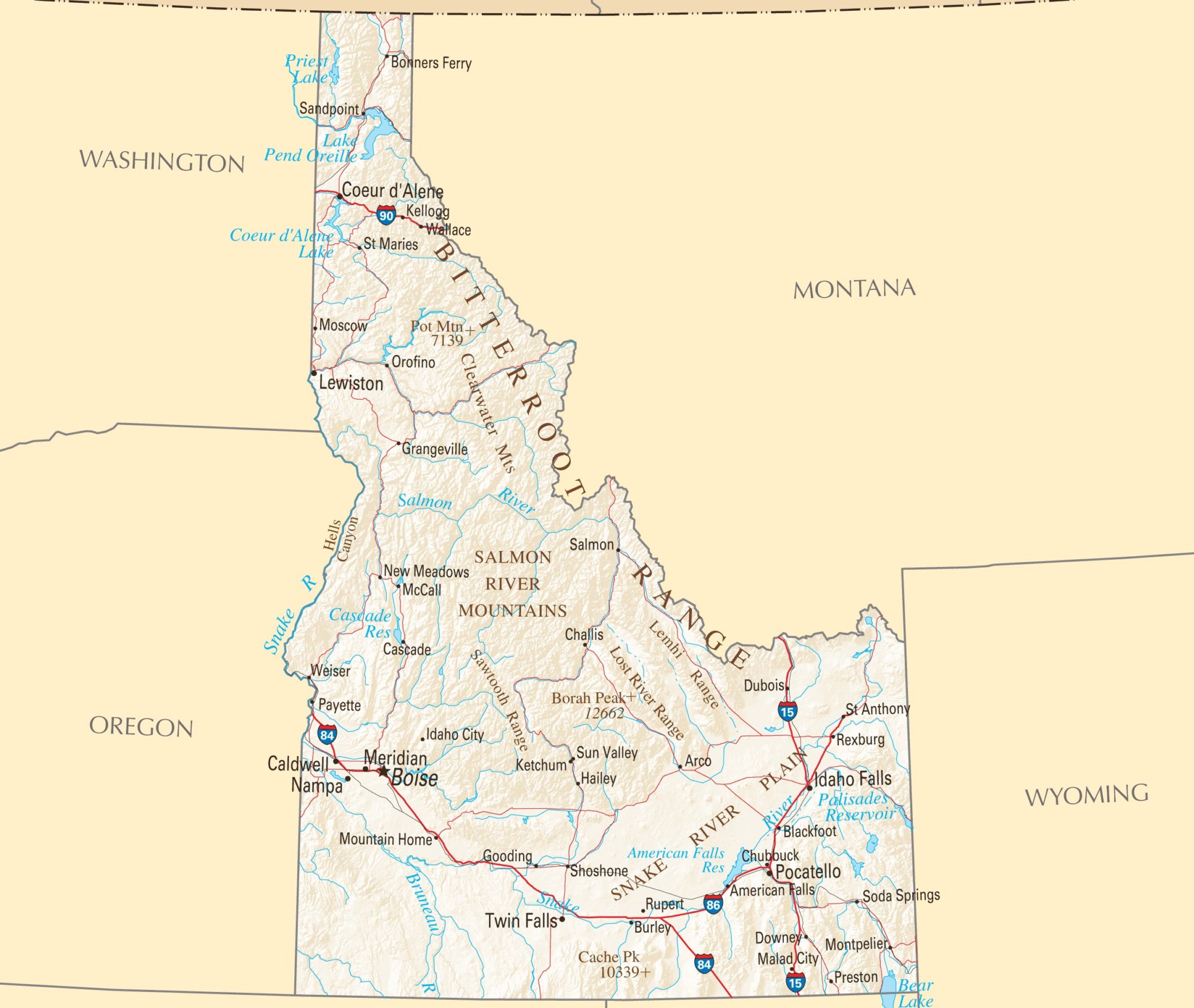
Political Map of Idaho

Idaho is a landlocked mountainous state Located in the Pacific Northwest region of the United States. The state shares borders with the U.S. states of Wyoming in the southeast, Nevada, and Utah in the south, and Washington and Oregon in the west. It shares its international border with the province of British Columbia to the north. The state’s capital and largest city is Boise. The state is divided into 44 counties.
The Political Map of Idaho shows Idaho with boundaries, the location of the state capital Boise, major cities and populated places, rivers, and lakes, interstate highways, principal highways, and railroads.
Physical Map of Idaho
![]()
Idaho is located in the Pacific Northwest region of the United States. It is a landlocked mountainous state. The Physical Map of Idaho is the 14th largest state in the United States with an area of 83,569 square miles (216,440 km2). It fully covered from north to south by the Rocky Mountains. Idaho shares borders with Montana, Nevada, Oregon, Utah, Washington, Wyoming, and Canada. Rivers, mountains, and farmland dominate Idaho’s landscape.
Geography Map of Idaho

Idaho covers an area of 83,570 square miles. It shares borders with six U.S. states and one Canadian province. Idaho is a Rocky Mountain state and its landscape is basically rugged. The highest point of the state is Borah Peak at 3,859 m (12,662 ft), located in the Lost River Range, another subrange of the Rockies.
Some major rivers of Idaho are Clearwater River, Snake River, Salmon River, and the Clark Fork/Pend Oreille River. Idaho’s most significant river is the Snake River. it rises in the Grand Tetons of Wyoming and flows all the way to the Columbia River in Washington State. The Salmon River Mountains and the Smokey Mountains are both parts of the Rocky Mountains.
Geography Statistics
- Land Area: (land) 82,747 sq miles (water) 823 sq miles (TOTAL) 83,570 sq miles
- Horizontal Width: 307 miles
- Bordering States: (6) Montana, Wyoming, Utah, Nevada, Oregon, and Washington
- Counties: (44)
- County (largest by population) Ada, 300,904
- Highest Point: Borah Peak, 12,663 ft.
- Lowest Point: Snake River, near Lewiston (710 ft.)
Transportation Map of Idaho
![]()
Some important interstate highways are US Route 95, I-84, I-184, I-86 and I-15. The busiest airport in the state is Boise Airport. Major airports include Spokane International Airport, Pullman-Moscow Regional Airport, Lewiston-Nez Perce County Airport. Some prominent rail services that cross through the state are Burlington Northern Santa Fe, Union Pacific Railroad.
Cities Map of Idaho

The state’s capital and largest city is Boise. The state is divided into 44 counties. Cities with a population of more than 50,000: Napa, Meridian, Idaho Falls, and Pocatello.
Other Idaho Major Cities And Towns:
American Falls, Arco, Blackfoot, Bonners Ferry, Burley, Caldwell, Cascade, Challis, Chubbuck, Coeur d’Alene, Downey, Dubois, Gooding, Grangeville, Hailey, Idaho City, Kellogg, Ketchum, Lewiston, Malad City, Mc Call, Montpelier, Moscow.
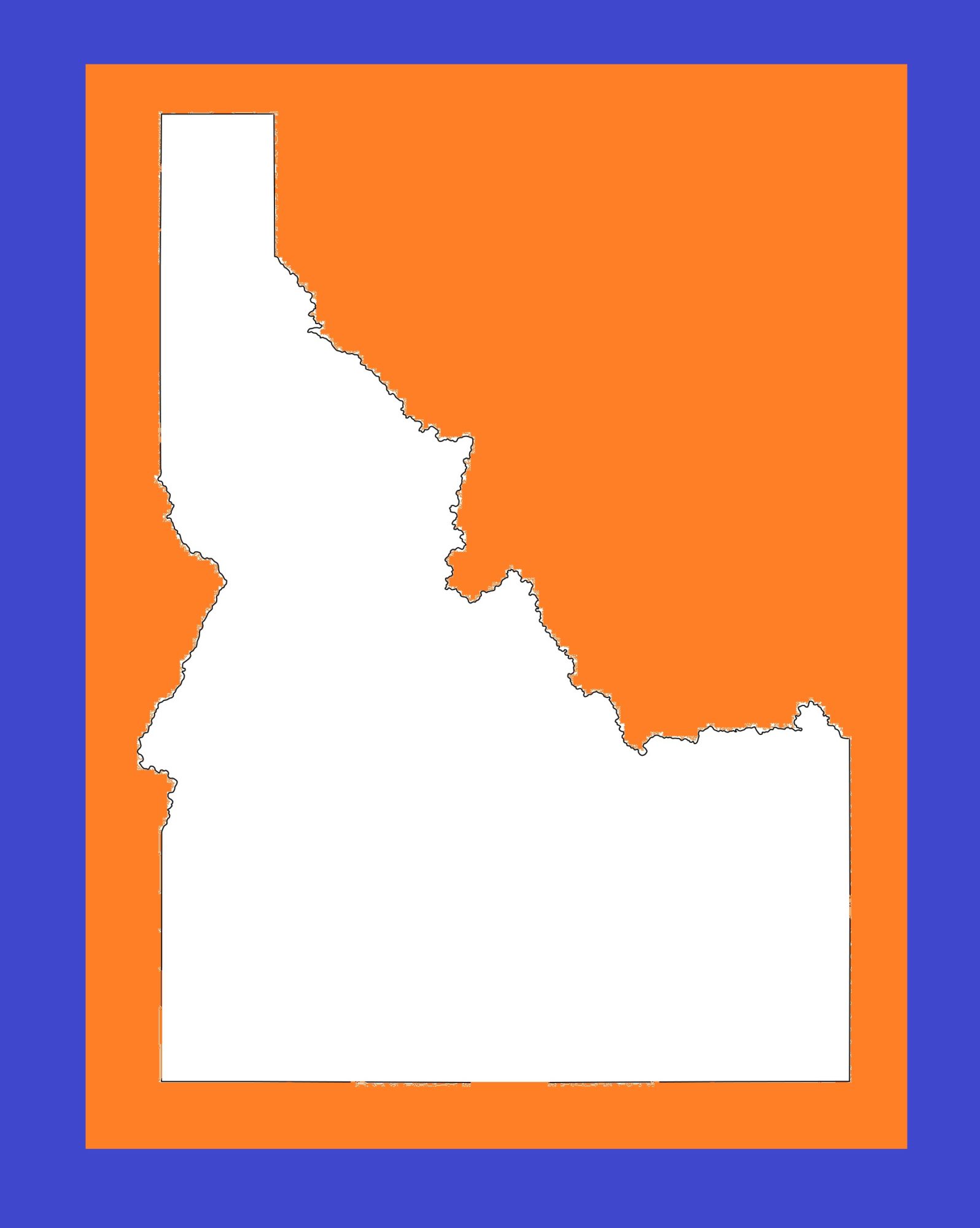
Idaho Blank Outline Map | Large Printable and Standard Map 3
Idaho Political Map | Large Printable and Standard Map 3