City Map of Georgia | Large Printable and Standard City Map

City Map of Georgia | Large Printable and Standard City Map is the Map of Georgia state. You can also free download Map images HD Wallpapers for use desktop and laptop. Click Printable Large Map
Georgia is located in the Southeastern Region of the United States. It is the 24th-largest us state With an area of 153,909 km² (59,425 sq mi). “Peach State,” and “Yankee-land of the South” is the state’s nickname of Georgia. City Map of Georgia features some major cities of the state. Atlanta is both the state’s capital and the largest city of Georgia. It had an estimated population of 472,522 inhabitants.
Augusta is another major city in Georgia with a population close to 200,000. It is located on the eastern edge of Georgia. Columbus is the third-largest city in Georgia in terms of population. Savannah city is shown on the western edge of the state. Apart from the historic buildings, this important Atlantic seaport is also known for churches, squares, and forts.
Surprisingly, some of the cities are named Cairo, Dublin, Vienna, Athens, and Rome. Fulton County has some of the most popular cities in Georgia, including Sandy Springs, Roswell, Johns Creek, and Alpharetta.
City of Georgia

Major Cities in Georgia
| City Name | County | Population (2010) |
|---|---|---|
| Atlanta | Fulton, DeKalb | 420,003 |
| Augusta | Richmond | 192,147 |
| Columbus | Muscogee | 189,885 |
| Savannah | Chatham | 136,286 |
| Athens | Clarke | 115,452 |
| Sandy Springs | Fulton | 93,853 |
| Macon | Bibb, Jones | 91,351 |
| Roswell | Fulton | 88,346 |
| Albany | Dougherty | 77,434 |
| Johns Creek | Fulton | 76,728 |
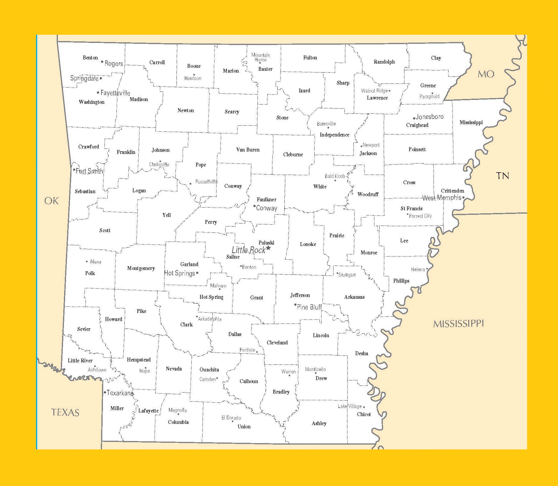
Arkansas City Map | Large Printable and Standard Map
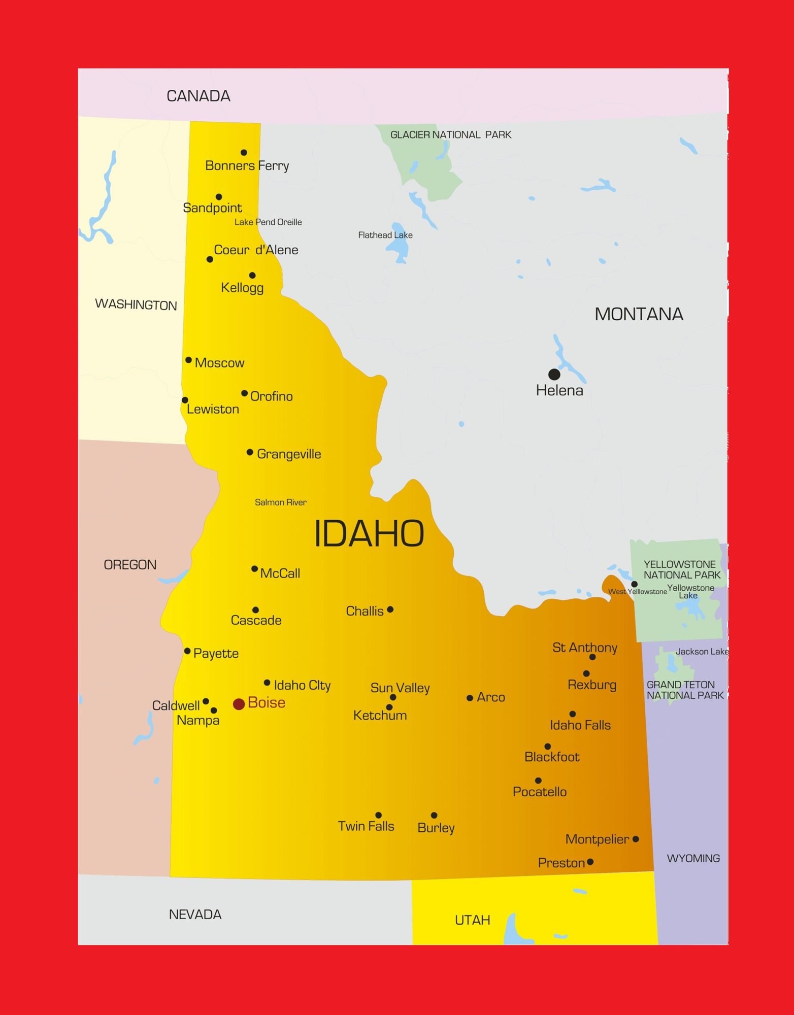
Idaho City Map | Large Printable and Standard Map