Montana Rivers Map | Large Printable High Resolution and Standard Map

Montana Rivers Map | Large Printable High Resolution and Standard Map is the Map of Montana. You can also free download Map images HD Wallpapers for use desktop and laptop. Click Printable Large Map
Montana is the 4th largest state of the country covering an area of 147,040 square miles. It is located in the Northern Rockies and Plains region in the northwestern United States. It shares borders with North Dakota, Idaho, Wyoming, South Dakota, British Columbia, Canada, and Alberta. Montana Rivers Map consists of many rivers like Red Rock River, Flathead River, Gallatin River, Musselshell River, Judith River, and many more.
Some major river valleys in the state are Big Hole Valley, Bitterroot Valley, Gallatin Valley, Flathead Valley, and Paradise Valley. The Yellowstone River is famous for its scenic beauty. It is the last major undammed river in the lower 48 states. In addition, Flathead Lake and Fort Peck Lake are two important lakes in Montana. These two covers a total area of 375 sq miles, Ft. Peck Reservoir is one of the biggest inland bodies of water in the Northern US.
Montana River List
Beaverhead River, Big Hole River, Big Horn River, Big Muddy Creek, Bitterroot River, Blackfoot River, Clark Fork, Clarks Fork, Flathead River, Gallatin River, Jefferson River, Judith River, Kootenai River, Little Missouri River, Madison River, Marias River, Milk River, Missouri River, Musselshell River, O’Fallon Creek, Poplar River, Powder River, Red Rock River, Rosebud Creek, South Fork Flathead River, Sun River, Teton River, Tongue River and Yellowstone River.
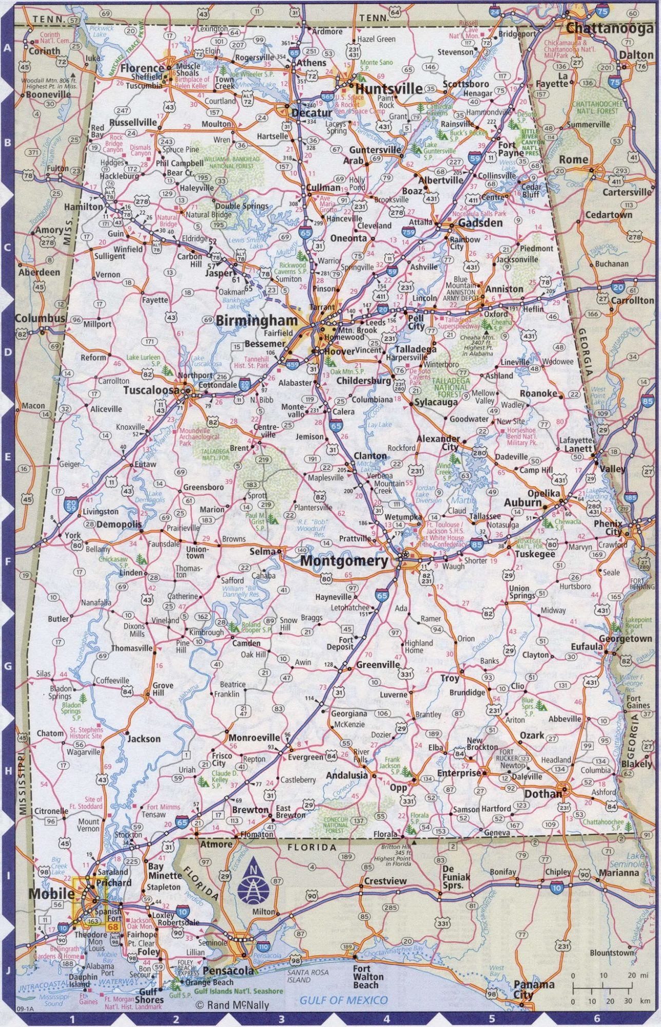
Road Map of Alabama | High Resolution, Large, City, Town, County Map
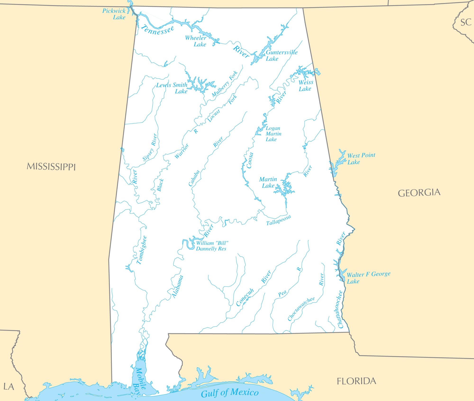
Alabama River Map | River Map of Alabama