Physical Map of USA With Rivers And Mountains

Physical Map of USA With Rivers And Mountains is the Map of United States of America. You can also free download United States of America Map images HD Wallpapers for use desktop and laptop. Click Printable Large Map
The Physical Map of USA With Rivers And Mountains Show the Physical landscape And Rivers And Mountains of the United States. The Appalachian Mountains can be seen in the eastern USA mountains map. It is along with the Adirondak Mountains of New York, the White Mountains of New England.
Map of USA Facts
- Official Name: United States of America
- Capital: Washington, D.C.
- Population: 329,256,465 (2018)
- Official Language: None; the most commonly spoken language is English
- Currency: US dollar (USD)
- Form of Government: Constitutional federal republic
- Climate: Mostly temperate, but tropical in Hawaii and Florida, arctic in Alaska, semiarid in the great plains west of the Mississippi River, and arid in the Great Basin of the southwest; low winter temperatures in the northwest are ameliorated occasionally in January and February by warm chinook winds from the eastern slopes of the Rocky Mountains
- Total Area: 3,796,725 square miles (9,833,517 square kilometers)
- Highest Point: Denali at 20,308 feet (6,190 meters)
- Lowest Point: Death Valley at -282 feet (-86 meters)
The United States has a diverse climate, with a wide range of temperatures and precipitation patterns across the country. The climate of a particular region is determined by several factors, including latitude, elevation, distance from the ocean, and mountain ranges.
The climate of the United States is changing due to human-caused climate change. The average temperature in the United States has increased by about 1.5°F since the late 19th century. This warming trend is expected to continue, and is likely to have a significant impact on the climate of the United States.
US Map With Mountains
![]()
- Rocky Mountains
- Appalachian Mountains
- Sierra Nevada
- Cascade Range
- Columbia Mountains
- Klamath Mountains
- Salmon River Mountains
- Black Hills
- Adirondack Mountains
- Front Range
- Ouachita Mountains
Because the major mountain ranges in the United States run in a north-south direction, they have a large impact on the climate of the country’s various regions. The west coast, for example, has a milder climate than the interior because it is moderated by its proximity to the ocean, whereas places like Arizona and Nevada are very hot and dry because they are on the leeward side of mountains ranges. Map of usa with mountains.
✅5 Major Mountain Ranges in the US?
- (1) Alaska Range (Alaska)
- (2) Saint Elias Mountains (Alaska/Canada)
- (3) Wrangell Mountains (Alaska)
- (4) Sierra Nevada (California)
- (5) Sawatch Range (Colorado)
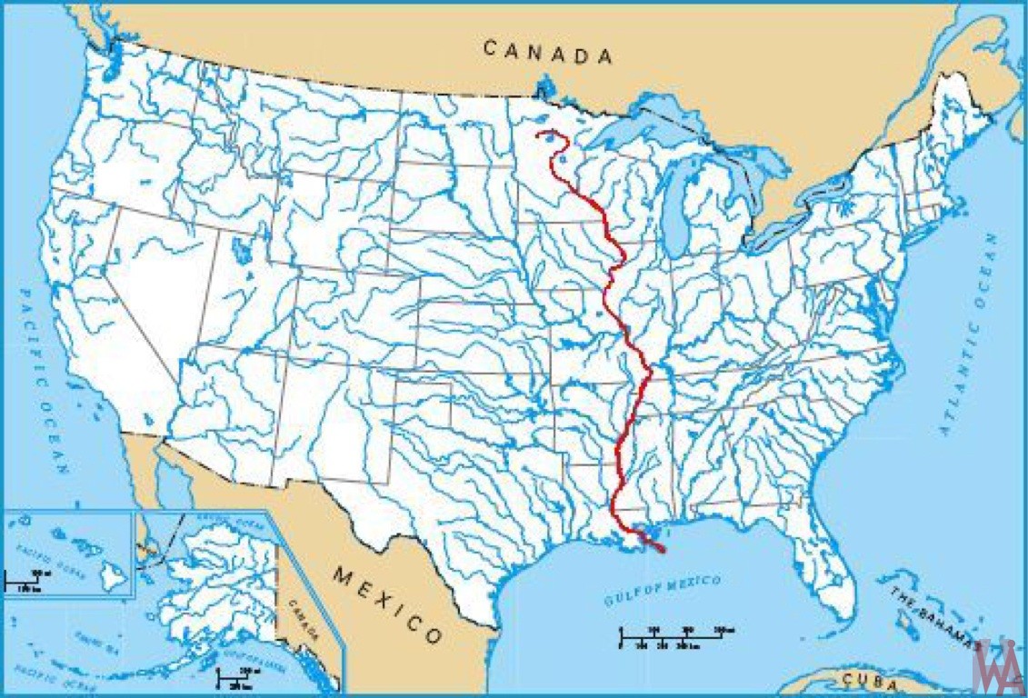
✅7 largest rivers in the US?
The Largest Rivers in the United States:
- Missouri River- 2,341 miles. The Missouri River is the largest river.
- Mississippi River- 2,320 miles.
- Yukon River- 1,982 miles.
- Rio Grande- 1,885 miles.
- Arkansas River- 1,469 miles.
- Colorado River- 1,450 miles.
- Red River- 1,360 miles.
Rivers And Mountains Map of USA

Major rivers in the Map of USA include the Mississippi, the Missouri, the Colorado, the Arkansas, and the Columbia. Large lakes include the Great Lakes system consisting of Lake Superior, Lake Huron, Lake Michigan, Lake Erie, and Lake Ontario.
Rocky Mountains
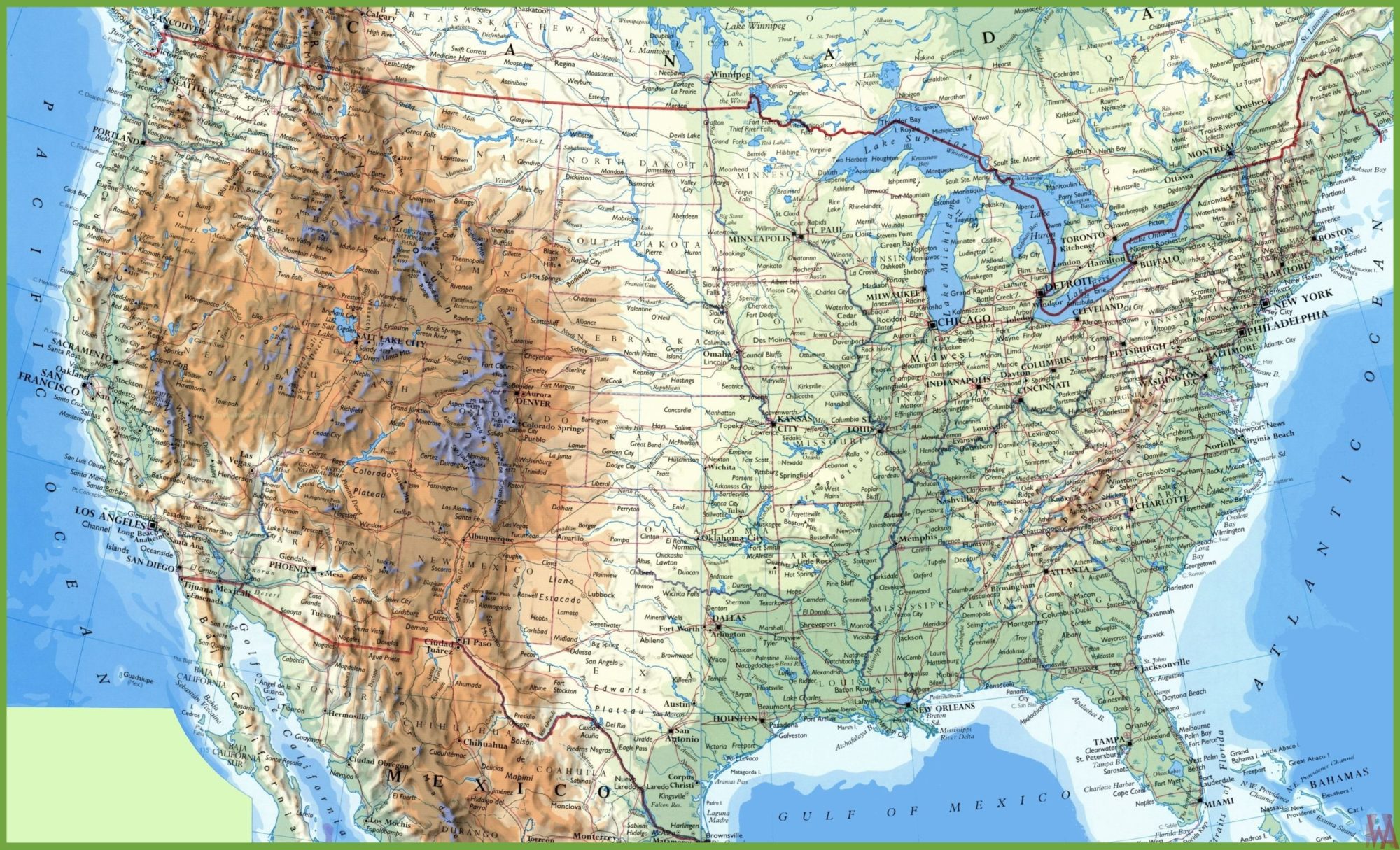
Rocky Mountains - Separating the western third of the USA Physical Map, the Rocky Mountains traverse the continent, forming the Continental Divide, where waters to the west all drain to the Pacific Ocean and waters to the east drain into the Atlantic.
Mississippi River
Mississippi river is a Part of the longest river system in the United States, the Mississippi Rivers Map runs from Minnesota down to New Orleans, Louisiana, where it drains into the Gulf of Mexico. Along the way, the Mississippi drains part of 31 different states.
Reference:


