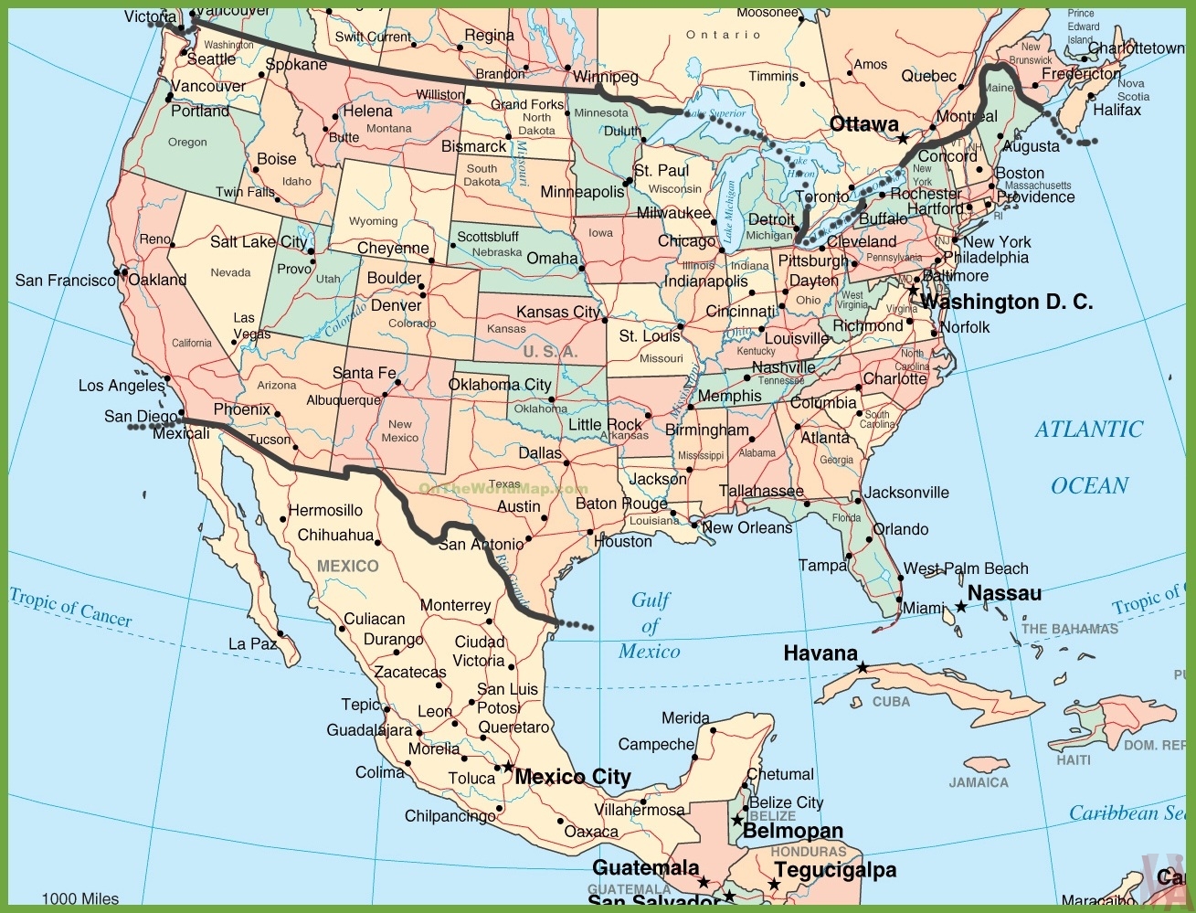
United States Political Map | US Map

United States Political Map | US Map is the Map of United States of America. You can also free download United States of America Map images HD Wallpapers for use desktop and laptop. Click Printable Large Map
The United States is located in central North America between Canada and Mexico. It is a Constitutional Federal Republic country. The map of the United States is the world’s third- or fourth-largest country by total area. It consists of 50 states. Besides the 48 conterminous states that occupy the middle latitudes of the continent, the United States includes the state of Alaska and the island state of Hawaii, in the mid-Pacific Ocean.
A Political Map is one that shows the political features of a given area. These features can include things like countries, states, provinces, cities, towns, major highways and byways, and major water structures.
Political HD Map

United States Of America‘s Quick Facts
- Land Area: 9,147,593 km2
- Water Area: 685,924 km2
- Total Area: 9,833,517 km2
- Population: 323,995,528
- Population Density: 32.95 / km2
- Government Type: Constitutional Federal Republic
- GDP (PPP): $18.60 Trillion
- GDP Per Capita: $57,300
- Currency: Dollar (USD)
- Largest Cities: New York City (8,175,133), Los Angeles (3,792,621), Chicago (2,695,598), Brooklyn (2,300,664), Borough of Queens (2,272,771), Houston (2,099,451), Philadelphia (1,526,006), Manhattan (1,487,536), Phoenix (1,445,632), The Bronx (1,385,108)
The Country shares a Political border with Canada to the east and Russia to the west across the Bering Strait. The overseas territories of the United States are spread out in the Caribbean and the Pacific Ocean. Washington is the national capital of the USA.
Political Map of USA

This HD Political Map of the USA highlights international and state boundaries, important cities, airports, roads, rivers, and major visitor attractions. This Political Map also points out the most popular attractions.
The United States Political Map HD Image also is a great guide for Spotting the natural wonders in the US, ranging from Niagara Falls to the Redwood National Forest, and Yosemite National Park to Yellowstone National Park.
The United States shares international land borders with two nations: The Canada–United States border to the north of the Contiguous United States and to the east of Alaska. Mexico–United States border is to the south.
Land Borders:
- Alaska, USA – Canada 1,538 miles (2,475 km)
- Canada – USA 3,145 miles (5,061 km)
- Mexico – USA 1,951 miles (3,141 km)
- Bordering Countries (2) Canada and Mexico

Electoral College Map of USA
The Election of the president and the vice president of the United States is an indirect election. The citizens of the US who are registered to vote in any U.S. state or in Washington, D.C., cast ballots for members of the Electoral College. When citizens cast their ballots for president in the popular vote, they elect a slate of electors. Electors then cast the votes that decide who becomes president of the United States.
✅Political Map of the United States
The Political map of the united states is the fourth largest country Map in the world after Russia, Canada, and China. The Country shares a Political border with Canada to the east and Russia to the west across the Bering Strait.
✅How Do Electoral Votes Get Divided?
Electoral votes are allocated among the States based on the Census. Every State is allocated a number of votes equal to the number of senators and representatives in its U.S.
United States Political Map HD Image

Political divisions of the United States are the various recognized governing entities that together form the United States – states, the District of Columbia, territories, and Indian reservations. The primary or first-level political division of the United States is the state. There are 50 states, which are bound together in a union.
Reference:


