Arizona Road Map | Large Printable and Standard Map

Arizona Road Map | Large Printable and Standard Map is the Map of Arizona. You can also free download Map images HD Wallpapers for use desktop and laptop. Click Printable Large Map
Arizona Road Map features highways and Many other routes. Arizona’s Interstate Highways connect its major cities and facilitate travel between Arizona and its neighbors. North-South interstates include Interstate 15, Interstate 17, and Interstate 19. East-West interstates include Interstate 8, Interstate 10, and Interstate 40.
- I-8 travelers can drive westward into southern California.
- I-10 traverses southern Arizona, connecting the cities of Phoenix and Tucson. It also linking California to the west with New Mexico to the east.
- I-15 traverses northwestern Arizona for a short distance.
- Central Arizona’s I-17 connects the cities of Phoenix and Flagstaff.
- From Arizona’s southern border with Mexico, I-19 travelers can drive northward, connecting with I-10 near Tucson.
- I-40 traverses the state from New Mexico in the east to California in the west.
Arizona Routes:
US Highways and State Routes include Route 60, Route 70, Route 89, Route 89A, Route 93, Route 95, Route 160, Route 180, and Route 191.
Road Map of Arizona features a number of scenic drives Road. The Grand Canyon Loop is one of them which begins and ends at Flagstaff and runs around the canyon’s outer rim. A short distance from Mesa lies the Apache Trail, a former Native American path that passes through Tonto National Forest and is home to some fascinating cliff dwellings.
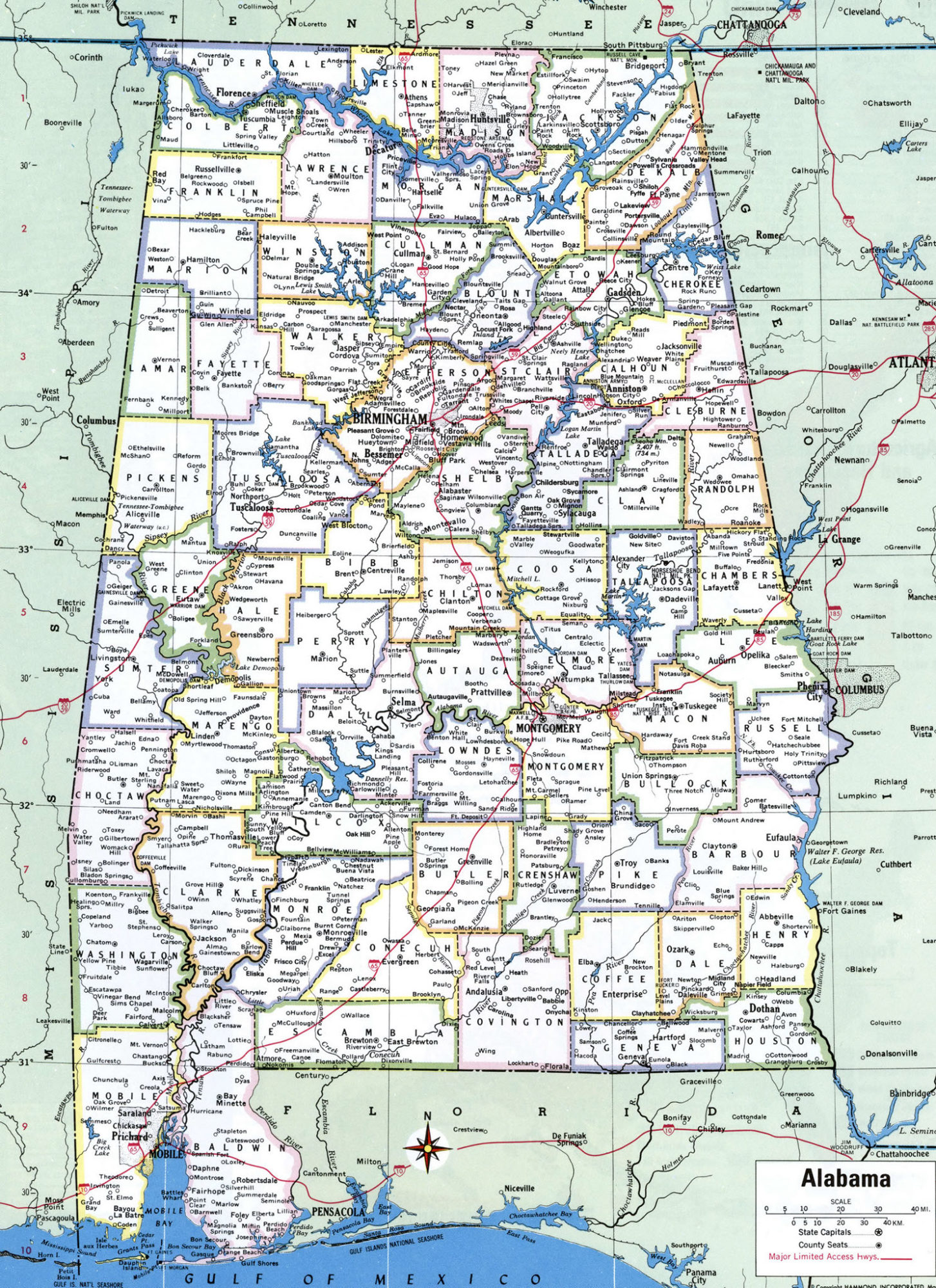
Alabama Large Political Map Political Map of Alabama With Capital , city and River lake-7
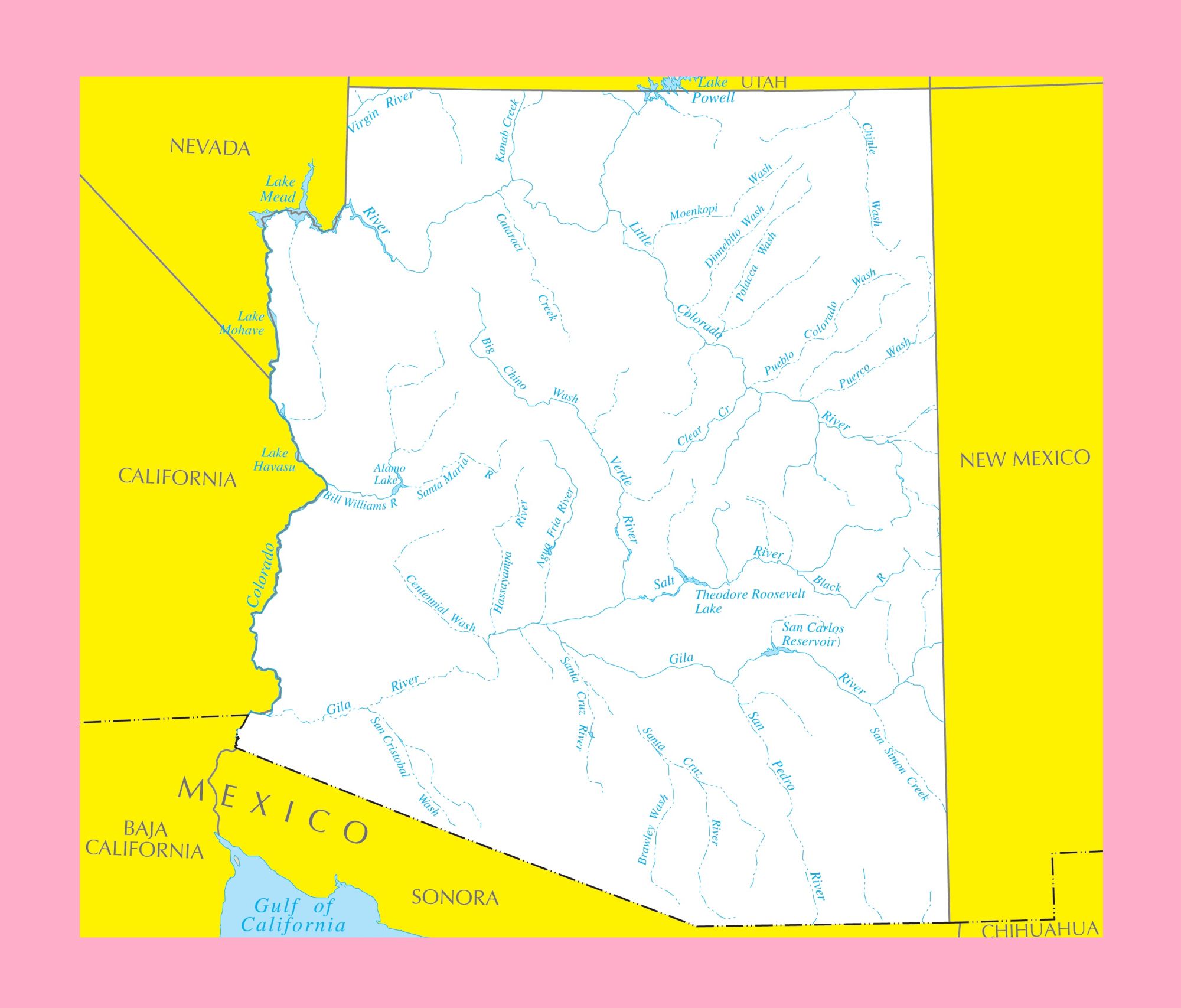
Arizona River Map | Large Printable and Standard Map 4