Alabama Road Map | High Resolution Road Map of Alabama

Alabama Road Map | High Resolution Road Map of Alabama is the Map of Alabama. You can also free download Map images HD Wallpapers for use desktop and laptop. Click Printable Large Map
Alabama Map Facts
- Nickname: The Heart of Dixie
- Statehood: 1819; 22nd state
- Population (as of July 2015): 4,858,979
- Capital: Montgomery
- Biggest City: Birmingham
- Abbreviation: AL
- State bird: yellowhammer
- State flower: camellia
Major Interstate Routes
Interstate 65 (I-65) travels north-south roughly through the middle of the state. I-10, I-20, I-59, and I-65 are the major interstate highways in Alabama. Several U.S. Highways also pass through the state, such as U.S. Route 11 (US-11), US-29, US-31, US-43, US-45, US-72, US-78, US-80, US-82, US-84, US-90, US-98, US-231, US-278, US-280, US-331, US-411, and US-431.
Interstate 65 Highway of Alabama Travel North-South Through Middle of The State. Interstate-20 Alabama Road Travel from the central west Mississippi state line to Birmingham. Interstate-59 Travel From North to East corner of the state.
Interstate-85 Road Started From Montgomery and travels East-Northeast to the Georgia state line. Interstate-10 Travels the southernmost portion of the state, traveling from west to east through Mobile. Interstate-22 Alabama highway map enters the state from Mississippi and connects Birmingham with Memphis, Tennessee.

There are four Large Roads in the State:
Montgomery Expressway in Montgomery
Northport/Tuscaloosa Western Bypass in Tuscaloosa and Northport
Emerald Mountain Expressway in Wetumpka
Beach Express in Orange Beach
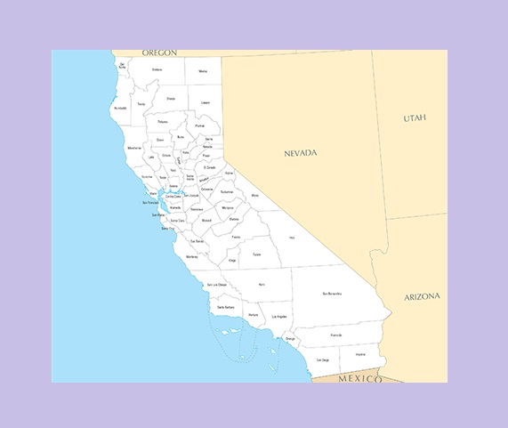
California County Map | Large Printable and Standard Map
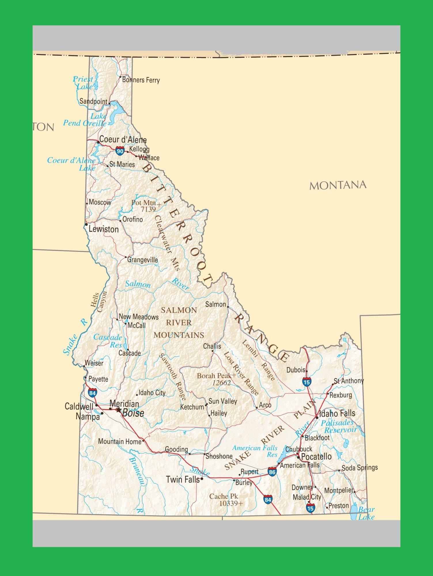
Idaho Political Map | Large Printable and Standard Map
| « Alabama River Map | River Map of Alabama | Alabama Location Map | Location Map of Alabama. High Resolution » | |


