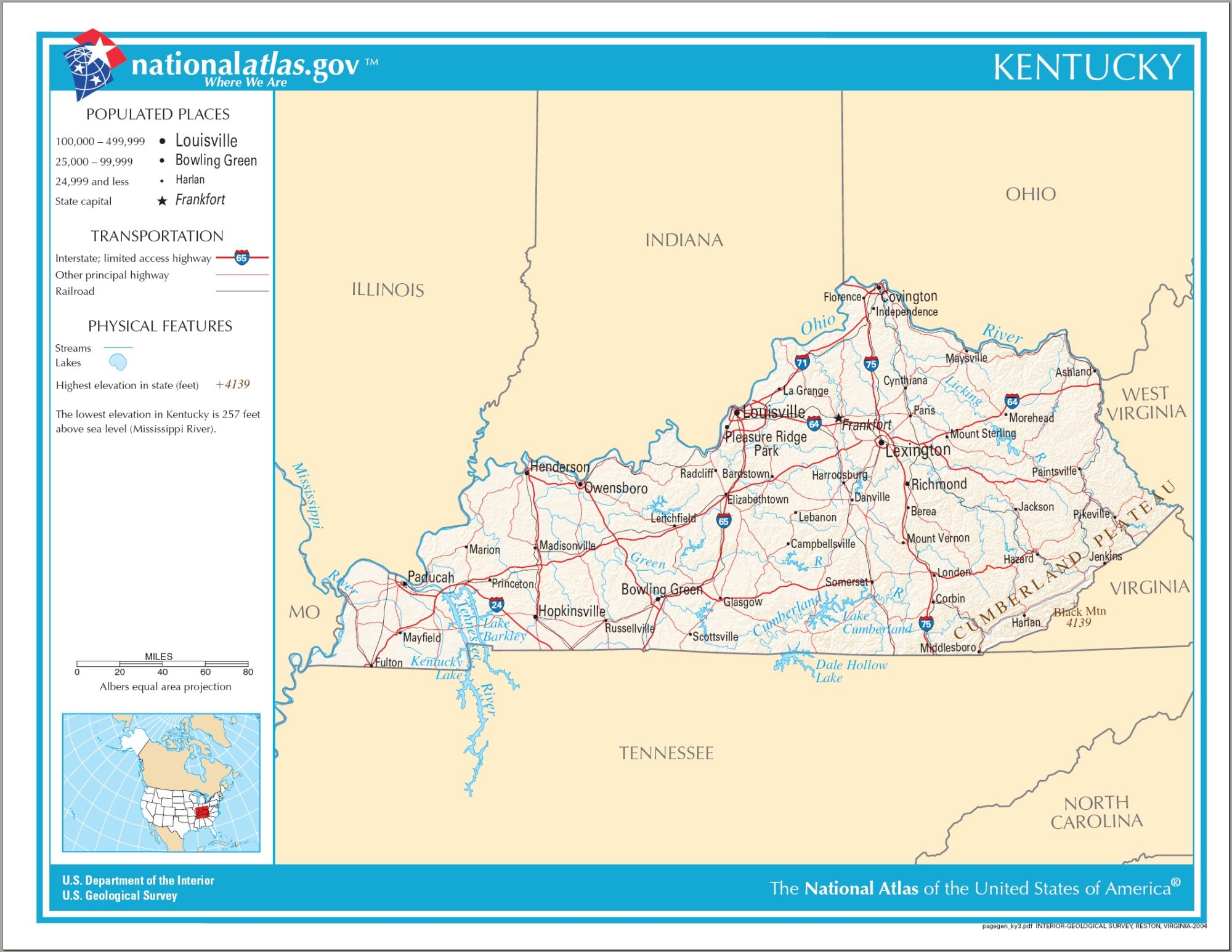
Kentucky City Map | Large Printable High Resolution and Standard Map

Kentucky City Map | Large Printable High Resolution and Standard Map is the Map of Kentucky. You can also free download Map images HD Wallpapers for use desktop and laptop. Click Printable Large Map
Kentucky is a US state located in the east south-central region along the west side of the Appalachian Mountains. It is officially known as the Commonwealth of Kentucky. Map of Kentucky is the 37th most extensive state with an area of 40,409 square miles. It is the 26th most populous state in the United States with 4.46 million people (2019 est.) Kentucky is home to 419 active cities. Frankfort is the official state capital of Kentucky while Louisville is its largest city.
Kentucky Fast Facts
- Capital City: Frankfort (pop) 27,077(2009 est.)
- Kentucky Population: 4,380,415 (2012 est.) (26th)
- Currency: U.S. Dollar (conversion rates)
- Language: English, others
- Largest Cities: (by population) Louisville, Lexington, Owensboro, Bowling Green, Covington, Hopkinsville
- Statehood: June 1, 1792 (15th state)
- Area rank: 37th
- Website: kentucky.gov
Kentucky Map

10 Largest Cities in Kentucky
- Louisville (615,924)
- Lexington (324,604)
- Bowling Green (74,363)
- Owensboro (60,903)
- Covington (40,181)
- Richmond (36,839)
- Georgetown (36,228)
- Florence (33,784)
- Nicholasville (31,191)
- Elizabethtown (30,651)
Other cities and towns in Kentucky:
Ashland, Bardstown, Morehead, Mount Sterling, Mount Vernon, Owensboro, Paintsville, Paris, Pikeville, Pleasure Ridge Park, Princeton, Radcliff, Richmond, Russellville, Scottsville, and Somerset.
Kentucky Political Map | Large Printable High Resolution and Standard Map
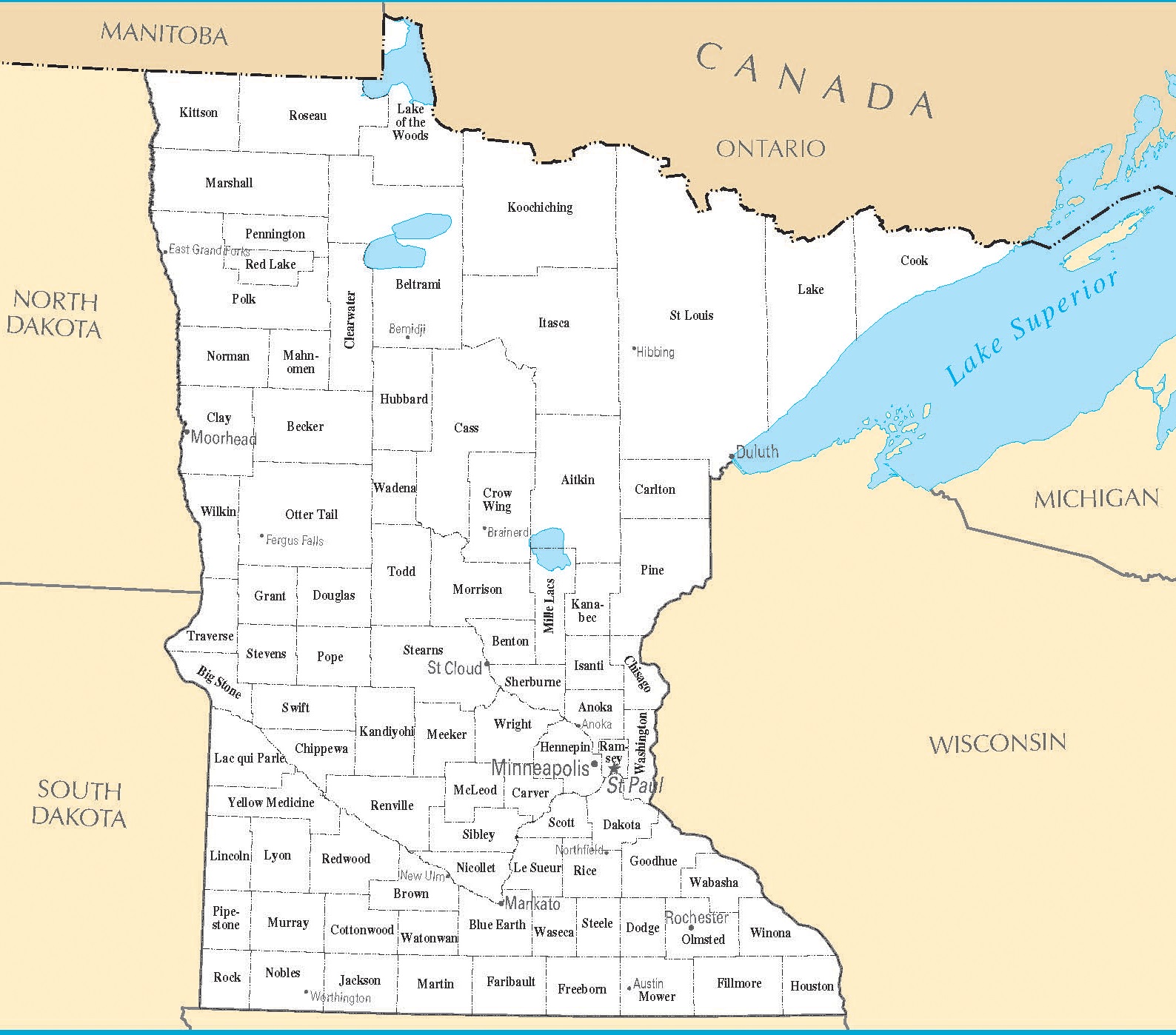
Minnesota City Map | Large Printable High Resolution and Standard Map