Arkansas River Map | Large Printable and Standard Map

Arkansas River Map | Large Printable and Standard Map is the Map of Arkansas. You can also free download Map images HD Wallpapers for use desktop and laptop. Click Printable Large Map
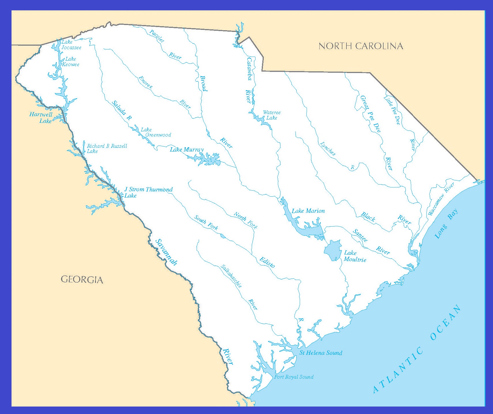
Arkansas US state located in the southeastern region of the United States. It is Nicknamed the “Natural State” and it is home to more than three million people as of 2018. It is the 29th largest state of the country with an area of 53,180 square miles. According to the Map of Arkansas, It shares borders with six other states. The Arkansas Rivers Map indicates the natural streams that flow through many prominent cities of the state. The 1,450-mile-long Arkansas River is famous for being the major perennial resource of the state.
The prime tributaries of the Arkansas River are Big Piney Creek, Mulberry and Petit Jean Rivers, Bayou Fourche LaFave, Cadron Creek, Bayou Metro, Lee Creek, Fall Creek, Shoal Creek, Illinois Bayou Middle Fork, Frog Bayou, Cub Creek, Illinois Bayou North Fork, and Hurricane Creek.
The map also highlights the other major streams of the state apart from Arkansas. Some prominent waterways that pass through Arkansas are Kings River, Buffalo River, Little Missouri River, Eleven Point River, White River, Little Red River, Cossatot River, Ouachita River, Caddo River, Spring River, Saline River, and the Strawberry River.
Arkansas Map With Capital

List of Rivers in Arkansas |
|---|
| S.no. | River Name | Area / Length | Source | Mouth |
|---|---|---|---|---|
| 1 | Kings River | 82.5 miles | ( Boston Mountains) Madison County, Arkansas | White River in Table Rock Lake, Barry County, Missouri |
| 2 | Buffalo River | 240 km | Boston Mountains | Salem Plateau just before joining the White River |
| 3 | White River | 722 mi (1,162 km) | Boston Mountains | Mississippi River |
| 4 | Mulberry River | 110 km (70 mi) | Ozarks, Newton County, Arkansas | Arkansas River |
| 5 | Arkansas River | 1,469 mi (2,364 km) | Confluence of East Fork Arkansas River and Tennessee Creek | Mississippi River |
| 6 | Green Ferry Lake | NA | NA | NA |
| 7 | Little Red River | 102-mile-long (164 km) | Devils Fork, Middle Fork, South Fork ( Greers Ferry Dam in Cleburne County, Arkansas) | Confluence with the White River in White County, Arkansas |
| 8 | Strawberry River | 115 mi (185 km) | Fulton County, Arkansas | Black River |
Alabama Large Political Map Political Map of Alabama With Capital , city and River lake
South Carolina Rivers Map | Large Printable High Resolution and Standard Map