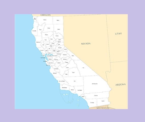
California County Map | Large Printable and Standard Map

California County Map | Large Printable and Standard Map is the Map of California. You can also free download Map images HD Wallpapers for use desktop and laptop. Click Printable Large Map
There are 58 Counties On the California County Map. At first, there were 27 Counties in California On on February 18, 1850. Of the original 27 counties, after 1850 only Marin neither added nor lost significant land to another county. Of the 32 California counties created after 1850, only seven counties neither added nor lost significant land to another county. The seven are Alameda, Alpine, Imperial, Madera, Modoc, Orange, and Riverside.
Each 38 million residents of California live within the boundaries of one of the state’s 58 counties. California’s counties serve a dual role. They provide a vast array of municipal services to residents, including roads, parks, law enforcement, emergency response services, and libraries. The County is Constructed by the California Constitution and the California Government Code. It is the largest political subdivision of the state. ca county map.
San Bernardino County is The Largest County in California With an area of 20,105 square miles (52,070 km2). Los Angeles County, officially the County of Los Angeles, is the most populous county in the United States. It had a population of 9,818,605 in the 2010 United States Census.
County Map of California

California Counties by Population
| Rank | County | Population |
|---|---|---|
| 1 | Los Angeles County | 10,098,052 |
| 2 | San Diego County | 3,302,833 |
| 3 | Orange County | 3,164,182 |
| 4 | Riverside County | 2,383,286 |
| 5 | San Bernardino County | 2,135,413 |
| 6 | Santa Clara County | 1,922,200 |
| 7 | Alameda County | 1,643,700 |
| 8 | Sacramento County | 1,510,023 |
| 9 | Contra Costa County | 1,133,247 |
| 10 | Fresno County | 978,130 |
✅Best County to Live in California?
San Mateo is the Best County to Live in California. In San Mateo County, most residents own their homes. Danville, CA comes in as the safest city in California. Located in Contra Costa County.
✅Highest Crime Rate in the US?
California County Map | Large Printable and Standard Map
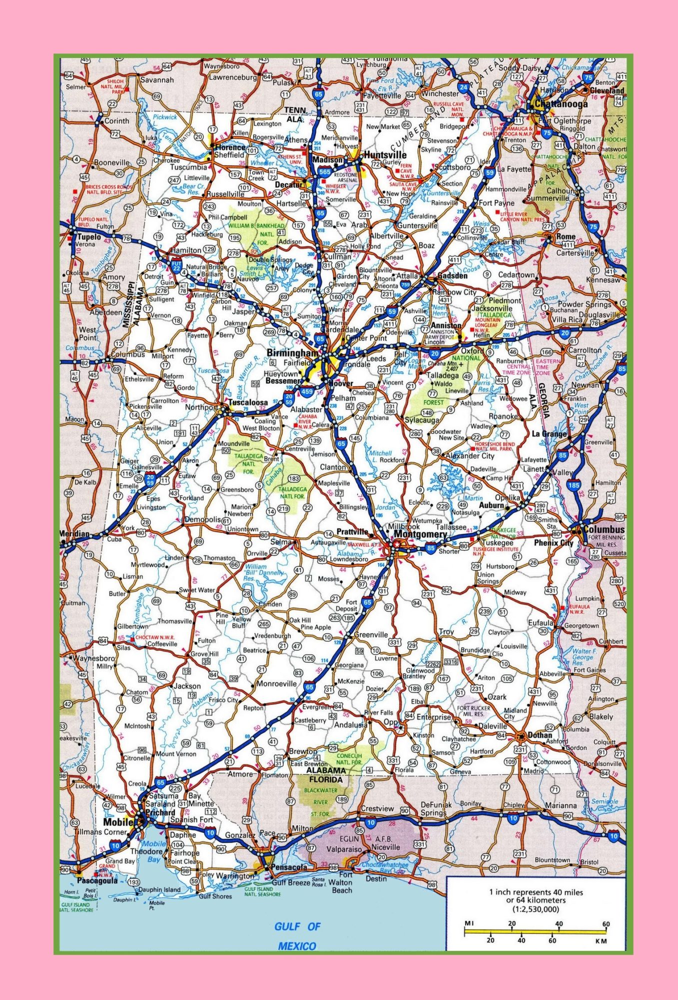
Alabama Large Highway Map | Large Highway Map of Alabama-city-county-political