Map of Kentucky | Political, County, Geography, Transportation, And Cities Map

Map of Kentucky | Political, County, Geography, Transportation, And Cities Map is the Map of Kentucky. You can also free download Map images HD Wallpapers for use desktop and laptop. Click Printable Large Map
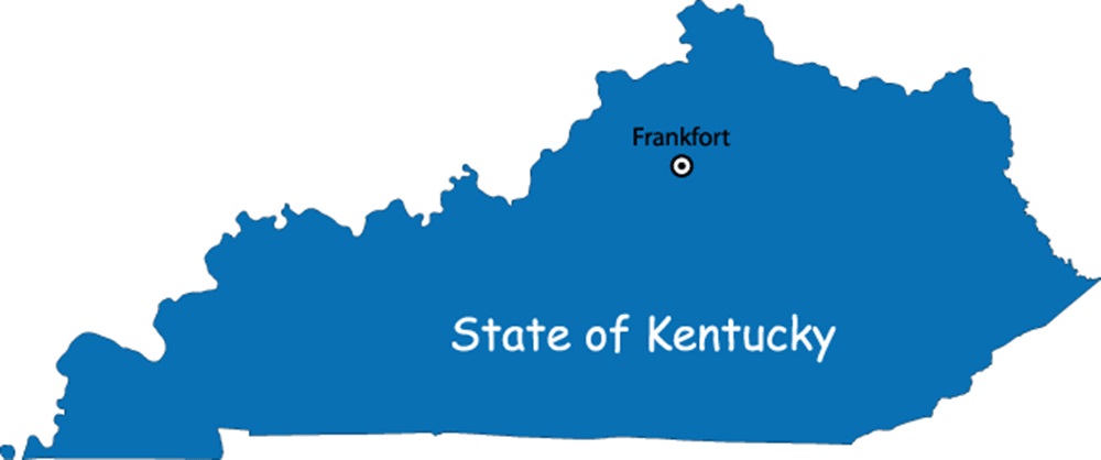
Kentucky is US states located in the east south-central region along the west side of the Appalachian Mountains. It is officially known as the Commonwealth of Kentucky. Map of Kentucky is the 37th most extensive state with an area of 40,409 square miles. It is the 26th most populous state in the United States with 4.46 million people (2019 est.) Frankfort is the official state capital of Kentucky while Louisville is its largest city.
In the mid-1700s, the French, Spanish, and English began exploring this land of green hills, mountains, valleys, and mighty rivers. The region of what is today Kentucky was ceded by the French to the British in 1763 and then to the US in 1783 by the Treaty of Paris (which ended the American Revolution). Kentucky became the 15th state to join the Union on June 1, 1792.
Kentucky Fast Facts
- Capital City: Frankfort (pop) 27,077(2009 est.)
- Kentucky Population: 4,380,415 (2012 est.) (26th)
- Currency: U.S. Dollar (conversion rates)
- Language: English, others
- Largest Cities: (by population) Louisville, Lexington, Owensboro, Bowling Green, Covington, Hopkinsville
- Statehood: June 1, 1792 (15th state)
- Area rank: 37th
- Website: kentucky.gov
Political Map of Kentucky

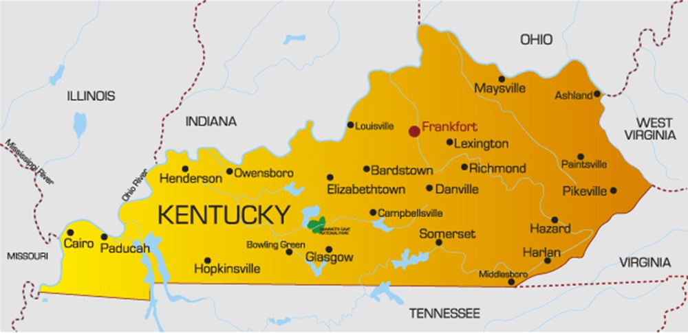
Kentucky is located in the east south-central region of the United States. Political Map of Kentucky covers an area of 40,409 square miles. Kentucky shares borders with Illinois, Indiana, and Ohio to the north, Virginia to the southeast, and Tennessee to the south. The Big Sandy and the Tug Fork Rivers define the state line with West Virginia in the east. The Mississippi River creates the border to Missouri in the southwest. The state is called ‘Bluegrass State’. This nickname is based on Kentucky bluegrass found in many of its pastures.
County Map of Kentucky

County Map of Kentucky is divided into 120 counties. It is one of the highest numbers of counties of any state in the USA. The largest county is Pike County at 787.6 square miles (2,040 km2), and the most populous county is Jefferson County with 741,096 residents as of 2010. Each county in Kentucky is governed at the county seat, which serves as the capital of the county.
Geography Map of Kentucky

Kentucky is located in the east south-central region along the west side of the Appalachian Mountains. It is the 37th most extensive state with an area of 40,409 square miles. Kentucky borders West Virginia, Virginia, Tennessee, Missouri, Illinois, Indiana, and Ohio. The state’s highest elevation point is on Black Mountain and has a height of 1,263 meters.
Kentucky’s Five Major Regions Are:
- The Cumberland Plateau
- The Bluegrass region
- The Pennyroyal Plateau
- The Western Coal Fields
- The Jackson Purchase
Major rivers are the Cumberland River, the Kentucky River, the Licking River, and the Green River. Major lakes in the state are Lake Barkley, Lake Cumberland, and the Kentucky Lake freshwater reservoir.
Geography Facts
- Land Area: (land) 39,728 sq miles (water) 679 sq miles (TOTAL) 40,407 sq miles
- Bordering States: (7) Virginia, Tennessee, Missouri, Illinois, Indiana, Ohio, and West Virginia
- Counties: (120) Map
- County: Jefferson 709,264
- Highest Point: Black Mountain, at 4,139 ft.
- Lowest Point: Mississippi River, 257 ft.
Transportation Map of Kentucky

There are six major Interstate highways I-24, I-64, I-65, I-69, I-71, and I-75 and six bypasses and spurs I-165, I-169, I-264, I-265, I-275, and I-471. The busiest airports in the state are Cincinnati/Northern Kentucky International Airport and Louisville International Airport. The national passenger rail system is Amtrak. It provides service to Ashland, South Portsmouth, Maysville, and Fulton.
Cities Map of Kentucky

Louisville is the largest city of the state with a population of 1,298,990. The second-largest city is Lexington with a 2018 census population of 323,780.
Major cities are Louisville, Lexington, Bowling Green, Covington, Hopkinsville, Paducah, and Frankfort (state capital).
Other cities and towns in Kentucky:
Ashland, Bardstown, Morehead, Mount Sterling, Mount Vernon, Owensboro, Paintsville, Paris, Pikeville, Pleasure Ridge Park, Princeton, Radcliff, Richmond, Russellville, Scottsville, and Somerset.


