Map of Maine | Political, County, Physical, Transportation, And Cities Map

Map of Maine | Political, County, Physical, Transportation, And Cities Map is the Map of Maine. You can also free download Map images HD Wallpapers for use desktop and laptop. Click Printable Large Map
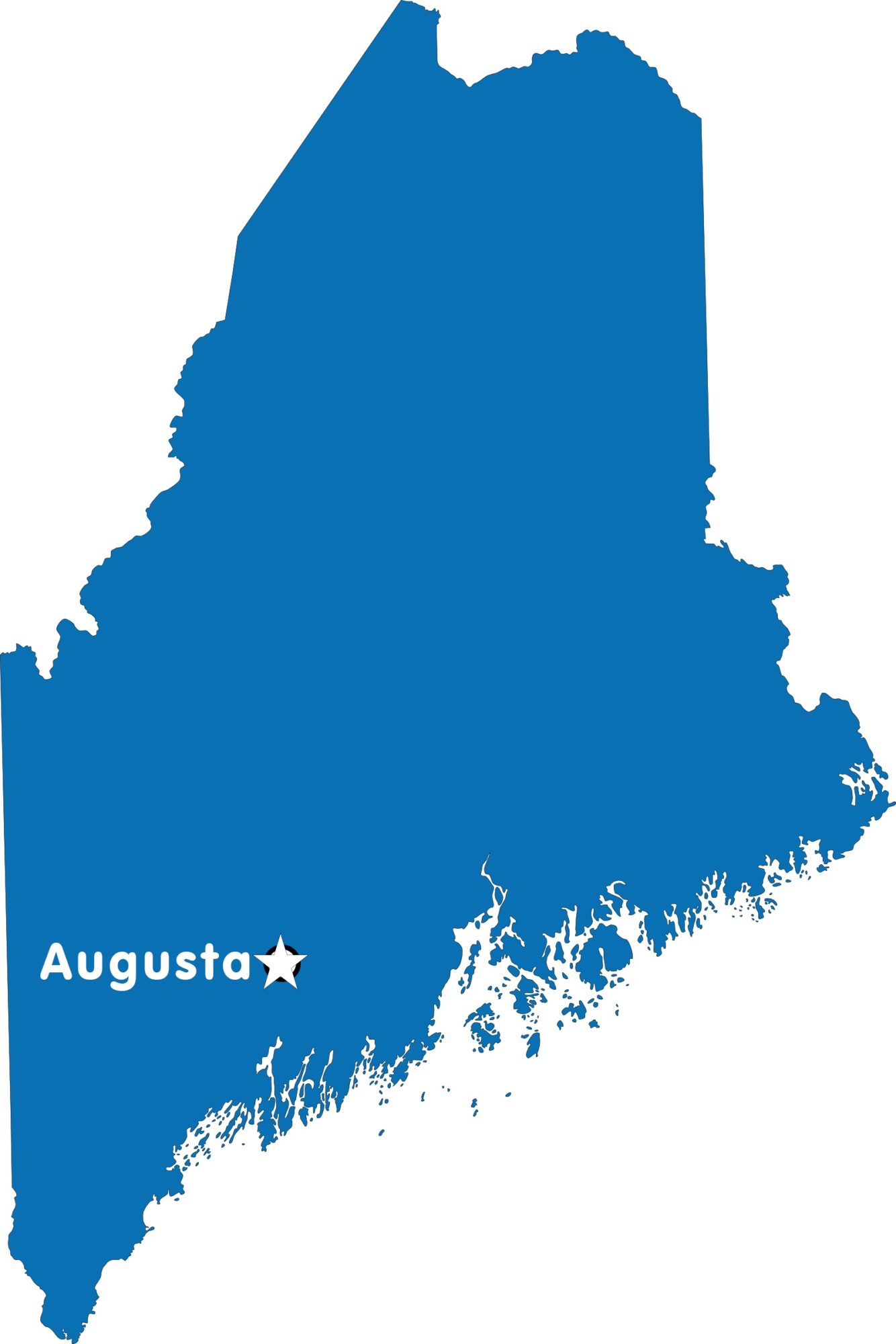
Maine is the most northern state situated in the northeastern part of the country. It is located in the New England region of the United States. The Map of Maine is the 12th smallest of the country with an area of 35,385 square miles. Maine had a population of 1,331,479 residents, which made it the 42nd most populous state of the country. Augusta is the state capital city of Maine, while Portland is the largest city of the state. Maine was joined to the Union on March 15, 1820, as the 23rd state.
indigenous peoples were the original inhabitants of present-day Maine. Maine colonized by England in the 17th and 18th centuries. Maine was originally part of Massachusetts. Massachusetts agreed to allow its district of Maine to petition for statehood In 1819. On March 15, 1820, Maine was admitted to the Union as the 23rd state under the Missouri Compromise.
- Capital City: Augusta 18,367 (2008 est.)
- Maine Population: 1,329,192 (2012 est.) (41st)
- Currency: U.S. Dollar
- Language: English, others
- Largest Cities: (by population) Portland, Lewiston, Bangor, South Portland, Auburn, Biddeford
- Statehood: March 15, 1820 (23rd state)
- Time zone: UTC−05:00
Political Map of Maine

Maine located in the New England region of the United States. The Political Map of Maine is the 12th smallest of the country with an area of 35,385 square miles. Maine shares its borders with the US state of New Hampshire on the west, the Atlantic Ocean to the southeast.
It also shares international borders with the Canadian provinces of Québec to the northwest and New Brunswick to the north and northeast. Augusta is the official state capital city of Maine, while Portland is the largest city.
County Map of Maine

Maine County Map is divided into 16 counties. The countries are served by individual county seats.
List Of Countries In Maine |
|---|
| County Name | Population (2016) | Area (sq. mi.) |
|---|---|---|
| Androscoggin County Map | 107,319 | 470.27 |
| Aroostook County Map | 67,959 | 6671.54 |
| Cumberland County Map | 292,041 | 835.51 |
| Franklin County Map | 30,001 | 1697.81 |
| Hancock County Map | 54,419 | 1587.7 |
| Kennebec County Map | 120,569 | 867.58 |
| Knox County Map | 39,744 | 365.67 |
| Lincoln County Map | 34,216 | 455.99 |
| Oxford County Map | 57,217 | 2078 |
| Penobscot County Map | 151,806 | 3395.73 |
| Piscataquis County Map | 16,843 | 3966.22 |
| Sagadahoc County Map | 35,273 | 253.9 |
| Somerset County Map | 50,915 | 3926.5 |
| Waldo County Map | 39,364 | 729.73 |
| Washington County Map | 31,450 | 2568.48 |
| York County Map | 202,343 | 990.92 |
Physical Map of Maine

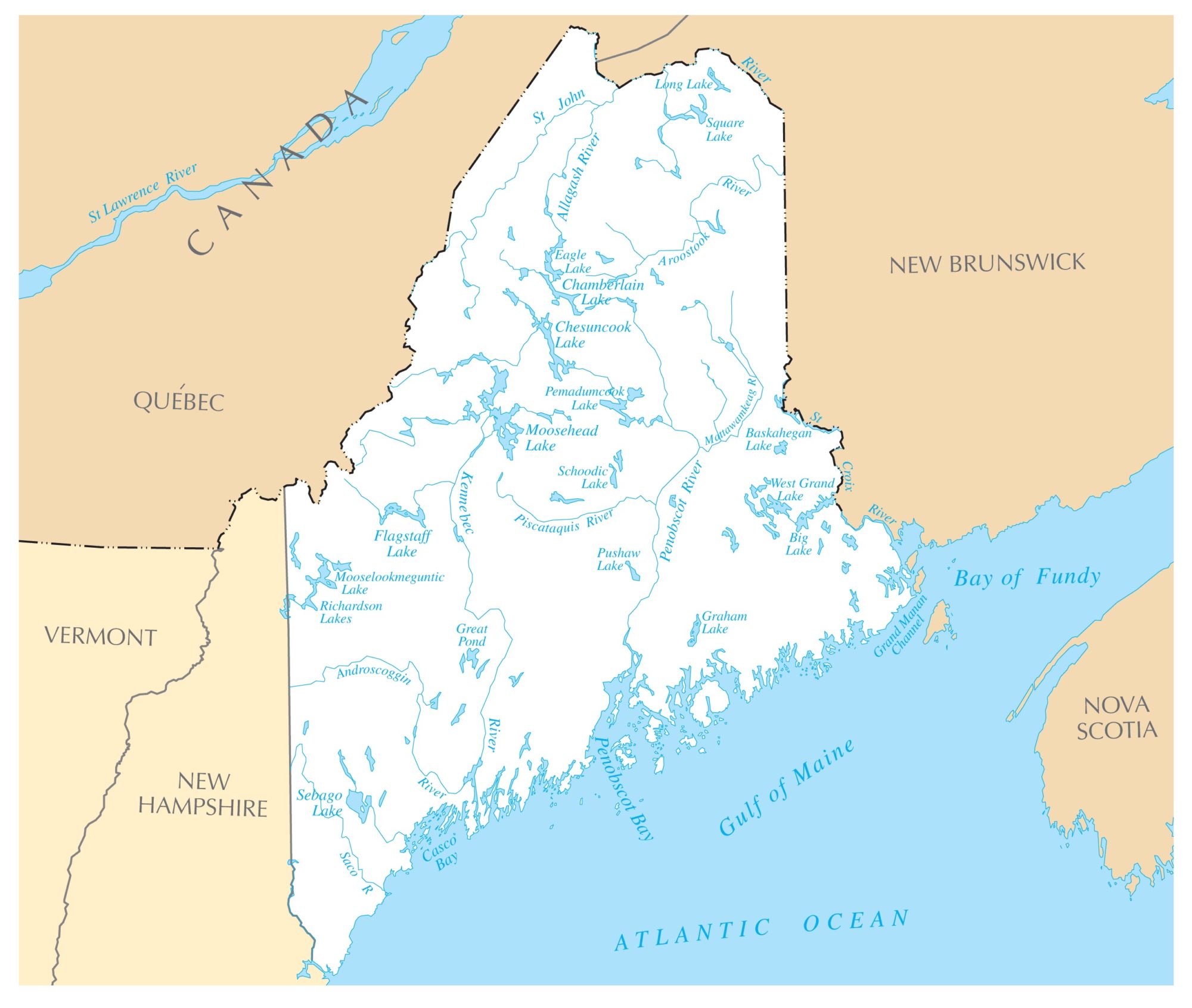
Maine is the most northern state located in the New England region of the United States. The Map of Maine is the 12th smallest of the country with an area of 35,385 square miles. Maine had a population of 1,331,479 residents, which made it the 42nd most populous state of the country.
Maine is divided into three distinct areas; the Atlantic Ocean Coastal Lowlands, the Central Uplands, and mountain ranges of the Appalachian Mountains in the northwestern reaches of the state. Maine’s landscape offers some amazing geographical features: the state is number one in forestry in the US, about 83% of its territory is forested.
Mount Katahdin in Baxter State Park is the highest point with 1,606 meters (5,276 feet) above the sea level. The monthly average temperature of the state is 78.9 degrees to 11.9 degrees Fahrenheit.
Physical Facts
- Land Area: (land) 30,862 sq miles (water) 4,523 sq miles (TOTAL) 35,385 sq miles)
- Bordering States: (1) New Hampshire
- Counties: (16) Map
- County: (largest by population) Cumberland 267,933
- Highest Point: Mt. Katahdin, at 5,267 ft.
- Lowest Point: the Atlantic Ocean, 0 ft.
Transportation Map of Maine
![]()
Major interstate highways are Interstate 95 (I-95) travels through Maine, as well as its easterly branch I-295 and spurs I-195, I-395, and the unsigned I-495 (the Falmouth Spur). The busiest airports in the state are Portland International Jetport and Bangor International Airport. The Downeaster passenger train, operated by Amtrak, provides passenger service.
Cities Map of Maine

Largest cities in Maine with a population of more than 20,000
Portland (66,200), Lewiston (36,600), Bangor (33,000), South Portland (25,000; adjoining Portland), Auburn (23,000; Auburn and Lewiston are known as the Twin Cities), Sanford (21,000), Biddeford (21,000).
Other cities and towns in Maine:
Ashland, Augusta, Bar Harbor, Bath, Belfast, Brunswick, Bucksport, Calais, Camden, Caribou, Dexter, Dover-Foxcroft, Eastport, Ellsworth, Farmington.
Maine Rivers Map | Large Printable High Resolution and Standard Map
Maine Capital Map | Large Printable High Resolution and Standard Map