Maine Transportation And Physical Map | Large Printable Map

Maine Transportation And Physical Map | Large Printable Map is the Map of Maine. You can also free download Map images HD Wallpapers for use desktop and laptop. Click Printable Large Map
Maine located in the New England region of the United States. The Map of Maine is the 12th smallest of the country with an area of 35,385 square miles. Major interstate highways are Interstate 95 (I-95) travels through Maine, as well as its easterly branch I-295 and spurs I-195, I-395, and the unsigned I-495 (the Falmouth Spur). The busiest airports in the state are Portland International Jetport and Bangor International Airport. The Downeaster passenger train, operated by Amtrak, provides passenger service.
Maine is divided into three distinct areas; the Atlantic Ocean Coastal Lowlands, the Central Uplands, and mountain ranges of the Appalachian Mountains in the northwestern reaches of the state. Maine’s landscape offers some amazing geographical features: the state is number one in forestry in the US, about 83% of its territory is forested.
Mount Katahdin in Baxter State Park is the highest point with 1,606 meters (5,276 feet) above the sea level. The monthly average temperature of the state is 78.9 degrees to 11.9 degrees Fahrenheit.
Physical Facts
- Land Area: (land) 30,862 sq miles (water) 4,523 sq miles (TOTAL) 35,385 sq miles)
- Bordering States: (1) New Hampshire
- Counties: (16) Map
- County: (largest by population) Cumberland 267,933
- Highest Point: Mt. Katahdin, at 5,267 ft.
- Lowest Point: the Atlantic Ocean, 0 ft.
The major rivers in Maine are the Saint John River, Kennebec River, Androscoggin River, the St. Croix River, and the Penobscot River. The capital is Augusta, the largest city is Portland. Other major cities in Maine include Lewiston, Bangor, Eastport, and Presque Isle.
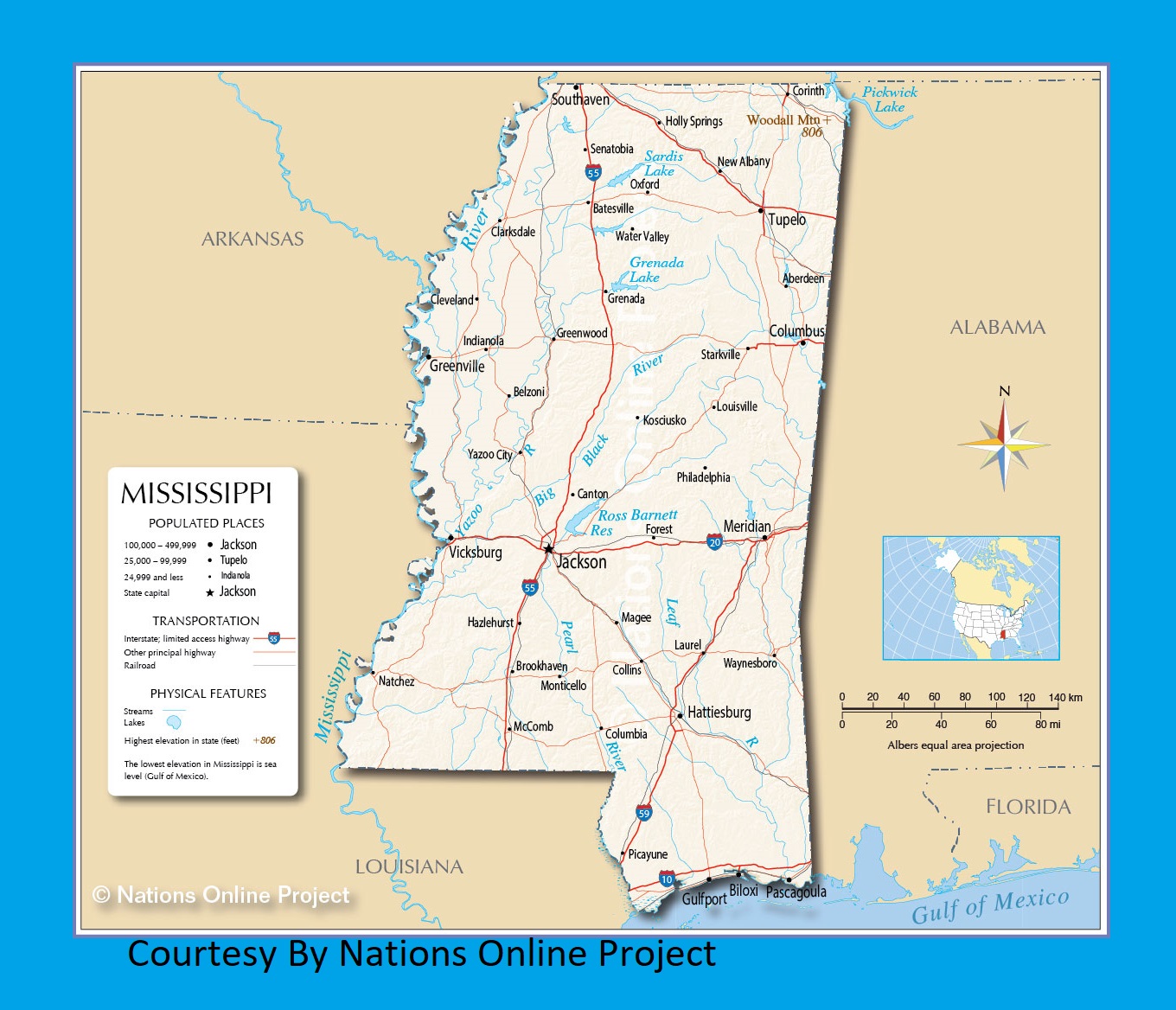
Mississippi Transportation and physical map large printable
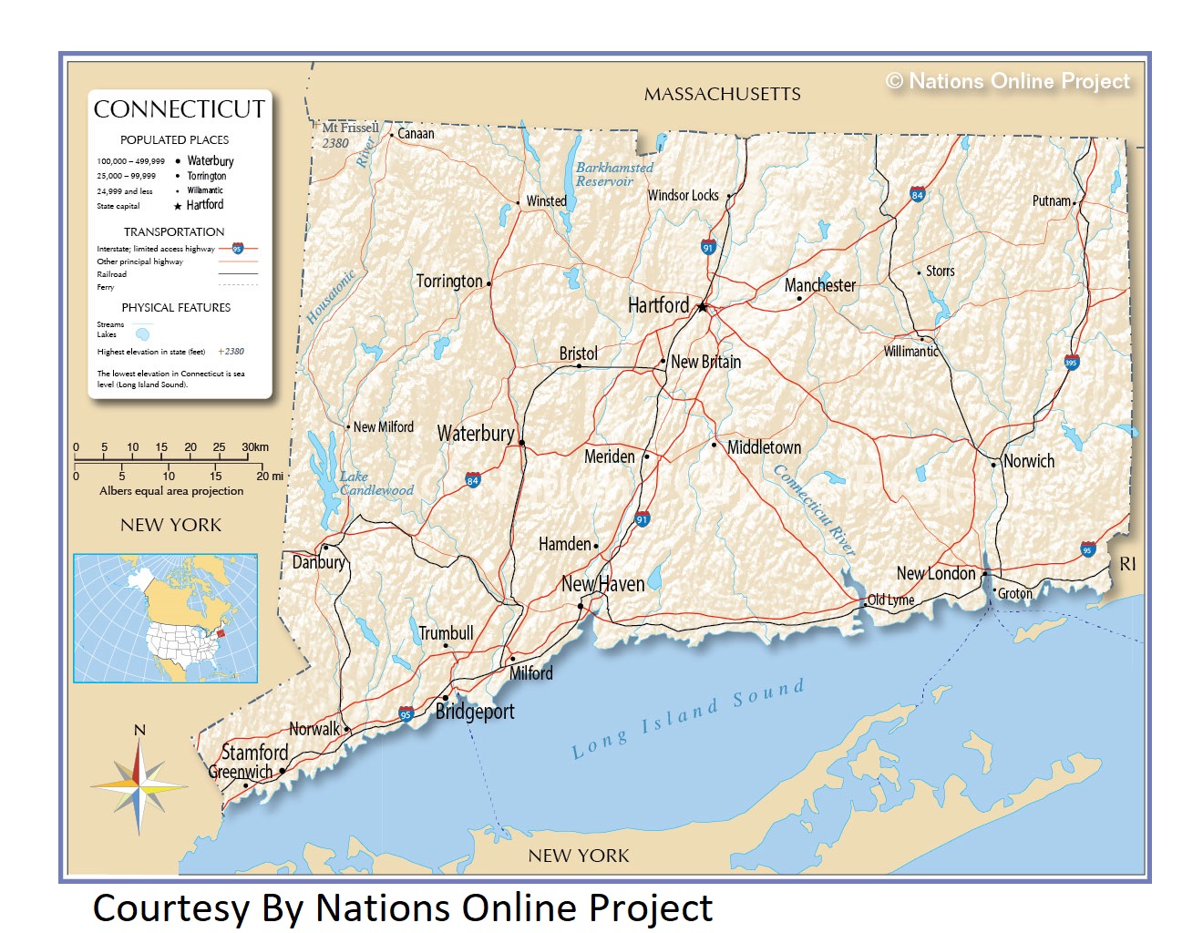
Connecticut Transportation and physical map large printable
| « Louisiana Transportation and physical map large printable | Maryland Transportation and physical map large printable » | |


