Physical Map of Florida | Large Printable, Standard Florida Map

Physical Map of Florida | Large Printable, Standard Florida Map is the Map of Florida. You can also free download Map images HD Wallpapers for use desktop and laptop. Click Printable Large Map
Florida is located in the southeastern region of the United States. It is the most southeastern state of the USA and known as the “Sunshine State”. Physical Map of Florida features more than 12,000 km² (4,700 sq mi) of lakes. 7,700 lakes are greater than 4 hectares in size. The state is slightly larger than twice the size of Austria.
Florida shares a land border with only two other states, both along its northern boundary: Georgia (east) and Alabama (west). The total area of Florida is 58,560 square miles. The state has 663 Miles of Beaches. The climate varies from subtropical in the north to tropical in the south. Florida’s marine shoreline totals more than 8,400 miles (13,500 km), including some 5,100 miles (8,200 km) along the gulf.
The state is divided into four regions: Gulf Coast/Atlantic Ocean coastal plains, uplands of the north and northwest, the swampy Everglades, and the Florida Keys in the far south. Much of the state is at or near sea level with an average elevation of 100 feet above sea level. The total area is 58,560 square miles and has 663 Miles of Beaches. The climate varies from subtropical in the north to tropical in the south.
Florida Facts
- Nickname: The Sunshine State
- Capital City: Tallahassee (pop. 168,979) (2010 est.)
- Population 2019 (estimate): 21,477,737 (Rank 3rd)
- Currency: U.S. Dollar (conversion rates)
- Language: English, others
- Statehood: March 3, 1845 (27th state)
- Total Area: 65,758 square miles
- Highest Natural Point: 345 feet
- Beaches: 663 miles
- Longest River: St. Johns, 273 miles
- Largest Lake: Lake Okeechobee, 700 square miles
- Largest County: Palm Beach, 2,578 square miles
- Coastline: 1,350 statute miles
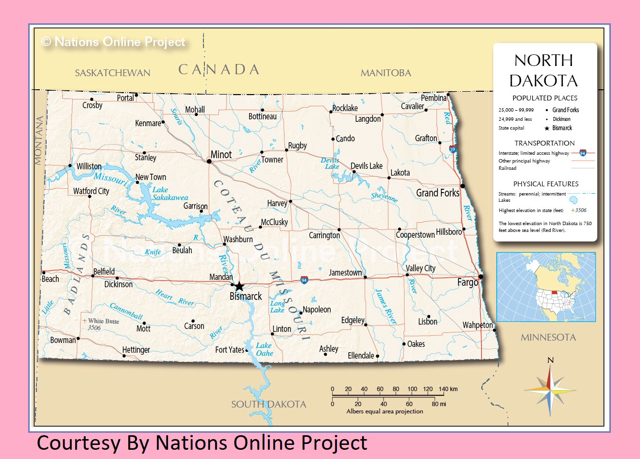
North Dakota Transportation and physical map large printable
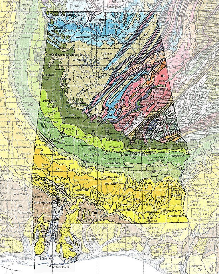
Alabama High-Resolution Physical And Geo Map | Large Printable HD Geographical Map Detailed