Alabama Transportation and physical map large printable

Alabama Transportation and physical map large printable is the Map of Alabama. You can also free download Map images HD Wallpapers for use desktop and laptop. Click Printable Large Map
Alabama is alphabetically the first state of the United States. The map shows the Transportation and physical map of Alabama State. Alabama is standing southern The United States.
Alabama is located in the southern part of the, the United States on the coast of the Gulf of Mexico. Alabama borders the other US states of Georgia on the east, Florida on the south.
Major rivers in Alabama are the Tombigbee near the western border, Alabama cutting through the state from northeast towards southwest. The Tennessee river also flows a few miles in the northern part of the state.
The state is generally flat, with the exception of the northeastern section, where the highest point of the state is found, Mount Cheaha at 733 meters above sea level.
Montgomery is the capital, other cities in Alabama are Florence, Huntsville, Birmingham, Tuscaloosa, Gadsden, Dothan, and Mobile.
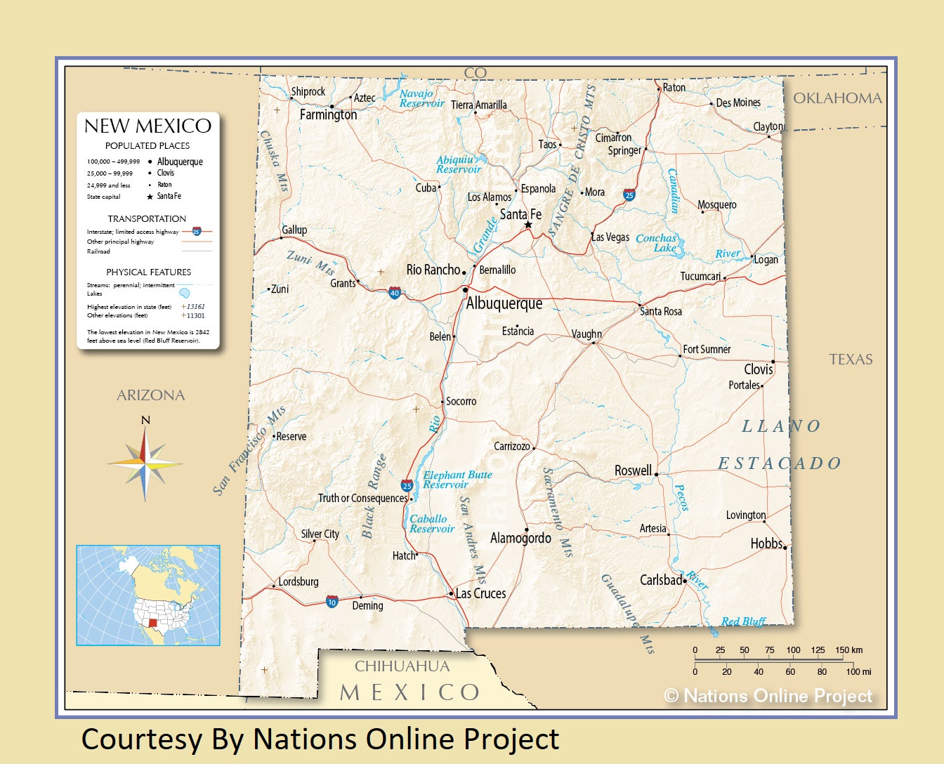
New Mexico Transportation and physical map large printable
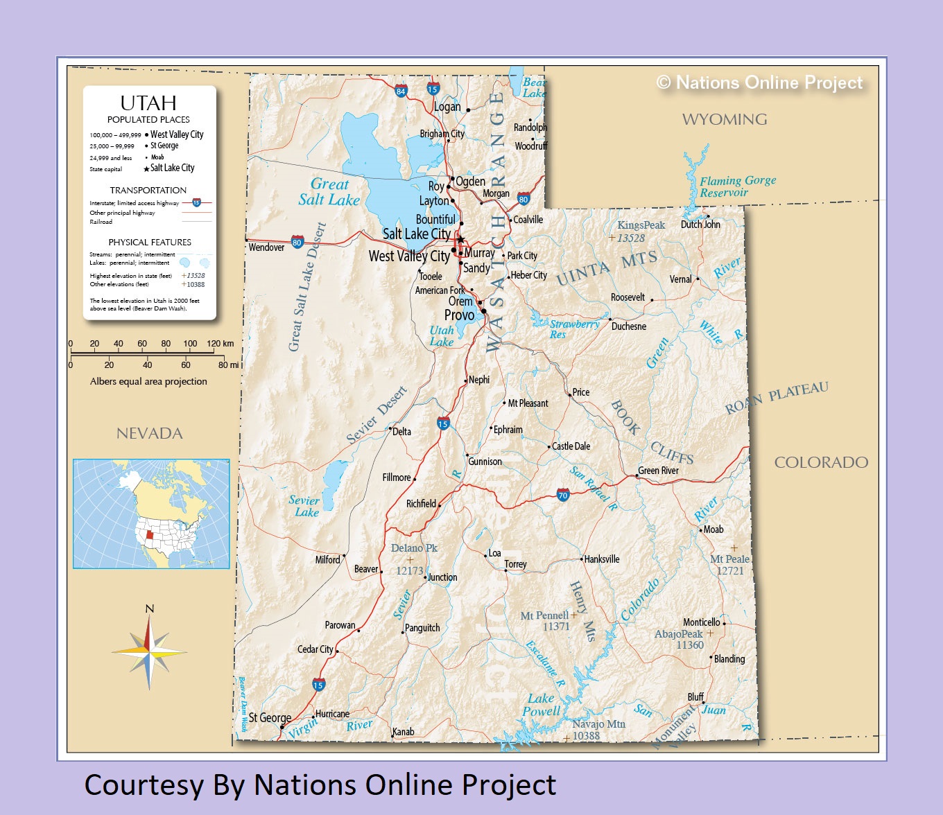
Utah Physical And Transportation Map | Large Printable Map