Kansas Transportation and physical map large printable

Kansas Transportation and physical map large printable is the Map of Kansas. You can also free download Map images HD Wallpapers for use desktop and laptop. Click Printable Large Map
Kansas is located in the central part of the United States, the geographic center of the 48 contiguous states is found in Kansas (Smith county). Kansas is bordered by the other states of Colorado, Nebraska, Missouri, and Oklahoma. The state, lying in the great central plain, has a generally flat surface, however, the land displays a gradual slope up from east to west.
The capital of Kansas is Topeka, the biggest city is Wichita. Other important cities are Garden City, Dodge City, Junction City, Salina, Emporia, Kansas City and Overland Park.
The Missouri River forms the border with Missouri State on the northeastern corner, other rivers flowing in Kansas are Kansas River, Arkansas, Smoky Hill River, Republican River, and Neosho.
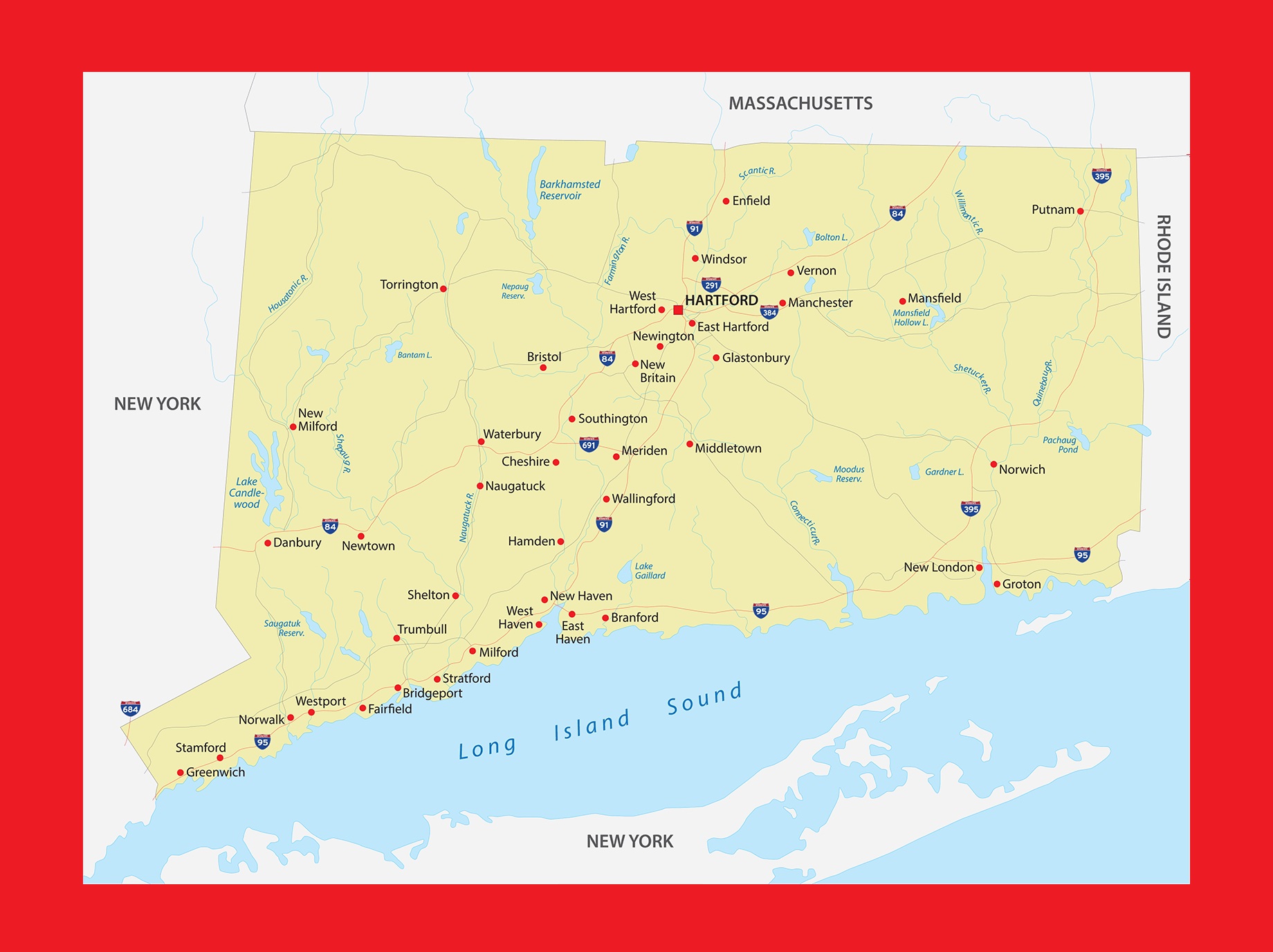
Connecticut Physical Map | Large Printable and Standard Map
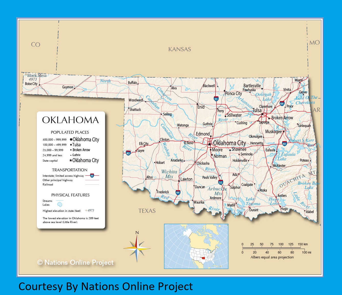
Oklahoma Transportation And Physical Map | Large Printable HD Map
| « Iowa Transportation And Physical Map | Large Printable Map | Kentucky Transportation And Physical Map | Large Printable Map » | |


