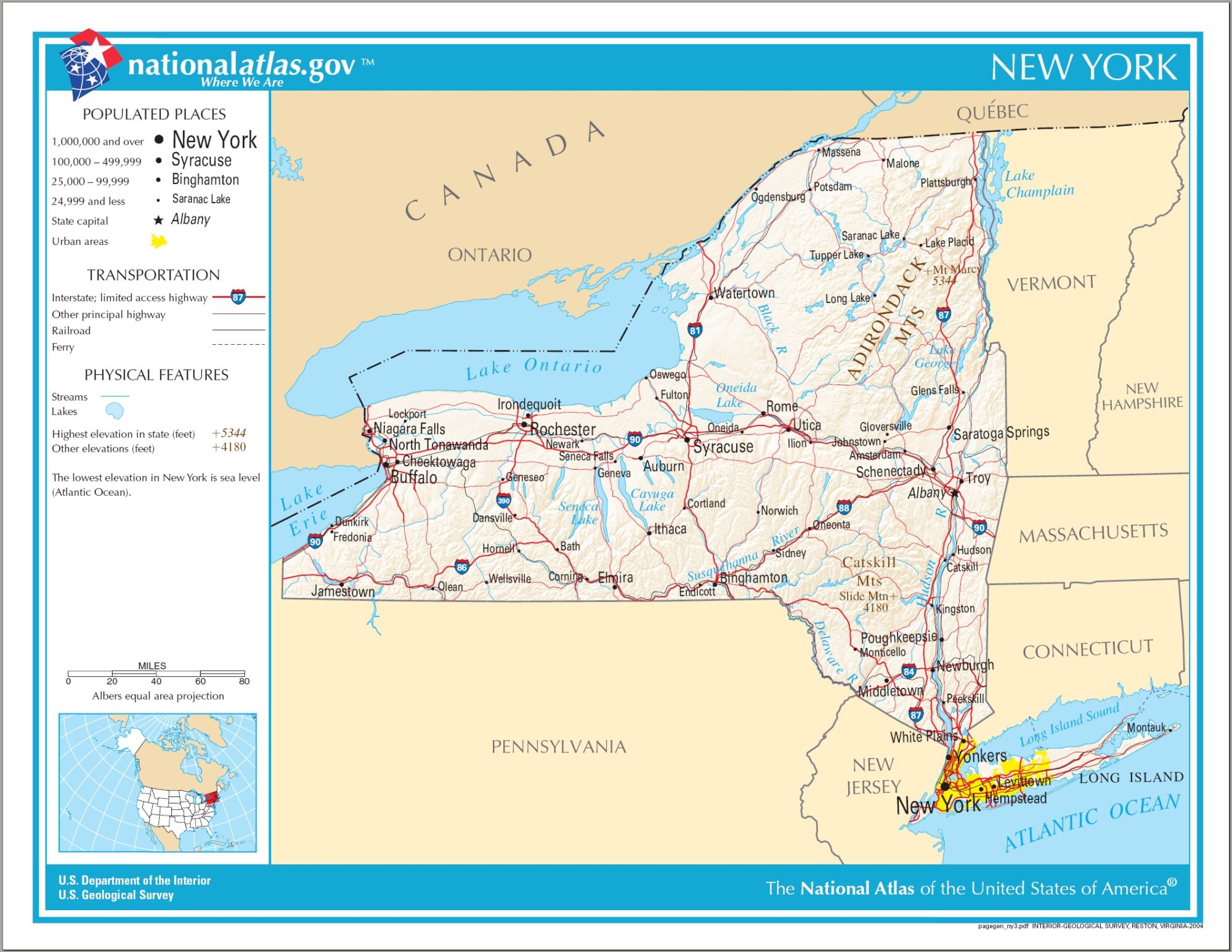
New York Transportation and physical map large printable

New York Transportation and physical map large printable is the Map of New York. You can also free download Map images HD Wallpapers for use desktop and laptop. Click Printable Large Map
Location: Mid-Atlantic and Northeastern regions of the United States
Capital: Albany
Largest city: New York City
Other important cities: Buffalo, Rochester, Syracuse, Lake Placid
Neighboring states/countries: New Jersey, Pennsylvania, Connecticut, Massachusetts, Vermont, Canada
Geographic Features: Allegheny Plateau, Catskill Mountains, Adirondack Mountains, Long Island
Major rivers: Hudson River, Black River, Saint Lawrence River
Largest Lake: Lake Champlain
Highest Point: Mount Marcy (1629 m)
Arizona Physical Map | Large Printable and Standard Map
New York Political Map | Large Printable High Resolution and Standard Map
| « New Mexico Transportation and physical map large printable | North Carolina Transportation and physical map large printable » | |


