Massachusetts Transportation and physical map large printable

Massachusetts Transportation and physical map large printable is the Map of Massachusetts. You can also free download Map images HD Wallpapers for use desktop and laptop. Click Printable Large Map
Location: Northeastern region of the United States, Atlantic Coast
Capital: Boston
Largest city: Boston
Other important cities: Springfield, Lowell, Cambridge, Worcester
Neighboring states: Rhode Island, New York, Connecticut, Vermont, New Hampshire
Geographic Features: The Berkshires, Pioneer Valley, Cape Cod, Martha’s Vineyard, Nantucket
Major rivers: Connecticut
Largest Lake: Quabbin Reservoir
Highest Point: Mount Greylock (1064 m))
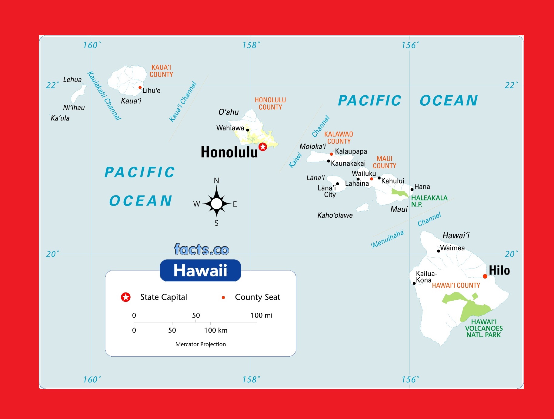
Hawaii Physical Map | Large Printable and Standard Map 2
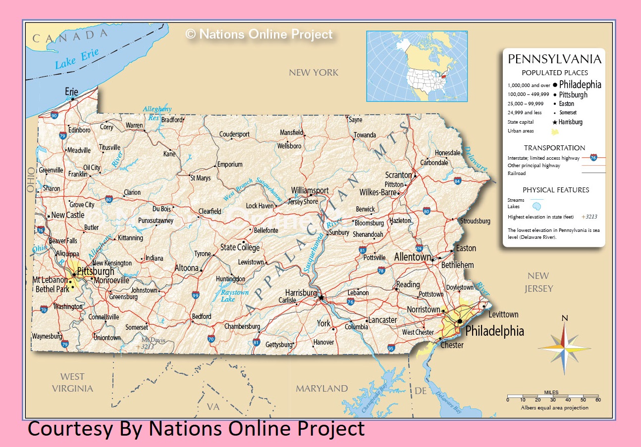
Pennsylvania Transportation And Physical Map | Large Printable Map
| « Maryland Transportation and physical map large printable | Michigan Transportation And Physical Map | Large And Printable Map » | |


