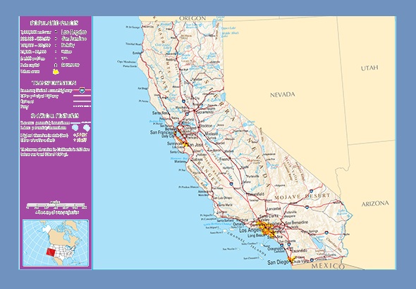
California Transportation and physical map large printable

California Transportation and physical map large printable is the Map of California. You can also free download Map images HD Wallpapers for use desktop and laptop. Click Printable Large Map
California is located in the southwestern part of the United States, on the Pacific coast. California is bordered by .html”>Mexico on the south, the other states of and on the east, and Central Valley, bounded by the coastal mountain ranges in the west, the Sierra Nevada to the east, the Cascade Range in the north. Mount Whitney of the Sierra Nevada is the highest peak in California, and also in the 48 contiguous states of the US.
The capital of California is Sacramento, the largest city is Los Angeles. Other important cities are San Francisco, San Diego, Palm Springs, Santa Barbara, Bakersfield, Fresno, and Eureka. In the south is a large inland salt lake, the Salton Sea, north of which lies the Mojave Desert and the Sonoran Desert. To the northeast of the Mojave lies Death Valley, which contains the lowest, hottest point in
| « Arkansas Transportation and physical map large printable | Transportation And Physical Map of Colorado | Large And Printable Map » | |


