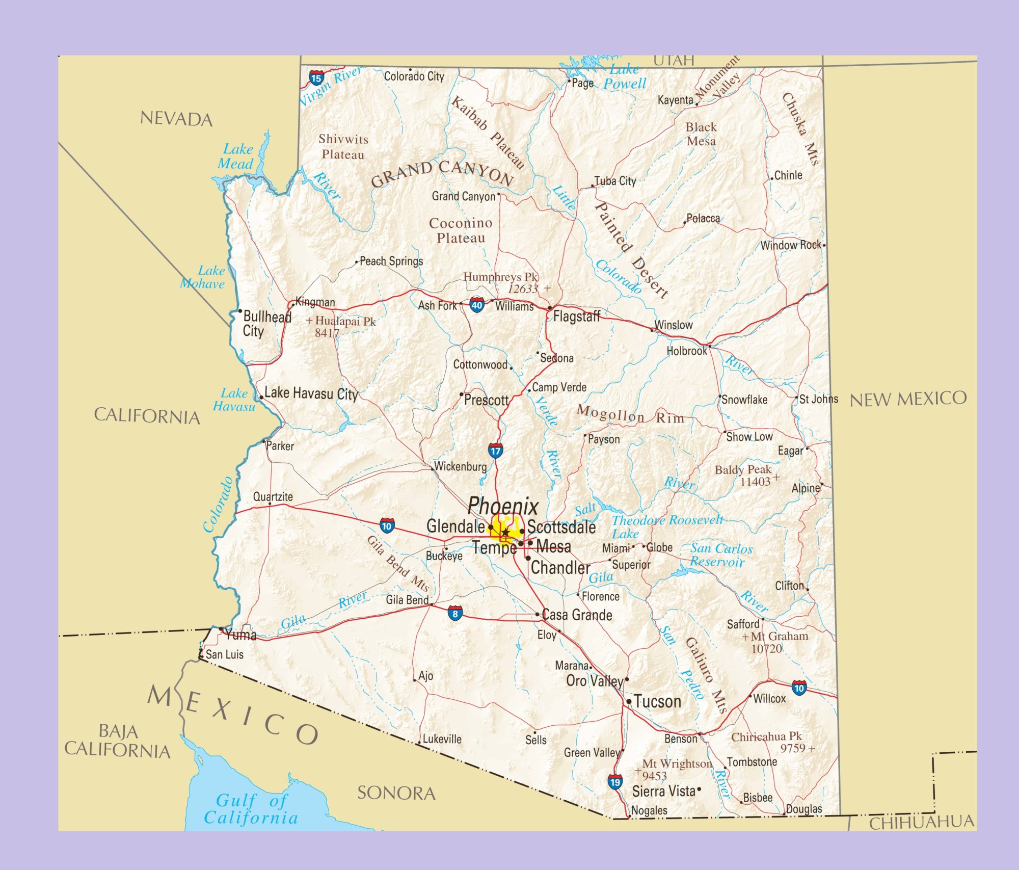
Arizona Physical Map | Large Printable and Standard Map

Arizona Physical Map | Large Printable and Standard Map is the Map of Arizona. You can also free download Map images HD Wallpapers for use desktop and laptop. Click Printable Large Map
Arizona is located in the southwestern region of the US Map. It is the 6th largest state and the 14th most populous state of the United States. Physical Map of Arizona is the 6th largest state Map with an area of 295,234 km² (113,990 sq mi). Arizona achieves statehood on February 14, 1912. Spain colonized the area in 1598 and Arizona was part of New Spain until 1821. In 1846 United States forces invaded and occupied the region of Arizona. The US government declared Arizona as a new U.S. Territory in Washington, D.C., on February 24, 1863.
Arizona is famous for its desert Basin and Range region in the state’s southern portions. This region is rich in a landscape of xerophyte plants such as the cactus. The Grand Canyon is a colorful, deep, steep-sided gorge, carved by the Colorado River. It is one of the Seven Natural Wonders of the World. It is one of America’s best-known natural landmarks.
Monument Valley on the On the Arizona-Utah state line is well-known for sandstone buttes, the tallest reaching 300 m (1,000 ft) above the valley floor. Humphreys Peak is the highest natural point in the state with 3,852 m (12,637 ft). Major Rivers of Arizona: The Colorado River, The Little Colorado River, Gila River, Salt River, Verde River, Santa Cruz River Etc.
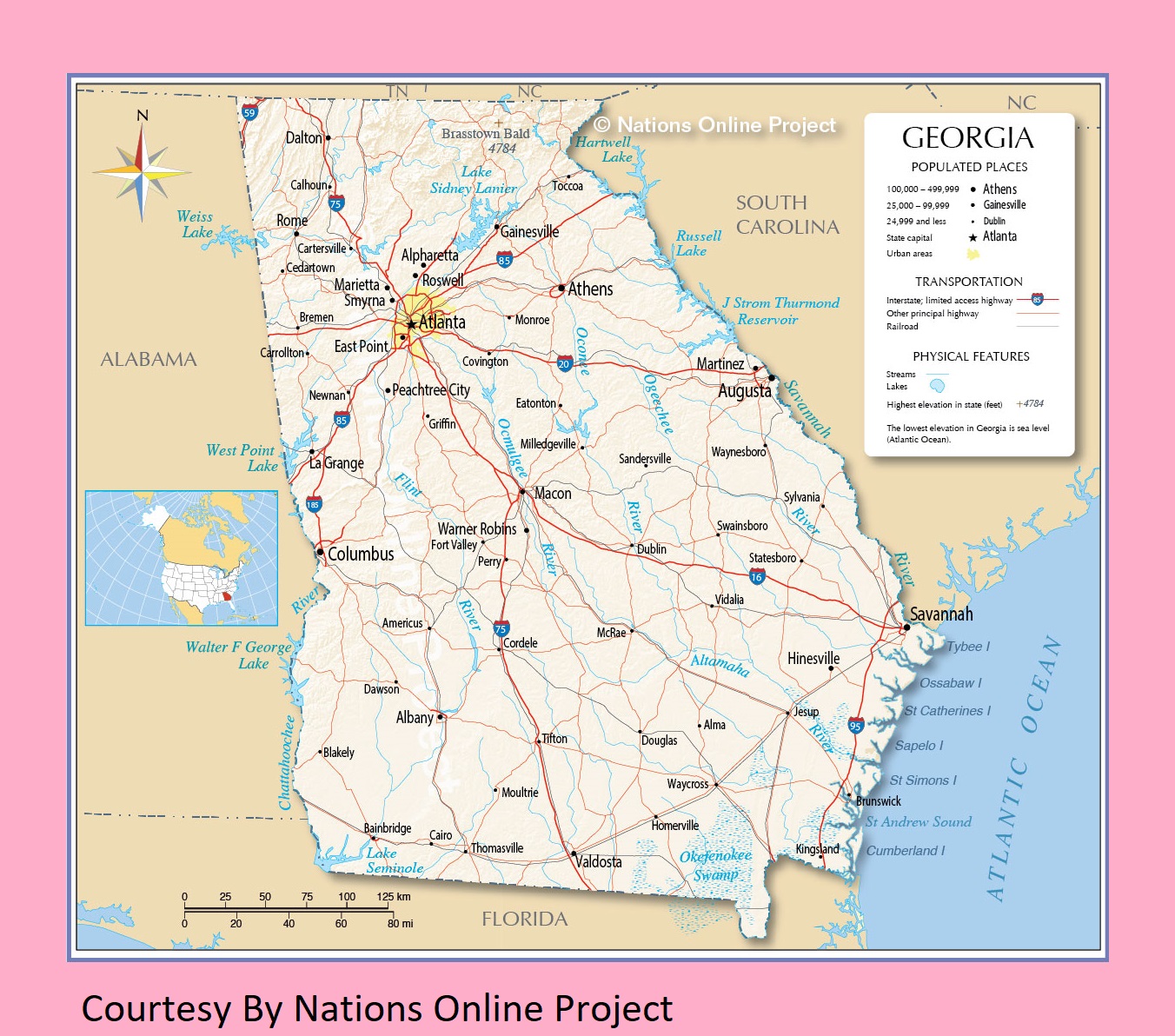
Transportation And Physical Map of Georgia | Large Printable Map
Arizona Political Map | Large Printable and Standard Map 2