Wyoming Transportation and physical map large printable

Wyoming Transportation and physical map large printable is the Map of Wyoming. You can also free download Map images HD Wallpapers for use desktop and laptop. Click Printable Large Map
Physical map of Wyoming shows elevations, plateaus, rivers, lakes, mountain peaks, plains, and other topographic features. Wyoming is one of the fifty states, its borders are lines of longitudes and latitudes, so it has no natural landmarks as its border. It is also the least populous state in the country. The terrain is mostly characterized by the ranges of the eastern Rocky Mountain Ranges, the Big Horn Mountains, the Absaroka Range, the Wind River Range, the Wyoming Range, the Laramie Mountains, the Medicine Bow Mountains. Rivers from these ranges, the most important of which are the Belle Fourche, Cheyenne, North Platte rivers, run down towards the east to reach the Great plains that occupy the eastern third of the state. There are also basins, like the Great Divide Basin, and some river valleys, like the Bighorn River valley, Green River Valley, or the Snake River Valley, that intersect the mountains. The highest peak is Gannett peak, at 4210 meters. The famous Yellowstone National Park is found in the northwestern corner of the states near the similarly named Yellowstone Lake.
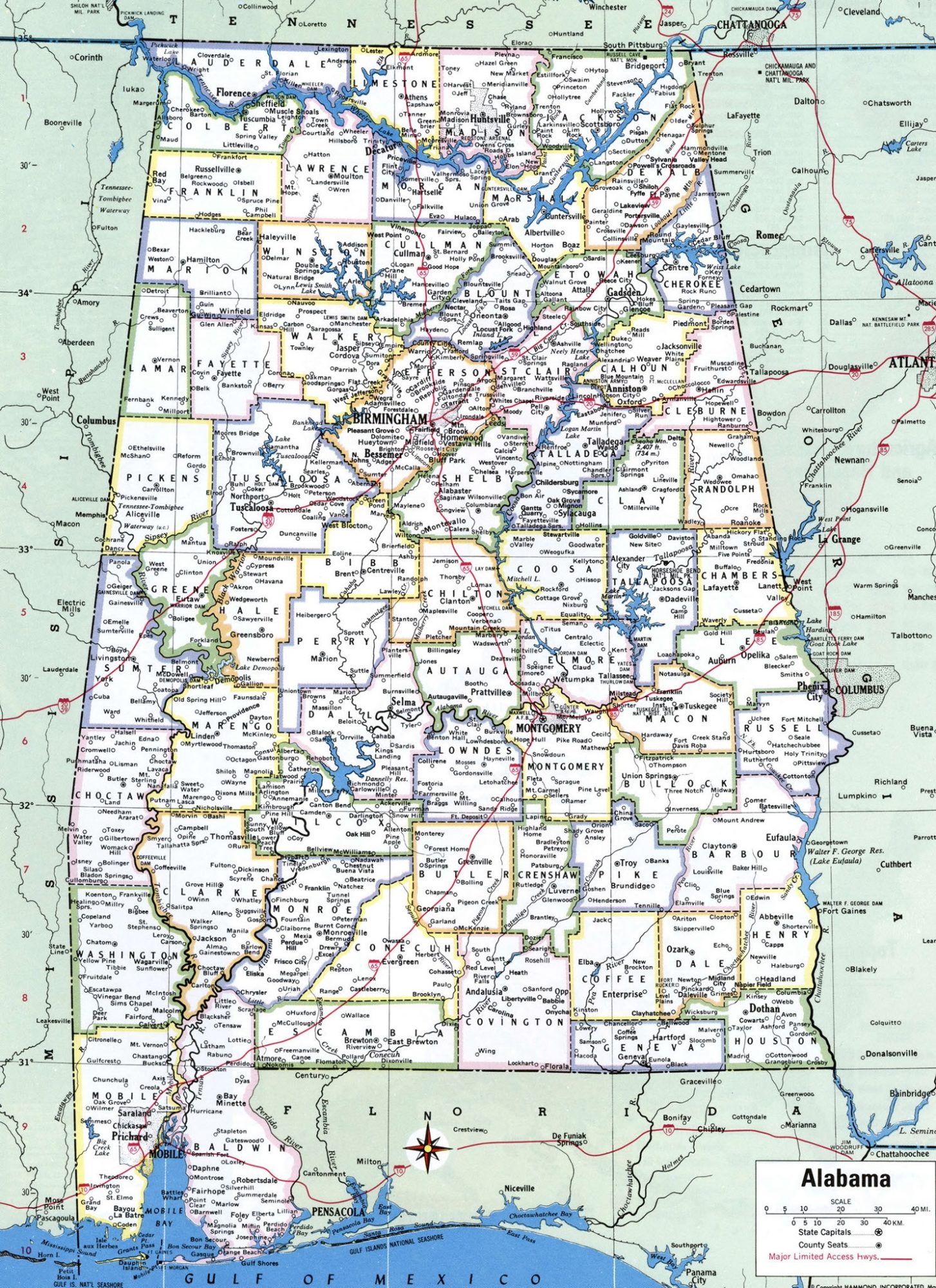
Alabama Large Political Map With Capital , City and River lake Large Printable
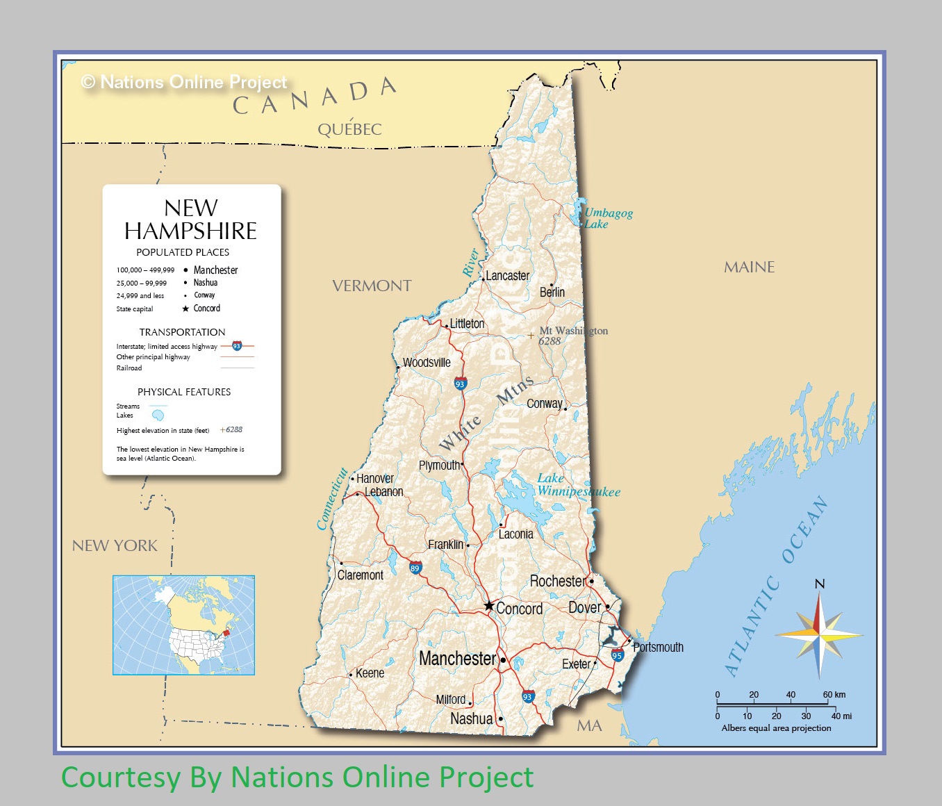
New Hampshire Transportation and physical map large printable
| « Wisconsin Transportation and physical map large printable | Political Map of Alabama With Capital, City River and Lake » | |


