Map of Wyoming | Political, County, Geography, Transportation, And Cities Map

Map of Wyoming | Political, County, Geography, Transportation, And Cities Map is the Map of Wyoming. You can also free download Map images HD Wallpapers for use desktop and laptop. Click Printable Large Map
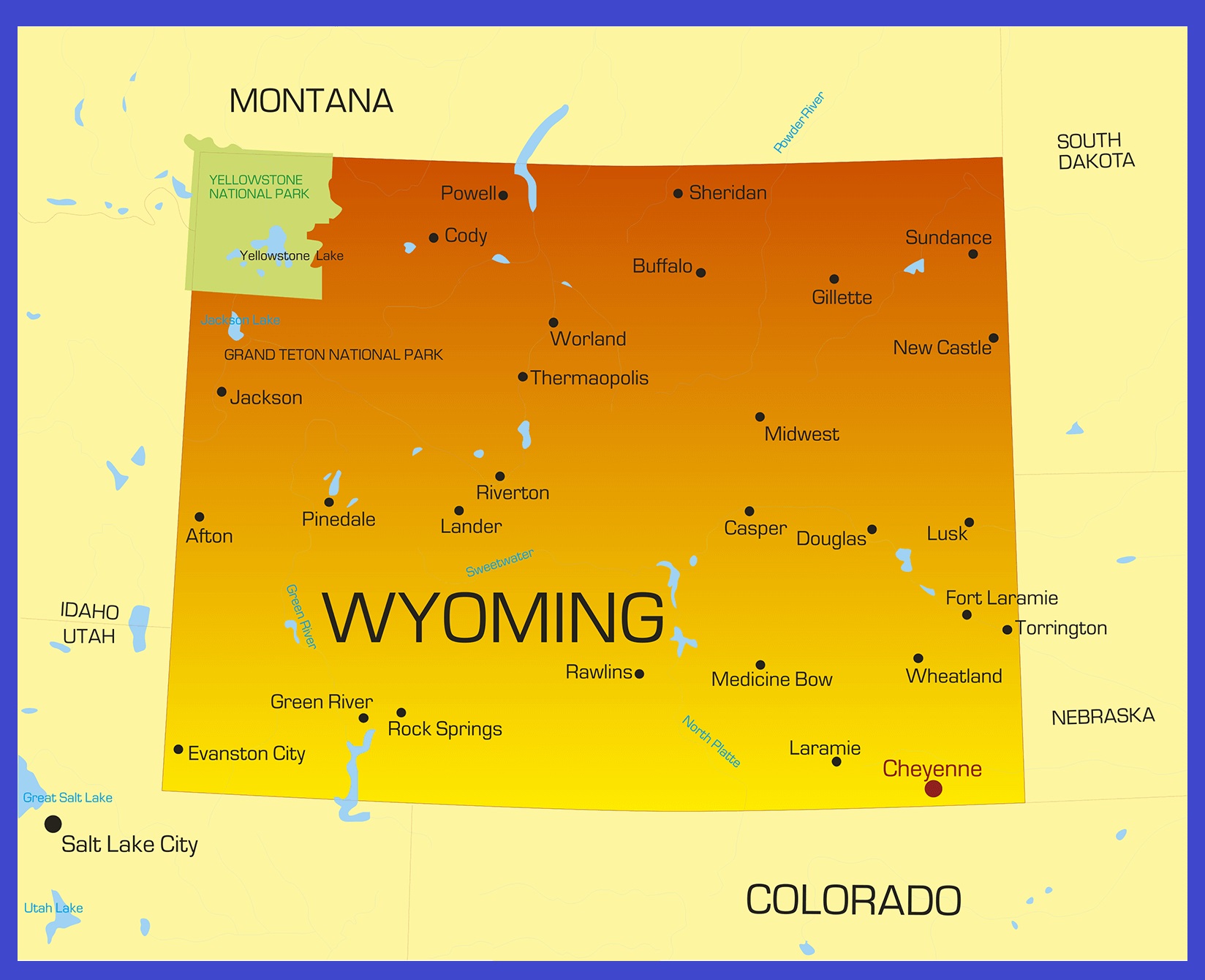
Wyoming is one of the 50 states of the United States. It is a landlocked state located in the Mountain Division in the western US mainland. It shares borders with Montana, South Dakota, Nebraska, Colorado, Utah, and Idaho. With about 578,000 inhabitants (2018 est.), It is the 2nd least densely populated of the fifty states of the USA. The state is the 10th largest state in the US, with a total area of 253,348 km² (97,818 sq mi). Cheyenne is the state capital and the most populous city of the state.
Nomadic indigenous tribes lived in this area for thousands of years. Spanish Empire claimed Wyoming as a part of their Empire. After that, It was Mexican territory until ceded to the U.S. In 1848, after the Mexican-American War, the United States took control of the region. The Wyoming Territory was established on 25 July 1868 and joined the Union in July 1890.
Quick Facts
- Capital City: Cheyenne (pop.) 55,995 (2010 est.)
- Wyoming Population: 576,412 (2012 est.) (50th)
- Nickname: The Equality State
- Currency: U.S. Dollar
- Key Cities: Cheyenne, Casper, Laramie, Gillette, Rock Springs
- Major Industries: Mining, real estate, manufacturing, agriculture, tourism
- Language: English, others
- Statehood: July 10, 1890 (44th state)
- Lowest point: Belle Fourche River at 3,099 ft.
- Highest point: Gannett Peak at 13,804 ft.
- Counties: 23
Political Map of Wyoming

Wyoming is a landlocked state located in the Mountain Division in the western US mainland. The state is the 10th largest state in the US, with a total area of 253,348 km² (97,818 sq mi). Wyoming shares borders with Montana to the north, South Dakota, and Nebraska to the east, Colorado, and Utah in the south, and Idaho in the west. Cheyenne is the state capital and the most populous city of the state.
County Map of Wyoming

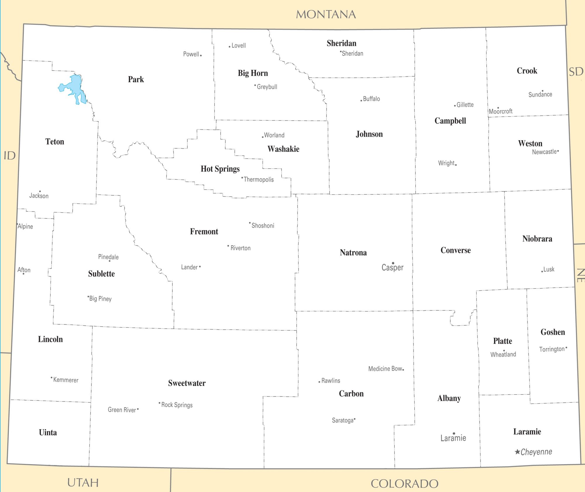
There are 23 counties in the County Map of Wyoming. On July 10, 1890, Wyoming was admitted to the Union with thirteen counties in it. Ten more counties were created after statehood. Sweetwater County is the largest county in Wyoming. It has a total area of 10,491 square miles (27,170 km2). Laramie County is the most populous county of the state with 91,738 people.
Geography Map of Wyoming

Wyoming is one of the 50 states of the United States. It is a landlocked state located in the Mountain Division in the western US mainland. It shares borders with Montana, South Dakota, Nebraska, Colorado, Utah, and Idaho. The state is the 10th largest state in the US, with a total area of 253,348 km² (97,818 sq mi). The state’s highest of the state is Gannett Peak in the Wind River Range within Bridger Wilderness. It has heights of 4,209 m (13,809 ft).
There are 2 Wyoming’s main geographical regions:
- The Great Plains, the Rocky Mountains
- The Intermontane Basins.
In general terms the Great Plains of North America slope east from the Rocky Mountains, extending south from Canada, covering the eastern parts of Wyoming.
Transportation Map of Wyoming

The largest and busiest airport in the state is Jackson Hole Airport, which serves Jackson (WY) and Grand Teton National Park. The second-largest airport is Casper/Natrona County International Airport. There are 3 interstate highways and 13 United States highways pass through Wyoming. I-25, I-80, I-90, I-180 are the main interstate highways of the state.
Cities Map of Wyoming

Cheyenne is the state capital and the most populous city of the state.
| Rank | City | County | Population |
|---|---|---|---|
| 1 | Cheyenne | Laramie | 63,957 |
| 2 | Casper | Natrona | 57,461 |
| 3 | Laramie | Albany | 32,473 |
| 4 | Gillette | Campbell | 31,903 |
| 5 | Rock Springs | Sweetwater | 23,082 |
| 6 | Sheridan | Sheridan | 17,849 |
| 7 | Green River | Sweetwater | 11,978 |
| 8 | Evanston | Uinta | 11,704 |
| 9 | Riverton | Fremont | 10,996 |
| 10 | Jackson | Teton | 10,429 |
| 11 | Cody | Park | 9,828 |
| 12 | Rawlins | Carbon | 8,658 |
| 13 | Lander | Fremont | 7,503 |
| 14 | Torrington | Goshen | 6,701 |
| 15 | Powell | Park | 6,310 |
| 16 | Douglas | Converse | 6,273 |


