Virginia Transportation And Physical Map | Large Printable HD Map

Virginia Transportation And Physical Map | Large Printable HD Map is the Map of Virginia. You can also free download Map images HD Wallpapers for use desktop and laptop. Click Printable Large Map
Transportation Map of Virginia features 57,867 miles (93,128 km) of the total 70,105 miles (112,823 km) of roads in the state. It is the third-largest state highway system in the United States. Interstate highways are I-64, I-66, I-73, I-77, I-81, I-85, I-95, I-264, I-464, I-564, I-664, I-381, I-581, I-785, I-195, I-295, I-395, I-495, I-895.
Virginia’s largest airport is Washington Dulles International Airport. Other major airports are Ronald Reagan Washington National Airport, Norfolk International Airport, and Richmond International Airport. From Fredericksburg and Manassas, Virginia Railway Express operates two commuter lines into Washington, D.C.
Virginia is one of the fifty states of the United States of America, located in the eastern part of the country. It is the 35th largest state in the USA with covering an area of 110,787 km² (42,775 sq mi). The state shares borders with Kentucky, Maryland, North Carolina, Tennessee, West Virginia, and Washington, District of Columbia.
The highest point in Virginia is Mount Rogers, at 1,746 m (5,729 ft). It is located in the Blue Ridge Mountains, which geologically belong to the Appalachians. The Geography Map of Virginia has several distinct regions. major rivers include the James, Potomac, Shenandoah, Rappahannock, and York. Large inland bodies of water include the John H. Kerr Reservoir and Smith Mountain Lake.
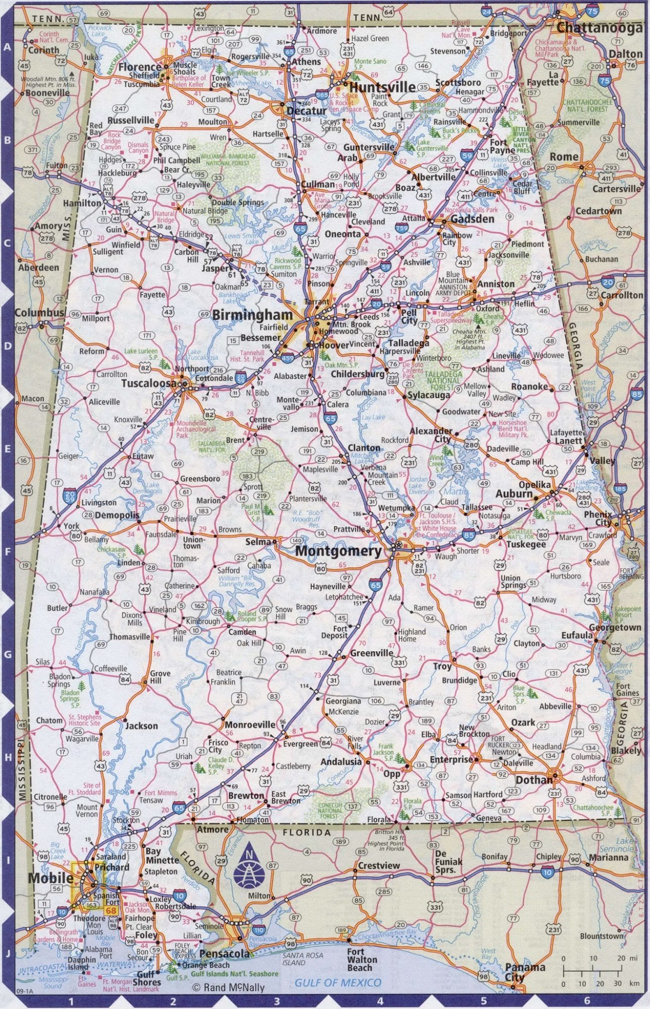
Alabama Large Highway Map Large Highway Map of Alabama-city-county-political
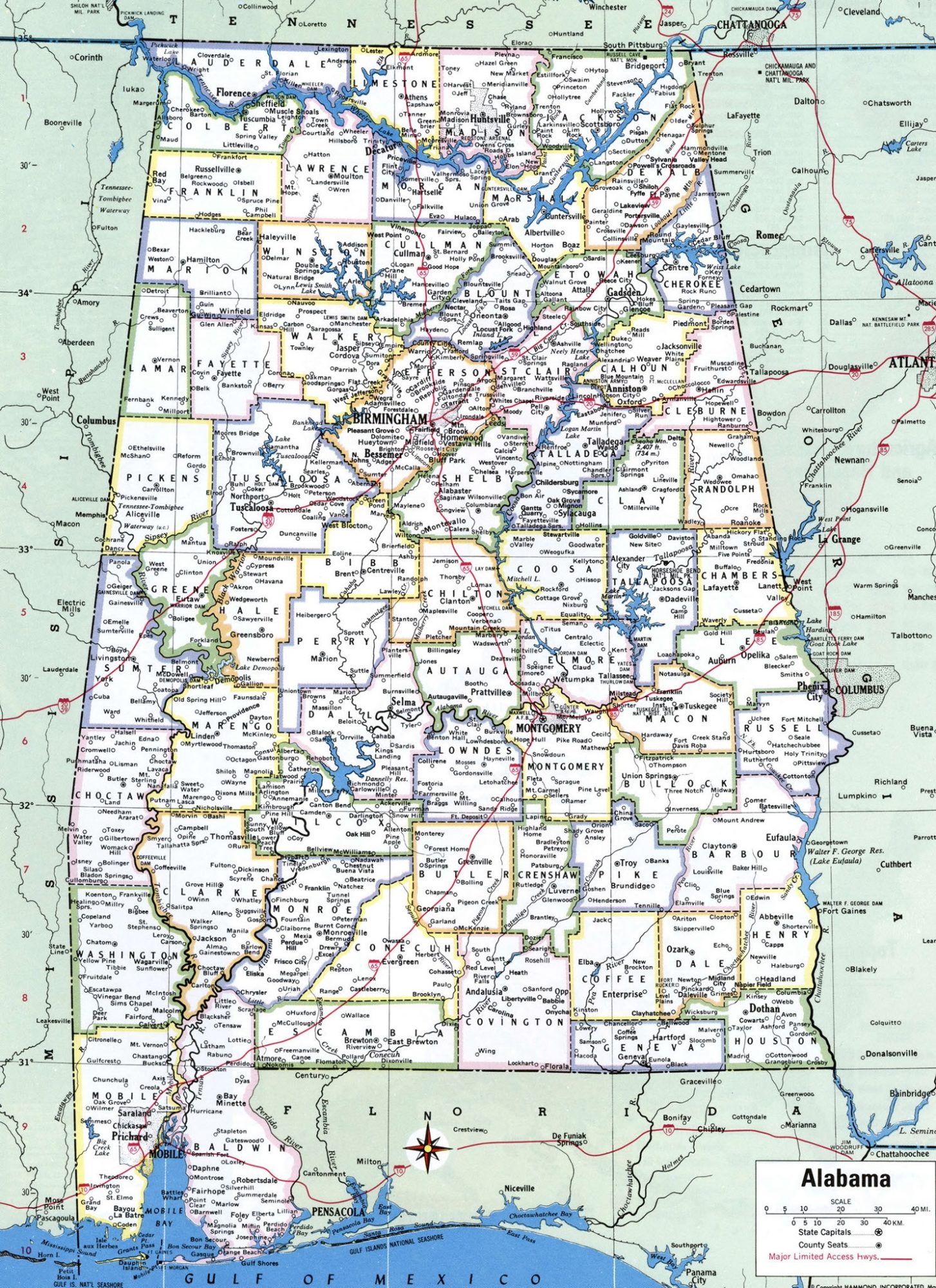
Alabama Large Political Map With Capital , City and River lake Large Printable
| « Vermont Transportation and physical map large printable | Washington Transportation and physical map large printable » | |
| States Physical Maps | The United States | States Transportation Map | United States | Virginia Map | US Virginia State Map |


