Arizona Transportation And Physical Map | Large, Printable Map

Arizona Transportation And Physical Map | Large, Printable Map is the Map of Arizona. You can also free download Map images HD Wallpapers for use desktop and laptop. Click Printable Large Map
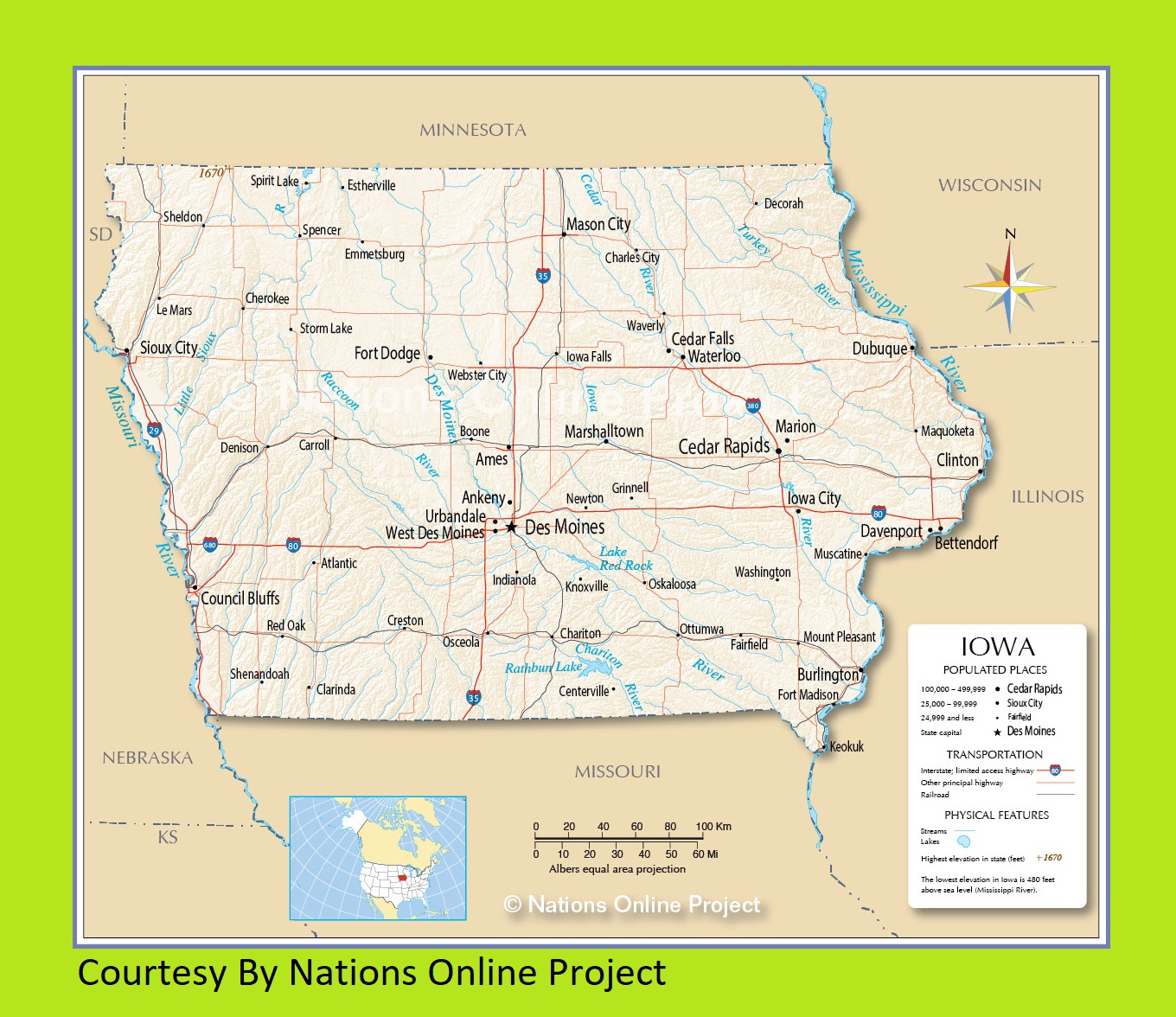
Transportation Map of Arizona features highway and airport. Phoenix Sky Harbor International Airport is the major and 7th busiest airport in the world. Another major airport is Tucson International Airport. A rail system was completed in December 2008. It is called Valley Metro Rail and connects Central Phoenix with the nearby cities of Mesa and Tempe.
Bus services are provided by Greyhound lines. It serves Phoenix, Tucson, Flagstaff, Yuma, and certain other areas. Main Interstate routes include I-17, and I-19 traveling north-south, I-8, I-10, and I-40. US Highways and State Routes include Route 60, Route 70, Route 89, Route 89A, Route 93, Route 95, Route 160, Route 180, and Route 191.
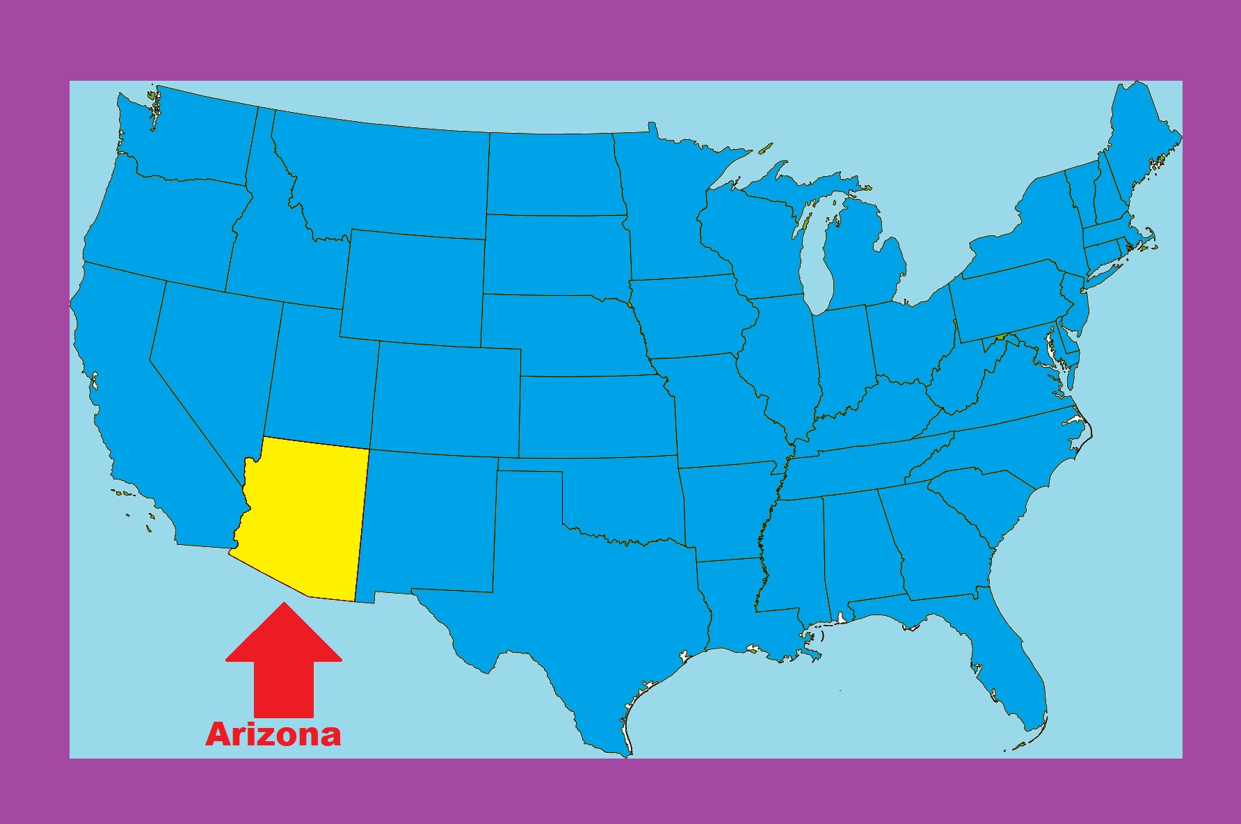
Arizona is located in the southwestern region of the US. It is the 6th largest state and the 14th most populous state of the United States. Physical Map of Arizona is the 6th largest state Map with an area of 295,234 km² (113,990 sq mi). Arizona is best known for its desert landscape. More than half of the state features mountains and plateaus and contains the largest stand of Ponderosa pine in the United States.
The Mogollon Rim, a 600 m escarpment, cuts across the central section of the state and marks the southwestern edge of the Colorado Plateau. The Grand Canyon is a colorful, steep-sided gorge, carved by the Colorado River, in northern Arizona. The canyon is one of the seven natural wonders of the world. The capital and largest city of Arizona is Phoenix. The highest point is Humphreys Peak at 3851 m.
Arizona Location Map | Large Printable and Standard Map
Iowa Transportation And Physical Map | Large Printable Map
| « Alaska Transportation And Physical Map Large Printable | Arkansas Transportation and physical map large printable » | |


