Map of Nebraska | Political, County, Geography, Transportation, And Cities Map

Map of Nebraska | Political, County, Geography, Transportation, And Cities Map is the Map of Nebraska. You can also free download Map images HD Wallpapers for use desktop and laptop. Click Printable Large Map
Nebraska is a landlocked state located in the Great Plains and the Midwestern United States. It shares a border with South Dakota, Iowa, Missouri, Kansas, Colorado, and Wyoming. Map of Nebraska the 16th largest state of the 50 states of the United States with an area of 77,358 square miles. With a population of 1.9 million people, it is the 37th most populated state of the country. The capital city of Nebraska is Lincoln and the largest city is Omaha.
Several indigenous tribes including Omaha, Missouria, Pawnee, and Otoe occupied the area for thousands of years before European exploration. Spanish and French explorers established trade relations with these areas of people. The territory was claimed by both France and Spain and was a part of the Louisiana territory. In 1803, Napoleon approved the sale of the entire area to the United States. It was the part of Louisiana Purchase and the United States doubled in size almost overnight. Nebraska became the 37th state of the US in 1867.
Nebraska Facts
- Capital City: Lincoln (pop. 248,744) (2008 est.)
- Nebraska Population: 1,855,413 (2012 census) (37th)
- Currency: U.S. Dollar
- Language: English, others
- Largest Cities: (by population) Omaha, Lincoln, Bellevue, Grand Island, Kearney, Fremont
- Statehood: March 1, 1867 (37th state)
Political Map of Nebraska

Nebraska is located in the Great Plains and the Midwestern United States. The state covers an area of 200,330 km². The Political Map of Nebraska is bordered by South Dakota to the north, Kansas to the south, Colorado to the southwest, and Wyoming to the west, the Missouri River creates the border with Iowa and Missouri in the east. The official name of the state is “Cornhusker State”. The capital city of Nebraska is Lincoln and the largest city is Omaha.
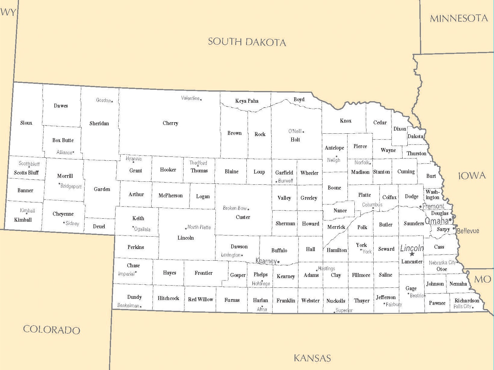
County Map of Nebraska

There are 93 counties in County Map of Nebraska. Nebraska’s postal abbreviation is NE and its FIPS state code is 31. Cherry County is the largest county in the state at nearly 6,000 square miles. Douglas County is the state’s most populous county with a population of 517,110.
Geography Map of Nebraska

Nebraska is a landlocked state. It is one of the states in the Great Plains region. The state covers a total area of more than 77,220 square miles. It shares a border with South Dakota, Iowa, Missouri, Kansas, Colorado, and Wyoming. Panorama Point near the Colorado border is the highest natural point in Nebraska with an elevation of 1,655 meters.
There are 2 prominent land regions in Nebraska: Great Plains to its west and Dissected Till Plains to its east. In western Nebraska, much of the land is blanketed by the Sand Hills, a large area of rolling sand dunes and mostly covered by vegetation. Three rivers cross the state from west to east. The Platte River, the Niobrara River, the Republican River.
Geography Facts
- Land Area: (land) 76,872 sq miles (water) 480 sq miles (TOTAL) 77,352 sq miles
- Horizontal Width: 421 miles
- Bordering States: (6) Colorado, Wyoming, South Dakota, Iowa, Missouri, and Kansas
- Counties: (105)
- County: (largest by population) Douglas, 463,585
- Highest Point: A 5,426 ft. the rise in the far southwestern corner of the state
- Lowest Point: along the Missouri River, 840 ft.
- Mean Elevation: 2,586 feet
Transportation Map of Nebraska
![]()
The Nebraska Department of Transportation (NDOT) maintains the Transportation Map of Nebraska. Major Interstate Highways through the State of Nebraska: I-76, I-80, I-129, I-180, I-480, I-680. Major railroad operations in the state are Amtrak, BNSF Railway, Canadian National Railway, and Iowa Interstate Railroad. The largest airport is Omaha’s Eppley Airfield.
Cities Map of Nebraska

The capital city of Nebraska is Lincoln and the largest city is Omaha. The largest cities in Nebraska are Omaha (468,000), Lincoln (capital city, 287,400), Bellevue (53,600), Grand Island (51,400).
Other cities and towns in Nebraska:
Ainsworth, Alliance, Alma, Ansley, Auburn, Beatrice, Benkelman, Blair, Bridgeport, Broken Bow, Burwell, Chadron, Columbus, Crawford, Dunning, Fairbury, Falls City, Hastings, Holdrege, Hyannis, Imperial, Kearney, McCook, Minden, Nebraska City, Neligh, Norfolk, Scottsbluff, Sidney, South Sioux City, Superior, Thedford, Valentine, Wahoo, Wayne, West Point, and York.
Cities Map of Nebraska | Large Printable High Resolution Nebraska City Map
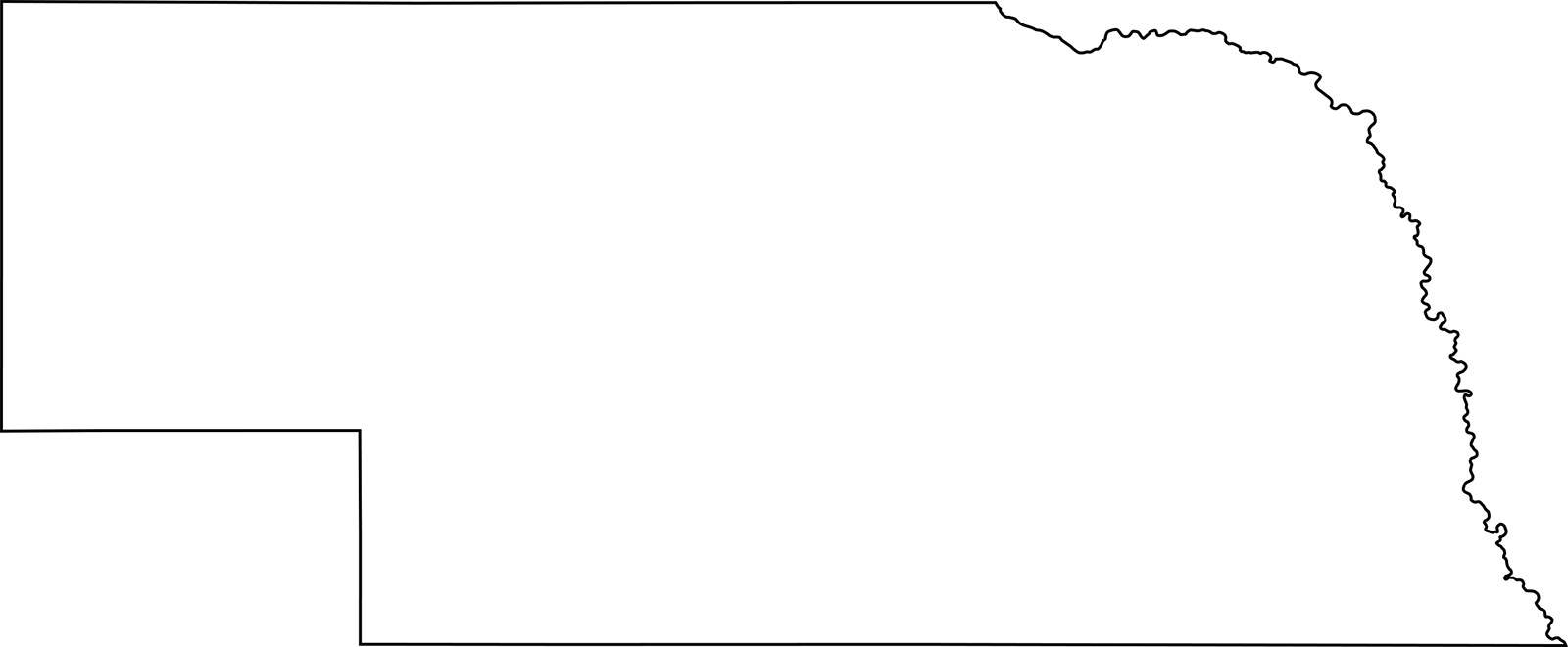
Nebraska Outline Map | Blank Large Printable High Resolution Map