Map of Washington | Political, County, Geography, Transportation, And Cities Map

Map of Washington | Political, County, Geography, Transportation, And Cities Map is the Map of Washington. You can also free download Map images HD Wallpapers for use desktop and laptop. Click Printable Large Map
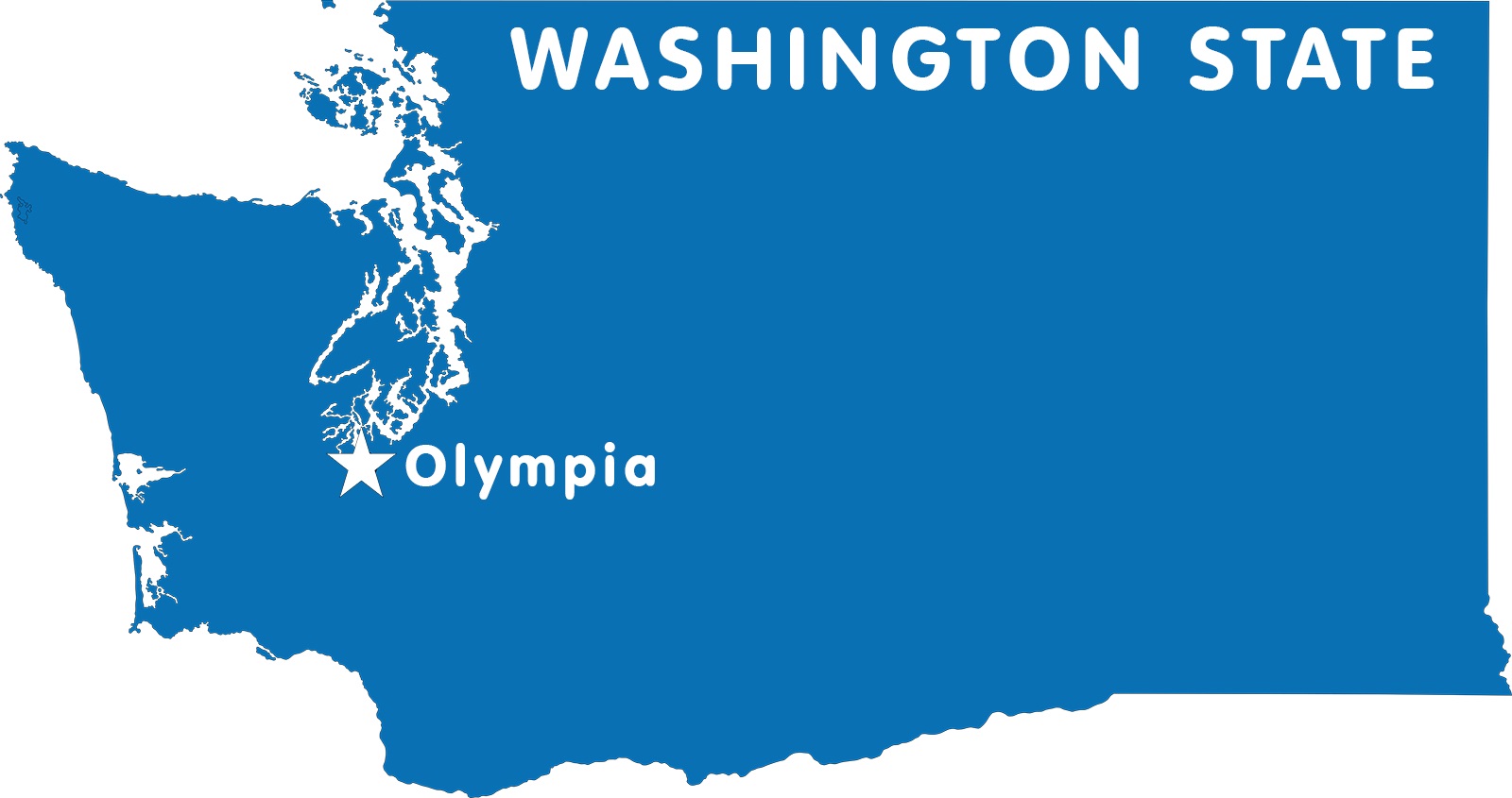
Washington is a state located in the Pacific Northwest region of the United States. It is the 18th largest state with covering an area of 71,362 square miles. The state has a population of 7.6 million people (2019 est.) which makes it the 13th most populous state of the country. The state was named for George Washington who was the first U.S. president. It shares borders with Idaho, Oregon, and Canada. Olympia is the state capital of Washington.
Before the Europeans exploration, the area had many established tribes of aboriginal Americans. They were notable for their totem poles and their ornately carved canoes and masks. The United States acquired the area through a treaty with Great Britain in 1846. Washington joined the Union as the 42nd state in 1889. The state consists of 39 counties.
Quick Facts
- Capital City: Olympia (pop.) 44,925 (2008 est.)
- Population: 7 million
- Nickname: The Evergreen State
- Currency: U.S. Dollar
- Key Cities: Seattle, Spokane, Olympia, Vancouver, Tacoma
- Major Industries: Aerospace, agriculture, and food manufacturing, technology, forest products
- Language: English, others
- Statehood: November 11, 1889 (42nd state)
- Size: 71,362 sq. miles
- Lowest point: the Pacific Ocean at sea level
- Highest point: Rainier at 14,410 ft.
- Counties: 39
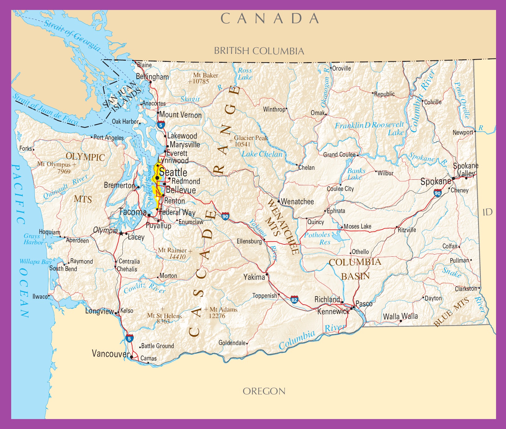
Political Map of Washington

Washington is located in the Pacific Northwest region of the United States. It covers an area of 71,362 square miles. Political Map of Washington Idaho in the east, Oregon in the south, and the Pacific Ocean in the west. The Columbia River defines a long section of the state’s border with Oregon in the south. The state also shares its international borders with the Canadian province of British Columbia in the north. Olympia is the state capital of Washington. The largest city of the state is Seattle and the largest urban area is Metro Seattle (Seattle-Tacoma-Bellevue).
County Map of Washington

The County Map of Washington consists of 39 counties. King County is the most populous county of the state with a population of 2,252,782 people. Garfield County is both the least populous and the least densely populated county of the state. Okanogan County is the largest county by area in the state. It has an area of 5,268 square miles. San Juan County is the smallest county by area.
Geography Map of Washington

Washington is a state located in the Pacific Northwest region of the United States. It is the 18th largest state with covering an area of 71,362 square miles. It shares borders with Idaho, Oregon, and Canada. Olympia is the state capital of Washington. The highest peak of the state is Mount Olympus at 2,432 m (7,980 ft).
Washington has several distinct geographical regions. The major mountain of the state is The Cascade Mountain Range, The Wenatchee Mountains, Mount Rainier, Mount Adams. The Columbia River is the largest river in the Pacific Northwest region. Other major rivers are the Columbia River, the Kettle River, the Spokane River, the Okanagan River, the Crab Creek, and the Yakima River.
Transportation Map of Washington
![]()
Washington has a system of state highways, called State Routes. It has a ferry system which is the largest in the nation and the third-largest in the world. I-5, I-82, I-90, I-205, I-405, I-705, I-182 are the major interstate highways of the state. The largest airport in the state is Seattle–Tacoma International Airport. Other major airports are Spokane International Airport, Bellingham International Airport, and Tri-Cities Airport in Pasco.
Cities Map of Washington

Olympia is the state capital of Washington.
- The 10 largest cities in Washington state:1. Seattle 745,000
2. Spokane 219,190
3. Tacoma 216,279
4. Vancouver 183,012
5. Bellevue 147,600
6. Kent (in the Seattle–Tacoma metroplex) 129,618
7. Everett 111,262
8. Renton 102,153
9. Federal Way 97,044
10. Yakima 93,884
Other cities and towns in Washington:
Aberdeen, Anacortes, Battle Ground, Bellingham, Blaine, Bremerton, Camas, Centralia, Chehalis, Chelan, Cheney, Clarkston, Colfax, Colville, Coulee City, Longview, Lynnwood, Marysville, Morton, Moses Lake, Mount Vernon, Newport, Oak Harbor, Omak, Oroville, Othello, PascoIlwaco, Raymond, Redmond, Renton, Seattle, South Bend, Spokane Valley, Toppenish, Walla Walla, Wenatchee, Wilbur, Winthrop, and Yakima.
Washington Capital Map | Large Printable High Resolution and Standard Map
Washington Political Map | Large Printable High Resolution and Standard Map