Map of West Virginia | Political, County, Geography, Transportation, And Cities Map

Map of West Virginia | Political, County, Geography, Transportation, And Cities Map is the Map of West Virginia. You can also free download Map images HD Wallpapers for use desktop and laptop. Click Printable Large Map
West Virginia is a landlocked US state in the Appalachian region of the Southern United States. It is also considered as a part of the Mid-Atlantic Southeast Region. With covering an area of 62,755 km² (24,230 sq mi), it is the 41st-largest state by area. The state is the 38th most populous state in the country with a population of 1.79 million people (2019). Charleston is the state capital of West Virginia and also the largest city of the state.
The area of North America was originally inhabited by the Adena Culture, or (Mound Builders.) They lived here for thousands of years. Between the years 1607 and 1776, West Virginia formed a part of the British Virginia Colony. West Virginia separated from Virginia during the American Civil War In 1861. The state joined the Union as a separate state on 20th June 1863, as the 35th state.
Quick Facts
- Capital City: Charleston (pop.) 50,478 (2008 est.)
- West Virginia Population: 1,855.413 (2012 est.) (38th)
- Nickname: Mountain State
- Currency: U.S. Dollar
- Key Cities: Morgantown, Charleston, Huntington, Wheeling, Fairmont
- Major Industries: Chemicals, biotech, energy, aerospace, automotive
- Lowest point: Potomac River at 240 ft.
- Highest point: Spruce Knob at 4,861 ft.
- Counties: 55
- Language: English, others
- Statehood: June 20, 1863 (35th state)
Political Map of West Virginia

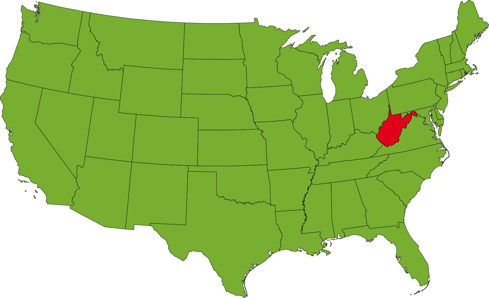
West Virginia is a landlocked US state. It is located in the Appalachian region of the Southern United States. Political Map of West Virginia shares borders with Pennsylvania in the north, Maryland to the east and northeast, Virginia in the east, and Kentucky in the southwest. The Ohio River forms the border with Ohio in the east, and the Potomac river creates a section of the state’s border with Maryland. Charleston is the state capital of West Virginia.
County Map of West Virginia

West Virginia is the 41st biggest state in the United States. The County Map of West Virginia has 55 counties. Fifty of them existed before which West Virginia was part of the Commonwealth of Virginia. The remaining five (Grant, Mineral, Lincoln, Summers, and Mingo) were formed within the state after its admission to the United States.
Randolph County is the largest county by area with a length of 1,040 square miles (2,694 km2). Hancock County is the smallest with 83 square miles (215 km2). Kanawha County is the most populated county (193,063 in 2010).
Geography Map of West Virginia

West Virginia is located in the Appalachian region of the Southern United States. With covering an area of 62,755 km² (24,230 sq mi), it is the 41st-largest state by area. It shares borders with Kentucky, Maryland, Ohio, Pennsylvania, and Virginia. Spruce Knob at 1,482 m (4,863 ft) is the state’s highest point and the highest peak in the Allegheny Mountains. The state’s lowest point is along the Potomac River at Harpers Ferry at 73 m (240 feet) above sea level.
Heavily forested land and the Appalachian Mountain dominated the majority of West Virginia. Major rivers are the Gauley River, Kanawha River, the Greenbrier River, the Guyandotte River, the Monongahela River, and the Elk River. West Virginia’s primary natural resources are coal, natural gas, stone, salt, oil, and mineral springs.
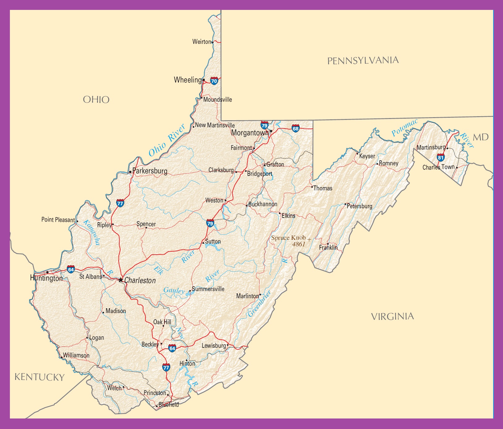
Transportation Map of West Virginia
![]()
Transportation Map of West Virginia features over 37,300 miles (60,000 km) of public roads in the state. There are seven Interstate Highways in the state, They are I-64, I-66, I-68, I-70, I-73, I-77, I-79, I-470. The largest airport in the state is Charleston’s Yeager Airport. Two routes of Amtrak pass through West Virginia and these are the Cardinal route and the Capitol Limited.
Cities Map of West Virginia

Charleston is the state capital of West Virginia and also the largest city of the state.
Large Cities Are:
- Charleston, 47,929
- Huntington, 47,079
- Morgantown, 30,547
- Parkersburg, 30,096
- Wheeling, 28,466
- Weirton, 18,685
- Fairmont, 18,467
- Martinsburg, 17,404
- Beckley, 16,404
- Clarksburg, 15,621
- South Charleston, 12,493
Other cities and towns:
Beckley, Bluefield, Bridgeport, Buckhannon, Charles Town, Clarksburg, Elkins, Fairmont, Franklin, Grafton, Hinton, Keyser, Lewisburg, Logan, Madison, Marlinton, Martinsburg, Moundsville, New Martinsville, Oak Hill, Parkersburg, Petersburg, Point Pleasant, Princeton, Ripley, Romney.
West Virginia Political Map | Large Printable High Resolution and Standard Map
West Virginia Location Map | Large Printable High Resolution and Standard Map