New Hampshire Details Map | Large Printable High Resolution and Standard Map

New Hampshire Details Map | Large Printable High Resolution and Standard Map is the Map of New Hampshire. You can also free download Map images HD Wallpapers for use desktop and laptop. Click Printable Large Map
The New Hampshire Details Map is the 5th smallest state by land area in the United States with an area of 24,214 km². It is located in the New England region of the northeastern United States. The state is the 41st most populous state of the country with a population of 1.35 million people. New Hampshire shares borders with Maine, Massachusetts, Vermont, and Canada. Concord is the official state capital of New Hampshire, while Manchester is the largest city of the state.
- Capital City: Concord (metro pop.) 42,392 (2008 est.)
- New Hampshire Population: 1,320,718 (2012 census) (42nd)
- Currency: U.S. Dollar
- Language: English, others
- Largest Cities: (by population) Manchester, Nashua, Concord, Derry, Rochester, Salem
- Statehood: June 21, 1788 (9th state)
There are 10 counties in the County Map of New Hampshire. Five of the counties from 1769. The last counties created are Belknap County and Carroll County. Hillsborough County is the most populous county in the state with a population of 406,678. Coös County is the largest county in New Hampshire by area.
There are seven major regions in New Hampshire Geography Map. The region is the Great North Woods, the Lakes Region, the White Mountains, the seacoast, the Merrimack Valley, the Monadnock Region, and the Dartmouth-Lake Sunapee area.
New Hampshire has a well-maintained Interstate highway, U.S. highways, and state highways. I-89, I-93, and I-95 are the major interstate highways in New Hampshire. U.S. Route 1, Route 2, Route 3, Route 4 are other major highways of the state.
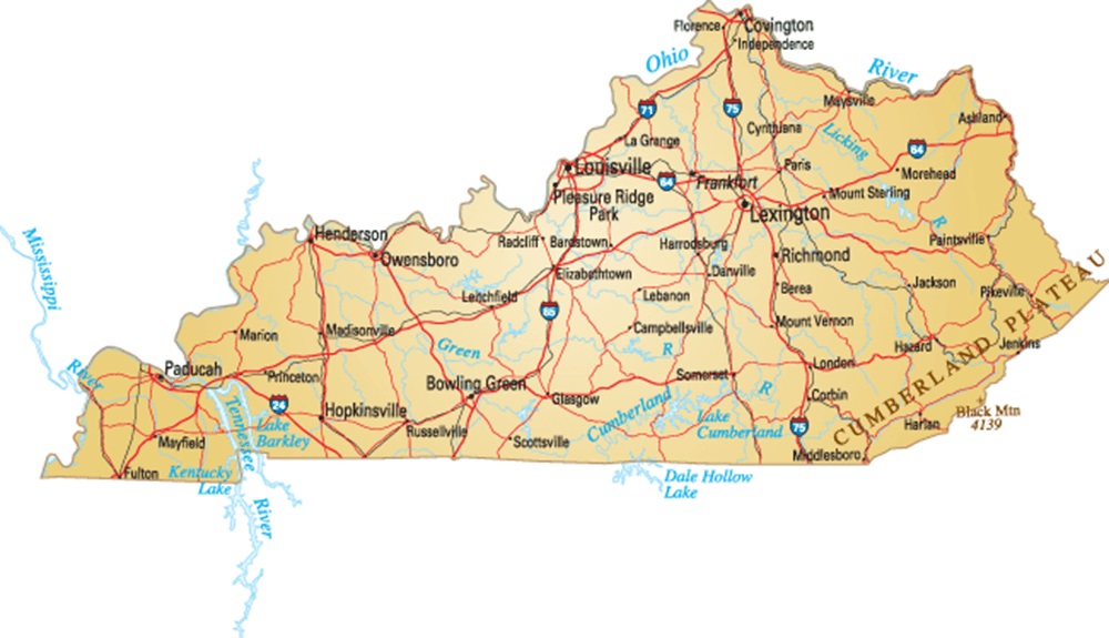
Kentucky Details Map | Large Printable High Resolution and Standard Map
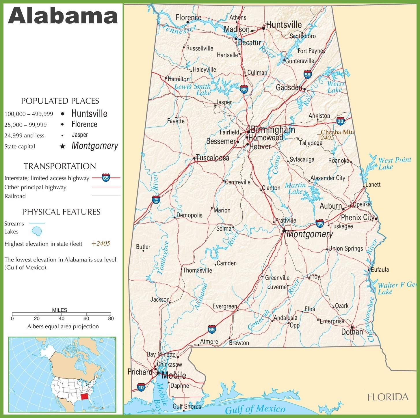
Alabama Large Highway Map | Alabama-City-County-Political Large Highway Printable Map