California Details Map | Large Printable and Standard Map

California Details Map | Large Printable and Standard Map is the Map of California. You can also free download Map images HD Wallpapers for use desktop and laptop. Click Printable Large Map
California is a US state located in the Pacific Region. The Map of California is the 3rd largest state by area With 163,696 square miles (423,970 km2). California is the most populous U.S. state With 39.5 million residents and it is also the world’s thirty-fourth most populous sub-national entity.
History
The name comes from Spanish explorers who believed they had discovered an island, rather than part of mainland USA. The name ‘California’ comes from the 16th-century story of Queen Califa, who was the ruler of a mythical island many years ago.
California Map Facts:
- Capital City: Sacramento (pop. 475,743) (2008 est.)
- California Population: 38,041,430 (2012 est.) (1st)
- California Population: (per square mile)
- U.S. State Populations: (all states)
- Currency: U.S. Dollar (conversion rates)
- Language: English, others
- Statehood: September 9, 1850 (31st state)
- Land Area: (land) 155,959 sq miles
(water) 7,734 sq miles
(TOTAL)163,693 sq miles - Land Area: (all states)
- Horizontal Width: 354 miles
- Vertical Length: 779 miles
- Highest Point: Mt. Whitney, 14,494 ft.
- Lowest Point: in California, and in the entire United States, is in Death Valley, (-282 ft.)

Geography And Landforms
California presents the most diverse series of landforms in all of the United States. The state’s diverse geography ranges from the Pacific Coast in the west to the Sierra Nevada mountain range in the east. From the redwood and Douglas fir forests in the northwest to the Mojave Desert in the southeast.
The Geography Map of California has four main geographic regions: the Coast, the Central Valley, the Mountains, and the Desert. California Pacific Ocean coastline is large with a 1,350 km (840 mi) area. The large parts of the coast are accessible by the California State Route 1.
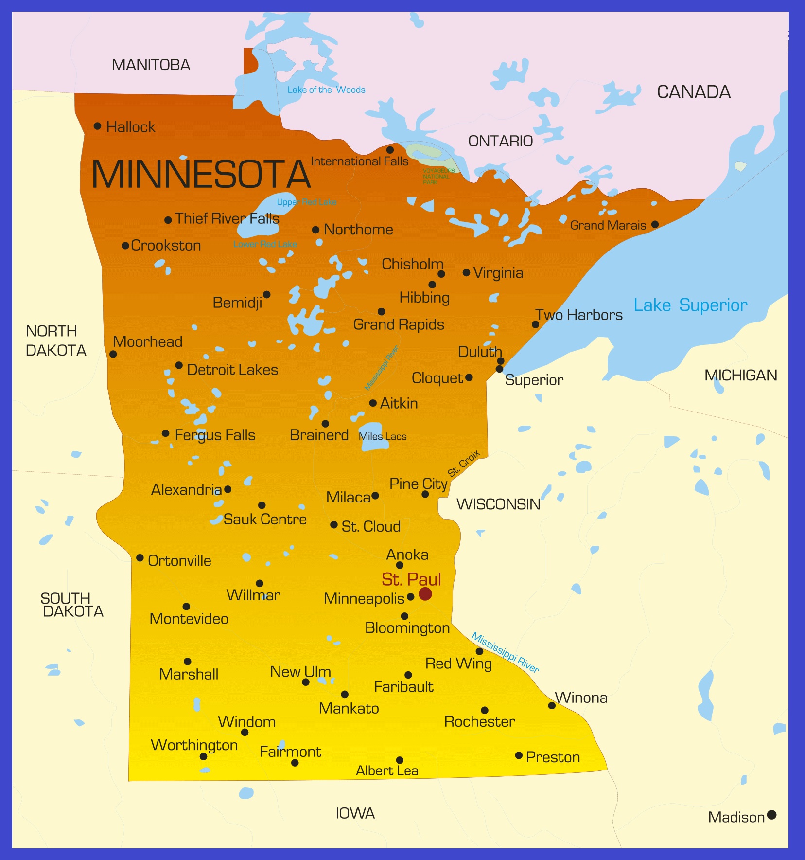
Minnesota Details Map | Large Printable High Resolution and Standard Map
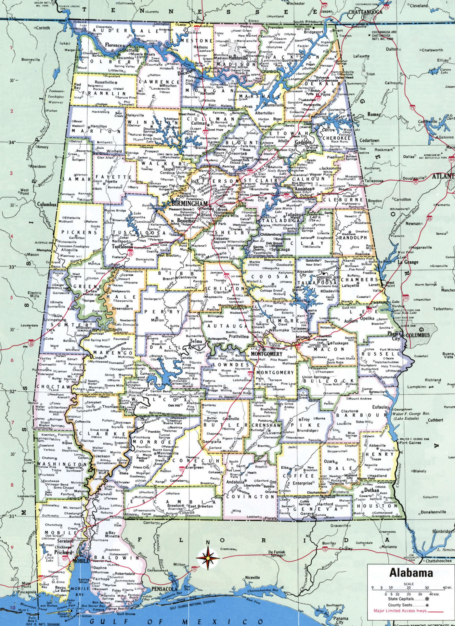
Alabama Large Political Map Political Map of Alabama With Capital , city and River lake-6