City Map of Florida | Large Printable and Standard Map

City Map of Florida | Large Printable and Standard Map is the Map of Florida. You can also free download Map images HD Wallpapers for use desktop and laptop. Click Printable Large Map
Florida is located in the southeastern region of the United States. It is the most southeastern state of the USA. Florida is the third-most populous state With a population of over 21 million. The Map of Florida covers an area of 65,755 square miles which makes it the 22nd largest state in the country. Jacksonville is the largest city in Florida by population. It comprised a population of 880,619 inhabitants.
Miami, with an estimated population of 453,579 (2016), is the second-most populous city in the state. Tampa stands at the third rank. Tallahassee, which is the capital of Florida, had an estimated population of 190,894 (2016), making it the seventh-largest city of the state by population. Lake Buena Vista is the smallest city in the state with a population of just 11 (2016).
Some Major Florida Cities:
Altamonte Springs, Apopka, Atlantic Beach, Bartow, Boca Raton, Boynton Beach, Bradenton, Callaway, Cape Coral, Clearwater, Cocoa, Cocoa Beach, Coral Gables, Coral Springs, Crestview, Daytona Beach, De Land, DeBary, Delray Beach, Deltona, Destin, Dunedin, Edgewater, Eustis, Fernandina Beach, Fort Lauderdale, Fort Myers, Fort Pierce, Fort Walton Beach, Gainesville, Gulfport, Haines City, Hialeah, Hollywood, Homestead, Jacksonville, Jacksonville Beach, Jupiter, Key West, Kissimmee, Lady Lake, Lake City, Lakeland, Largo, Leesburg, Lynn Haven, Melbourne, Miami, Miami Beach, Middleburg, Miramar, Naples, New Port Richey.
Alabama Road Map | High Resolution Road Map of Alabama

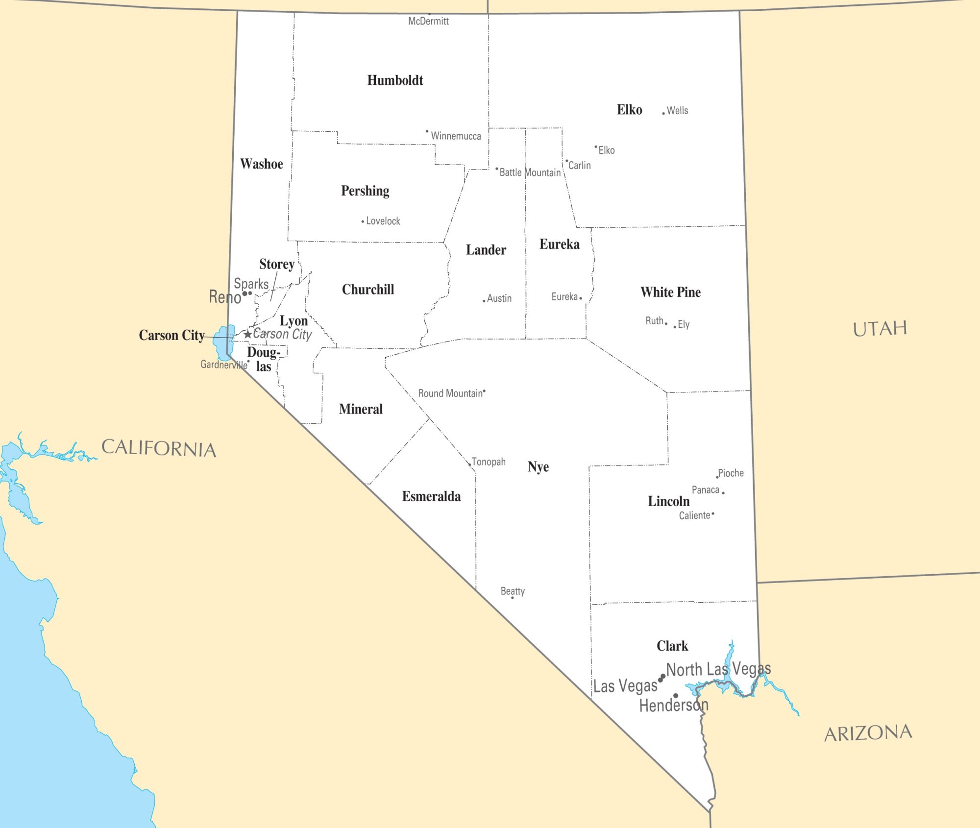
Nevada City Map | Large Printable High Resolution and Standard Map