Map of Arkansas | Political, Physical, Geographical, Transportation, And Cities Map

Map of Arkansas | Political, Physical, Geographical, Transportation, And Cities Map is the Map of Arkansas. You can also free download Map images HD Wallpapers for use desktop and laptop. Click Printable Large Map
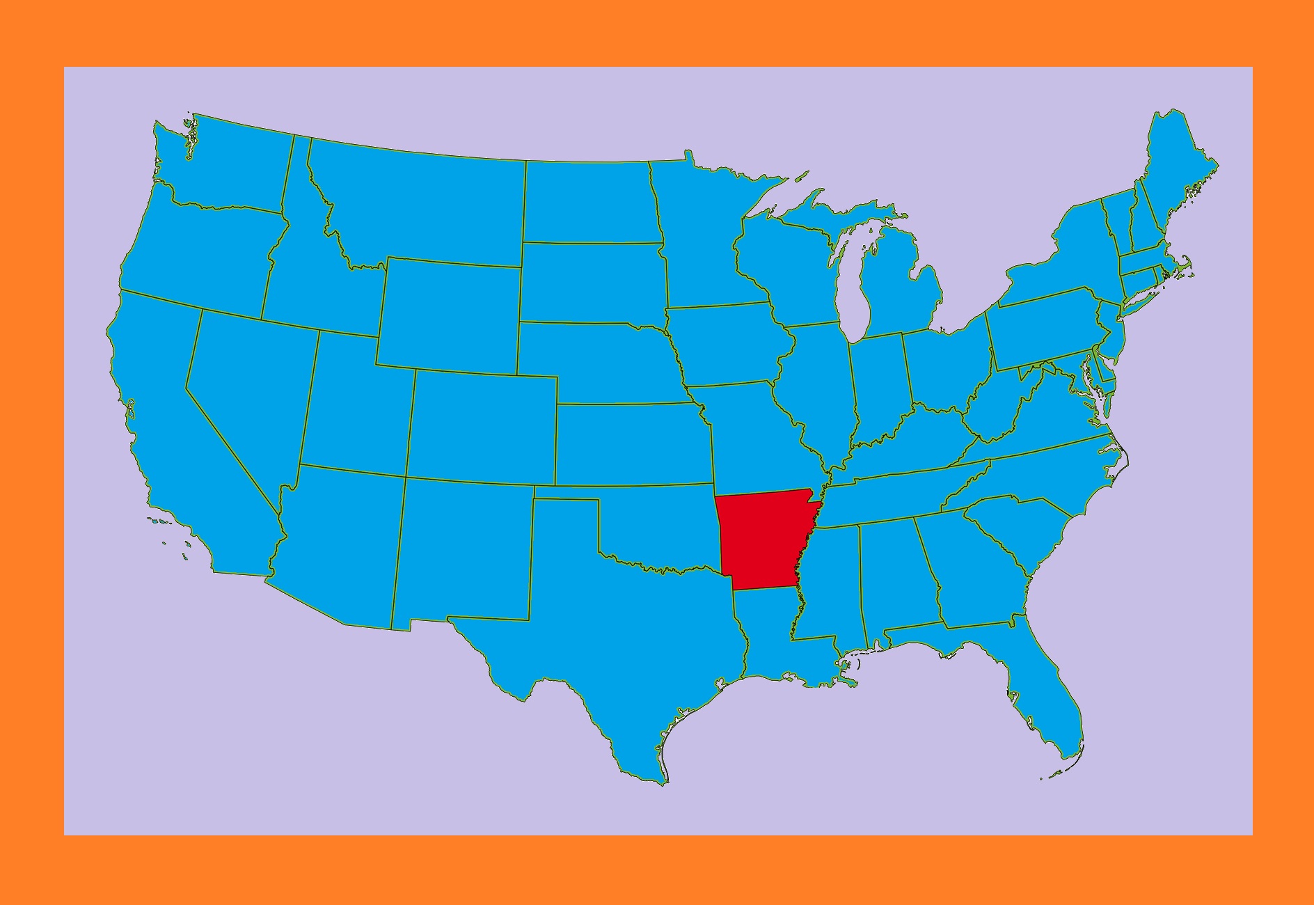
Arkansas US state located in the southeastern region of the United States. It is Nicknamed the “Natural State” and it is home to more than three million people as of 2018. It is the 29th largest state of the country with an area of 53,180 square miles. According to the Map of Arkansas, It shares borders with six other states. Texas in the southwest, Tennessee, and Mississippi in the east, Louisiana in the south, Missouri in the north, and Oklahoma in the west.
Little Rock is the capital And the most populous city in the Map of Arkansas. It is located in the central portion of the state, a hub for transportation, business, culture, and government. Arkansas Map Shows That the northwestern corner of the state is a population, education, and economic center.
It includes the area such as the Fayetteville–Springdale–Rogers Metropolitan Area and Fort Smith metropolitan. The largest city in the state’s eastern part is Jonesboro and the southeastern part is Pine Bluff.
Political Map of Arkansas

The Territory of Arkansas was admitted to the Union as the 25th state on June 15, 1836. According to the Political Map of Arkansas, It shares borders with six other states. Texas in the southwest, Tennessee, and Mississippi in the east, Louisiana in the south, Missouri in the north, and Oklahoma in the west. Little Rock is the capital And the most populous city in the Map of Arkansas. There are 75 counties in Arkansas.
The Government of Arkansas is Consist of 3 Branches:
1. Executive
2. Legislative
3. Judicial
These branches consist of the state governor’s office and a state court system. The Arkansas Constitution delineates the structure and function of the state government. Arkansas has four seats in the U.S. House of Representatives and two seats in the U.S. Senate.
Physical Map of Arkansas
![]()
The Ozark Plateau spans located in the northwestern portion of the state. This region is heavily forested by an oak-hickory ecosystem. It is also carved by numerous rivers and streams. The Arkansas River Valley stretches between the Ozark and Ouachita Mountains in the Physical Map of Arkansas.
The forests and prairies yield the flatter landscape of the Mississippi Delta Region that covers the eastern and far-southern areas of the state. Southeast Arkansas Physical Map is contiguous with the Mississippi Delta which is generally flat, fertile, and swampy.
Buffalo National River, Hot Springs National Park are popular natural attractions. The Mississippi River rolls by the eastern boundary of the state, being fed by its tributaries flowing from the west. Main rivers in Arkansas are the Mississippi, Arkansas, and the White River; other major rivers are St. Francis River, Red River, the Ouachita River, and their tributaries.
Geography Map of Arkansas

Geography Map of Arkansas comprises a total area of 53,179 square miles. It shares borders with Louisiana to the south, Texas to the southwest, Missouri to the north, Mississippi and Tennessee to the east, and Oklahoma to the west.
Mount Magazine in the Ouachita Mountains is the highest point in Arkansas at 2,753 feet (839 m) in Arkansas Geography Map. The lowest point is the Ouachita River located at 55 feet above sea level. The major rivers of the state are Arkansas River and Mississippi River and the major lakes are Lake Ouachita and Bull Shoals Lake.
Arkansas can be categorized into five regions:
1. Arkansas Valley
2. Ozark Plateau
3. Mississippi Alluvial Plain
4. Ouachita Mountains
5. The West Gulf Coastal Plain
Cities Map of Arkansas

Little Rock is the capital And the most populous city in the Map of Arkansas. It is located in the central portion of the state, a hub for transportation, business, culture, and government. The largest city in the state’s eastern part is Jonesboro and the southeastern part is Pine Bluff in the Cities Map of Arkansas.
Arkansas Cities:
Arkadelphia, Benton, Bentonville, Blytheville, Cabot, Camden, Conway, El Dorado, Fayetteville, Forrest City, Fort Smith, Harrison, Hot Springs, Jacksonville, Jonesboro, Little Rock, Magnolia, Mountain Home, North Little Rock, Paragould, Pine Bluff, Rogers, Russellville, Searcy, Sherwood, Siloam Springs, Springdale, Texarkana, Van Buren, and West Memphis.
The Fayetteville–Springdale–Rogers Metropolitan Area is the second-largest metropolitan area in Arkansas. It is growing at the fastest rate due to the influx of businesses and the growth of the University of Arkansas and Walmart.
Transportation Map of Arkansas
![]()
Transportation Map of Arkansas is looking after by the Arkansas Department of Transportation (ArDOT). The headquarters of the Arkansas Department of Transportation is in Little Rock. Several main corridors pass through Little Rock, including Interstate 30 (I-30) and I-40 (the nation’s 3rd-busiest trucking corridor).
Arkansas is served by 2,750 miles (4,430 km) of railroad track divided among twenty-six railroad companies including three Class I railroads. Arkansas also benefits from the use of its rivers for commerce.
Arkansas Location Map | Large Printable and Standard Map
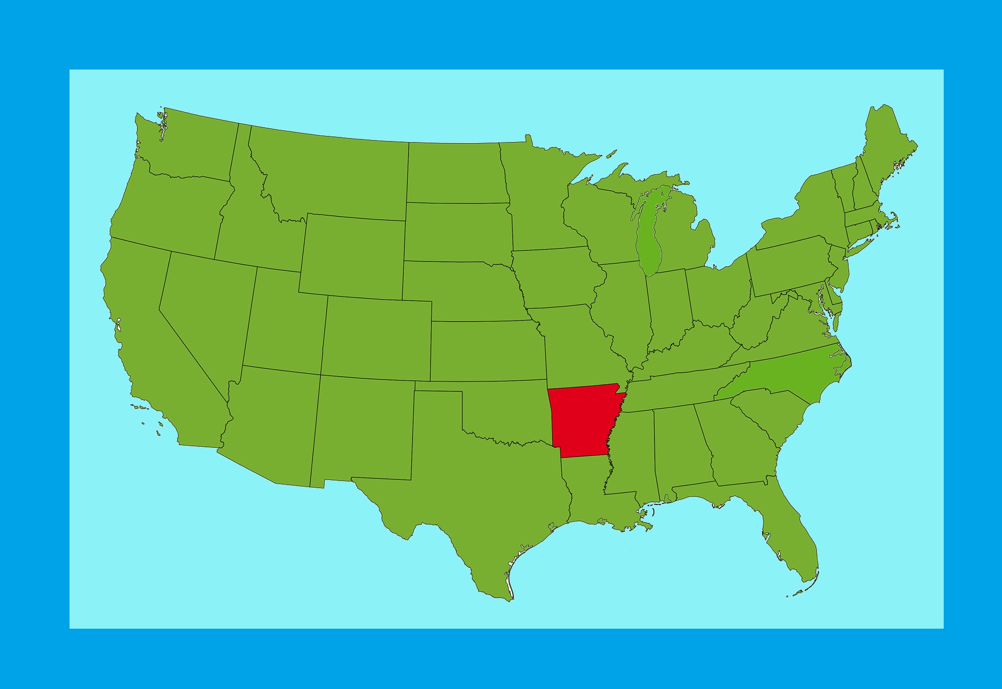
Arkansas Location Map | Large Printable and Standard Map