Texas Political Map | Large Printable High Resolution and Standard Map

Texas Political Map | Large Printable High Resolution and Standard Map is the Map of Texas. You can also free download Map images HD Wallpapers for use desktop and laptop. Click Printable Large Map
Texas is located in the South Central Region of the United States. It covers an area of 268,581 square miles. Texas Political Map shares borders with the states of Louisiana to the east, New Mexico in the west, Oklahoma to the north, Arkansas to the northeast. It also shares an international border with the Mexican states of Chihuahua, Coahuila, Nuevo León, and Tamaulipas in the southwest. Austin is the state capital of Texas.
The County Map of Texas is divided into 254 counties more than any other U.S. state. Brewster County is the largest county in the state with an area of 6,192 sq mi (16,040 km2). Rockwall County has the smallest area of any Texas county.
With a population of 4,092,459 people, Harris County the most populous county in Texas and the third-most populous county in the United States. Some counties of the state are Austin County, Bexar County, Dallas County, El Paso County, Houston County, Orange County, Travis County, and Washington County, among many others.
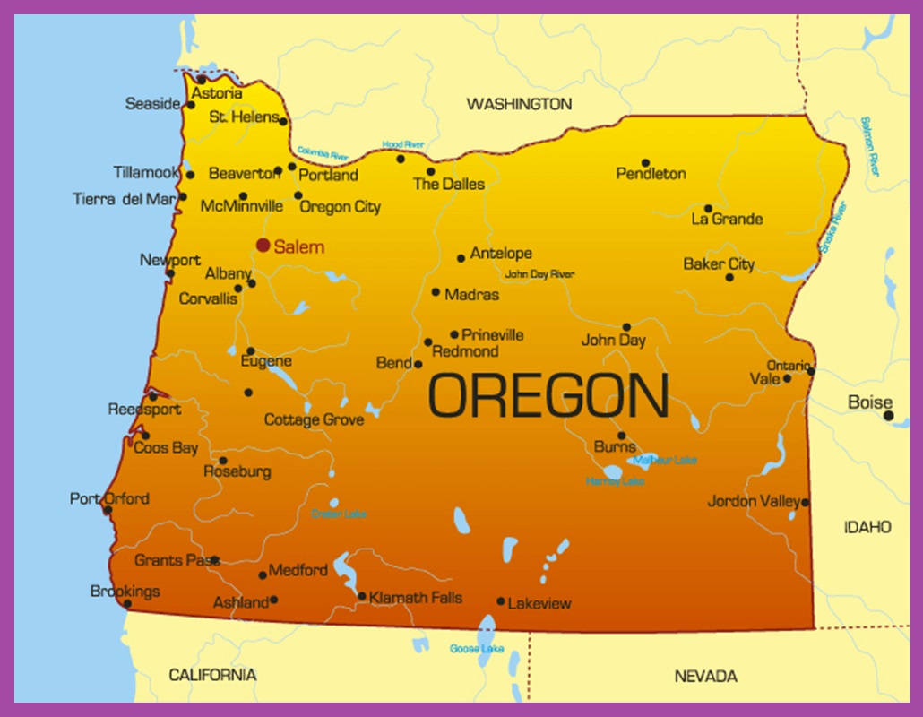
Oregon Political Map | Large Printable High Resolution and Standard Map
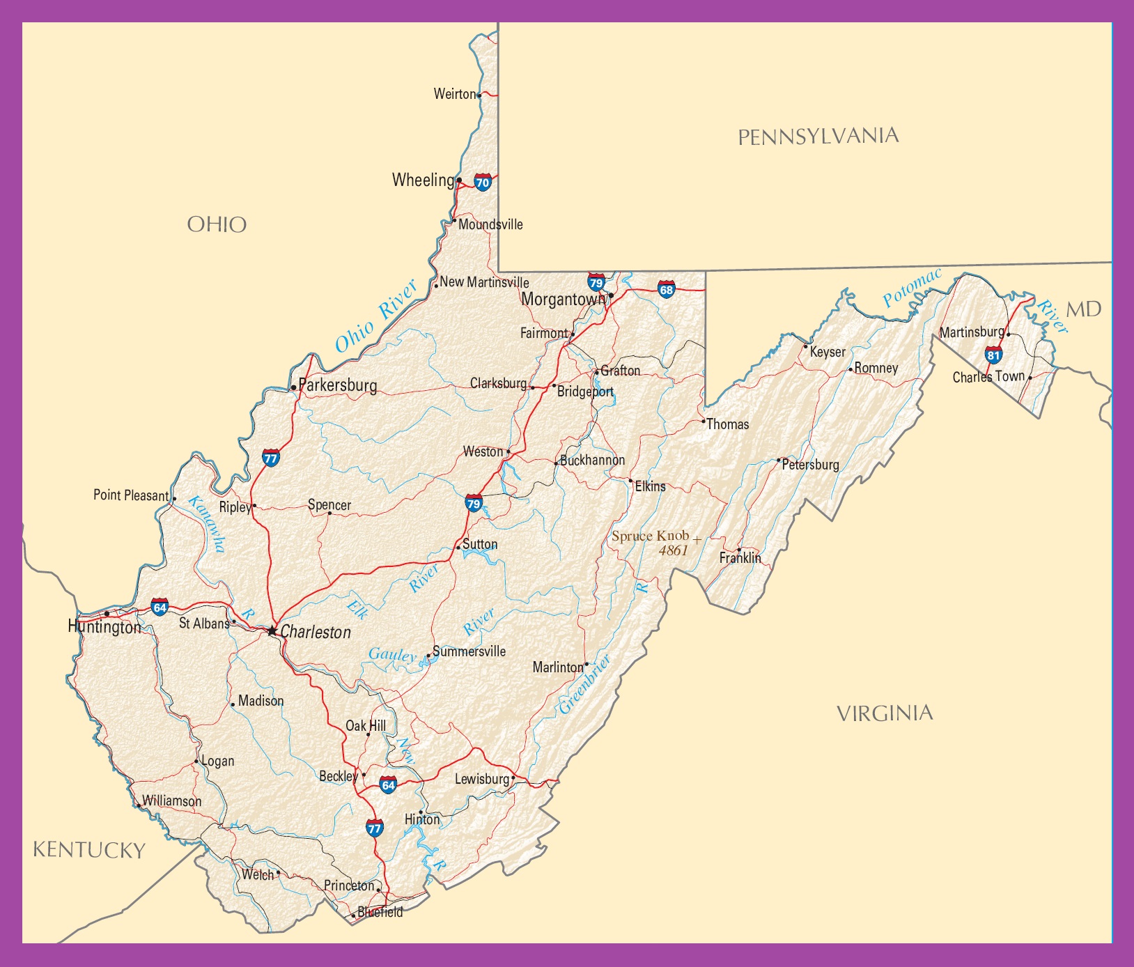
West Virginia Political Map | Large Printable High Resolution and Standard Map