Oregon Political Map | Large Printable High Resolution and Standard Map

Oregon Political Map | Large Printable High Resolution and Standard Map is the Map of Oregon. You can also free download Map images HD Wallpapers for use desktop and laptop. Click Printable Large Map
The state of Oregon is located in the Pacific Northwest region of the United States. It is one of just 3 US states in the contiguous United States with a coastline at the Pacific Ocean. Oregon is the 9th largest state with occupying an area of 254,800 km² (98,379 sq mi). With 4.2 million people, It is the 27th most populous U.S. state. Salem is the state capital of Oregon and the largest city is Portland.
Oregon Map Facts
- Territory: 14 August 1848
- State: 14 February 1859
- Counties: 36
- Capital: Salem
- Website: oregon.gov
- Land Area: 98,386 sq miles
- Population: 3,831,074
- Largest City: Portland
- Largest Metro: Portland metropolitan area

Political Map Oregon
Political Map of Oregon shares its borders with Washington, Idaho, California, and Nevada. The Colombia River largely defines Oregon’s border with Washington in the north. The Snake River forms a section on the eastern boundary with Idaho. The 42nd parallel north forms borders with California and Nevada in the south. Salem is the state capital of Oregon and the largest city is Portland.
The County Map of Oregon features 36 counties. Some major counties are Multnomah County, Washington County, Jackson County, Marion County, Lane County. Harney County is the largest in Oregon with 10,226 square miles (26,490 km2). Multnomah County is the most populous county in the state. Its county seat is Portland, the largest state in the city.
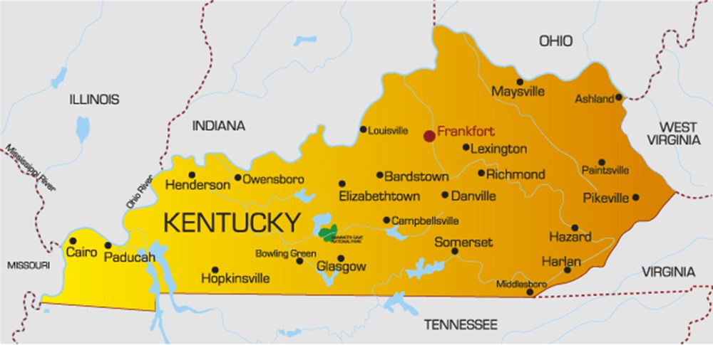
Kentucky Political Map | Large Printable High Resolution and Standard Map
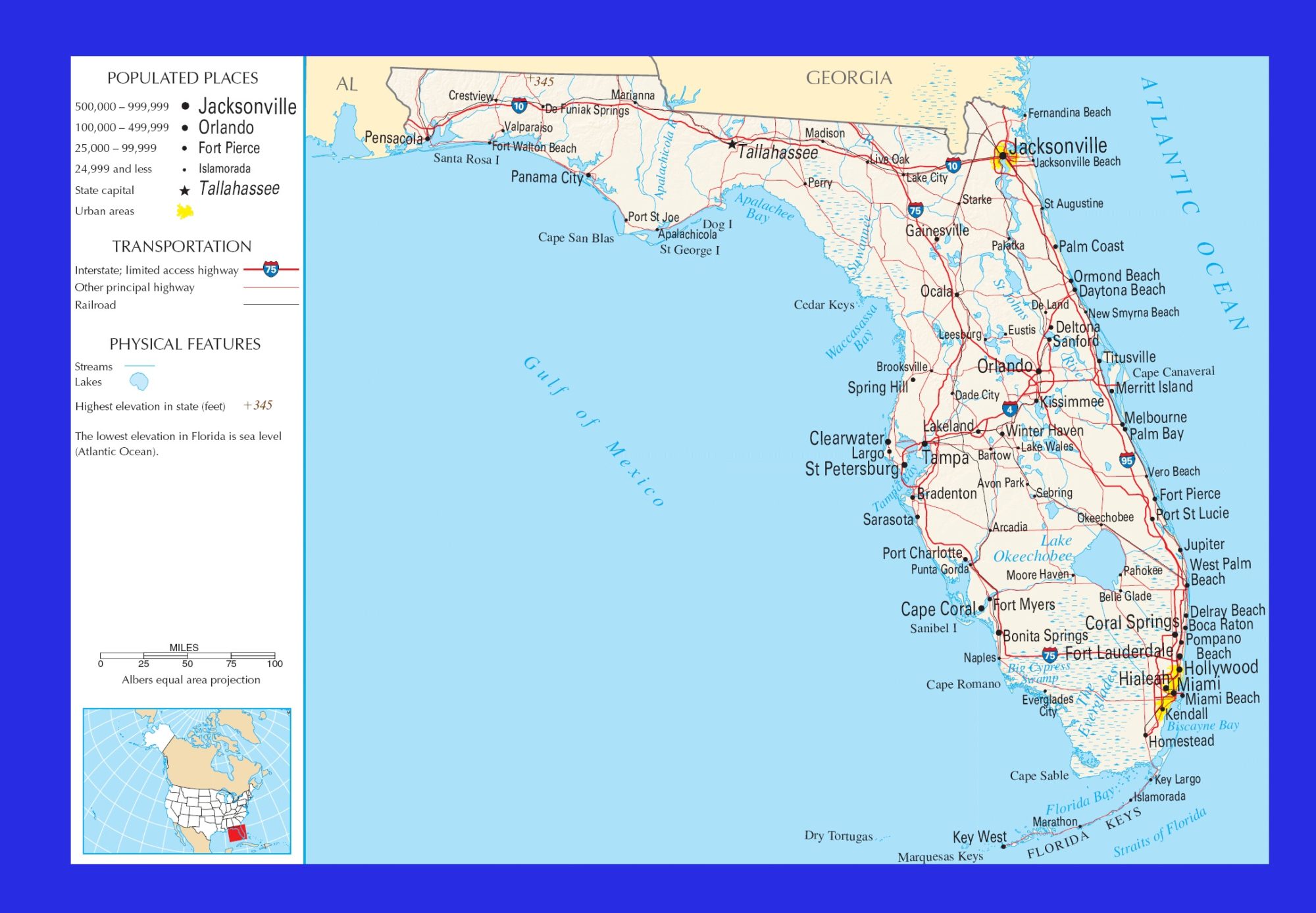
Florida Political Map | Large Printable and Standard Political Map