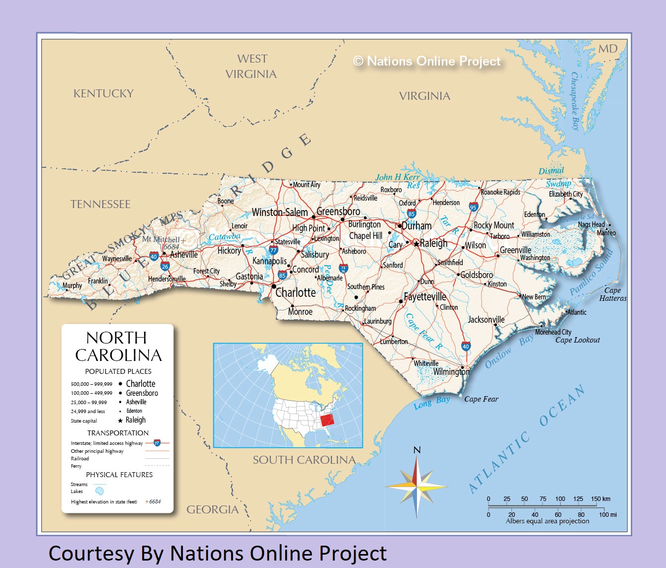
North Carolina Political Map | Large Printable Standard Map

North Carolina Political Map | Large Printable Standard Map is the Map of North Carolina. You can also free download Map images HD Wallpapers for use desktop and laptop. Click Printable Large Map
North Carolina is located in the southeastern region of the United States. North Carolina Political Map bordered by Virginia to the north, the Atlantic Ocean to the east, Georgia and South Carolina to the south, and Tennessee to the west. Raleigh is the state capital of North Carolina while Charlotte is the largest city of the state. Esse quam videri is a Latin phrase meaning “To be, rather than to seem” is the state motto of North Carolina adopted in 1893.
FAST FACTS
- Nickname: The Tar Heel State
- Statehood: 1789; 12th state
- Population (as of July 2015): 10,042,802
- Capital: Raleigh
- Biggest City: Charlotte
- Abbreviation: NC
- State bird: cardinal
- State flower: flowering dogwood
Map of North Carolina covers 53,819 square miles area making it the 28th most extensive state of the country. North Carolina is the 9th most populous state in the country. It has a population of 10.5 million people (est. in 2019).
North Carolina Political Map With Cities

The County Map of North Carolina is divided into 100 counties. The establishment of North Carolina counties started in 1668 with the creation of Albemarle County. It ends with the creation of Avery and Hoke counties in 1911.
North Carolina’s economy was based mainly on the growing of tobacco in the 1700s and 1800s and on the manufacture of tobacco products and textiles in the early 1900s. In the late 20th and early 21st centuries, North Carolina’s economy generated jobs at a higher rate than the national average in many areas.
As of July 1, 2019, Wake County is the most populous county in the Carolinas with a population of 1,111,761. Dare County is the largest county in North Carolina with a total area of 1,563 sq mi (4,050 km2). Largest cities in North Carolina are Charlotte (872,000), Raleigh (469,000), Greensboro (295,000), Durham (274,000), Winston-Salem (246,000), Fayetteville (209,000), Cary (168,000), Wilmington (122,000), High Point (112,000).
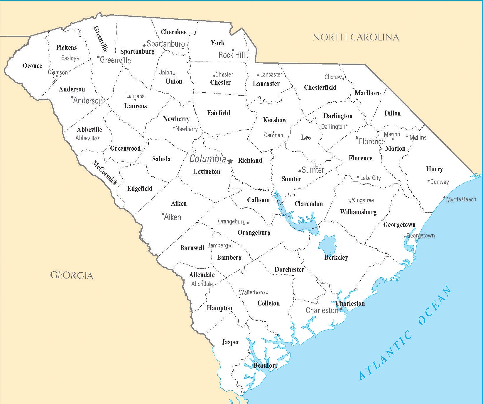
South Carolina Cities Map | Large Printable High Resolution and Standard Map
North Carolina Transportation and physical map large printable