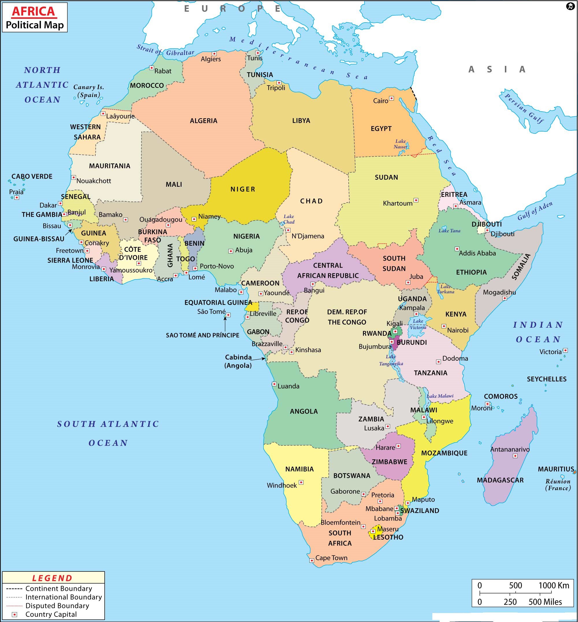
Map of Africa | Large Political Map of Africa

Africa is the second-largest and second-most-populous continent in the world. The Map of Africa Comprises of an area of about 30.3 million km2 (11.7 million square miles) including adjacent islands, it covers 6% of Earth’s total surface area and 20% of its land area. According to the Map of Africa, It is surrounded by the Mediterranean Sea to the north, the Isthmus of Suez and the Red Sea to the northeast, the Indian Ocean to the southeast, and the Atlantic Ocean to the west.
With a 2011 population of 1,032,532,974, it accounts for just over 14% of the world’s human population. Map of Africa contains the Nile River system, the world’s longest, and the massive Sahara Desert, the world’s largest.
Algeria is Africa’s largest country by area, and Nigeria is its largest by population. Africa hosts a large diversity of ethnicities, cultures, and languages. In the late 19th century, European countries colonized almost all of Africa; most present states in Africa emerged from a process of decolonization in the 20th century.
History of Africa
Africa is the birthplace of mankind, as large numbers of human-like fossils (discovered nowhere else) were found on the continent, some dating back 3.5 million years. In 3200 BC the Egyptian culture emerged along the lower reaches of the Nile River; it was among the earliest civilizations and their tools and weapons were made of bronze. They also pioneered the building of massive pyramids and temples.
Before the Middle Ages began, the Roman Empire collapsed and the Arabs quickly took their place on the continent. The continent-changing 16th Century began with Europeans transporting African slaves to the Americas for profit. By mid-century, most of the continent was independent, with Angola finally free in 1975.

The Political Map of Africa depicts the various countries of the continent, the international boundaries, and neighboring continents. Oceans and seas adjoining Africa are also depicted on the Map of Africa.
The Large Political Map of Africa shows that There are 54 sovereign countries in Africa. 55 African countries are members of the African Union, a federation of African nations established in 2001 in Addis Ababa, Ethiopia.
Country List of Africa
| Country | Capital | Population |
|---|---|---|
| Algeria | Algiers | 33,333,267 |
| Angola | Luanda | 16,941,000 |
| Benin | Porto-Novo | 8,439,000 |
| Botswana | Gaborone | 1,839,833 |
| Burkina | Ouagadougou | 13,228,000 |
| Burundi | Bujumbura | 7,548,000 |
| Cameroon | Yaoundé | 17,795,000 |
| Cape Verde | Praia | 420,979 |
| Central African Republic | Bangui | 4,216,666 |
| Chad | N’Djamena | 10,146,000 |
| Comoros | Moroni | 798,000 |
| Congo | Kinshasa | 75,507,308 |
| Congo, Democratic Republic of Congo | Brazzaville | 4,012,809 |
| Djibouti | Djibouti City | 906,000 |
| Egypt | Cairo | 84,550,000 |
| Equatorial Guinea | Malabo | 504,000 |
| Eritrea | Asmara | 5,880,000 |
| Ethiopia | Addis Ababa | 85,237,338 |
| Gabon | Libreville | 1,384,000 |
| Gambia | Banjul | 1,517,000 |
| Ghana | Accra | 23,000,000 |
| Guinea | Conakry | 10,057,975 |
| Guinea-Bissau | Bissau | 1,586,000 |
| Ivory Coast | Yamoussoukro | 17,654,843 |
| Kenya | Nairobi | 34,707,817 |
| Lesotho | Maseru | 2,067,000 |
| Liberia | Monrovia | 4,128,572 |
| Libya | Tripoli | 6,036,914 |
| Madagascar | Antananarivo | 18,606,000 |
| Malawi | Lilongwe | 12,884,000 |
| Mali | Bamako | 13,518,000 |
| Mauritania | Nouakchott | 3,069,000 |
| Mauritius | Port Louis | 1,219,220 |
| Morocco | Rabat | 35,757,175 |
| Mozambique | Maputo | 20,366,795 |
| Namibia | Windhoek | 2,031,000 |
| Niger | Niamey | 13,957,000 |
| Nigeria | Abuja | 174,507,539 |
| Rwanda | Kigali | 7,600,000 |
| Sao Tome and Principe | Sao Tome | 183,176 |
| Senegal | Dakar | 11,658,000 |
| Seychelles | Victoria | 80,654 |
| Sierra Leone | Freetown | 6,144,562 |
| Somalia | Mogadishu | 10,532,017 |
| South Africa | Bloemfontein | 52,981,991 |
| South Sudan | Juba | 8,260,490 |
| Sudan | Khartoum | 36,787,012 |
| Swaziland | Lobamba | 1,032,000 |
| Tanzania | Dodoma | 44,929,002 |
| Togo | Lomé | 7,154,237 |
| Tunisia | Tunis | 10,102,000 |
| Uganda | Kampala | 27,616,000 |
| Zambia | Lusaka | 14,668,000 |
| Zimbabwe | Harare | 13,010,000 |

Regions of Africa
The Political Map of the Africa continent is commonly divided into five subregions: North or Northern Africa, West Africa, Central or Middle Africa, East Africa, and Southern Africa.
Map of Africa | Large Political Map of Africa. You can also free download Map images HD Wallpapers for use desktop and laptop.
Geography of Africa
The Physical Map of Africa shows the continent in shaded relief. Mountainous regions are shown in shades of tan and brown, such as the Atlas Mountains, the Ethiopian Highlands, and the Kenya Highlands. There are many rivers in the Congo Basin of central Africa, while the Sahara Desert region of northern Africa has almost none. Physical features within Africa's Great Rift Valley can be seen on the map, including Lake Tanganyika, Lake Malawi, and Lake Victoria, which are located in the southern portion of the valley.
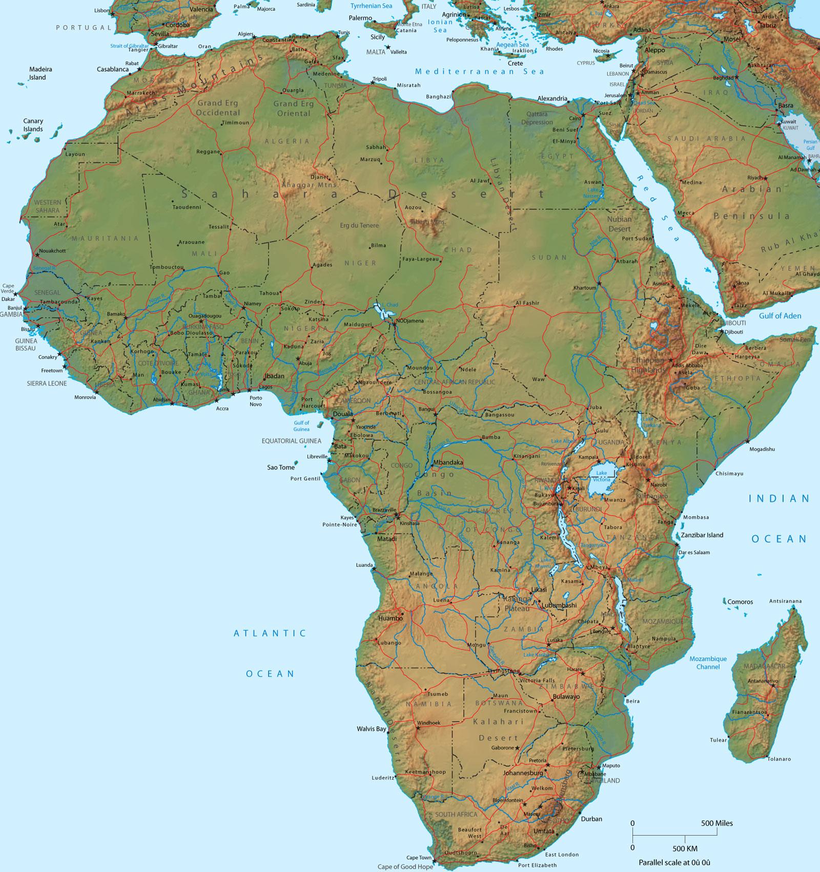
Two of Africa's most interesting geographical features are the Nile River System and the Sahara Desert. The Nile is a north-flowing river considered the longest river in the world at 6,650 km (4,130 mi) long. Sahara Desert is the world's hottest desert, the third largest desert after Antarctica and the Arctic, and almost as large as China.
Economy of Africa
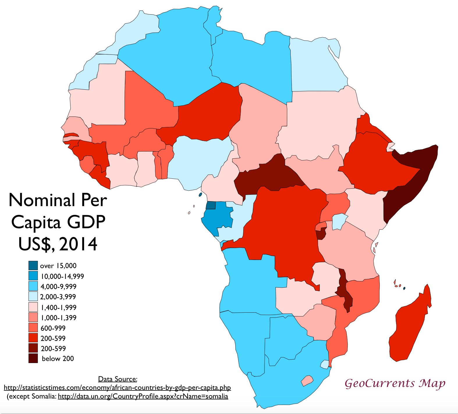
With the exception of South Africa and the countries of North Africa, all of which have diversified production systems, the economy of most of Africa can be characterized as underdeveloped. Africa as a whole has abundant natural resources, but much of its economy has remained predominantly agricultural, and subsistence farming still engages more than 60 percent of the population.
Reference:
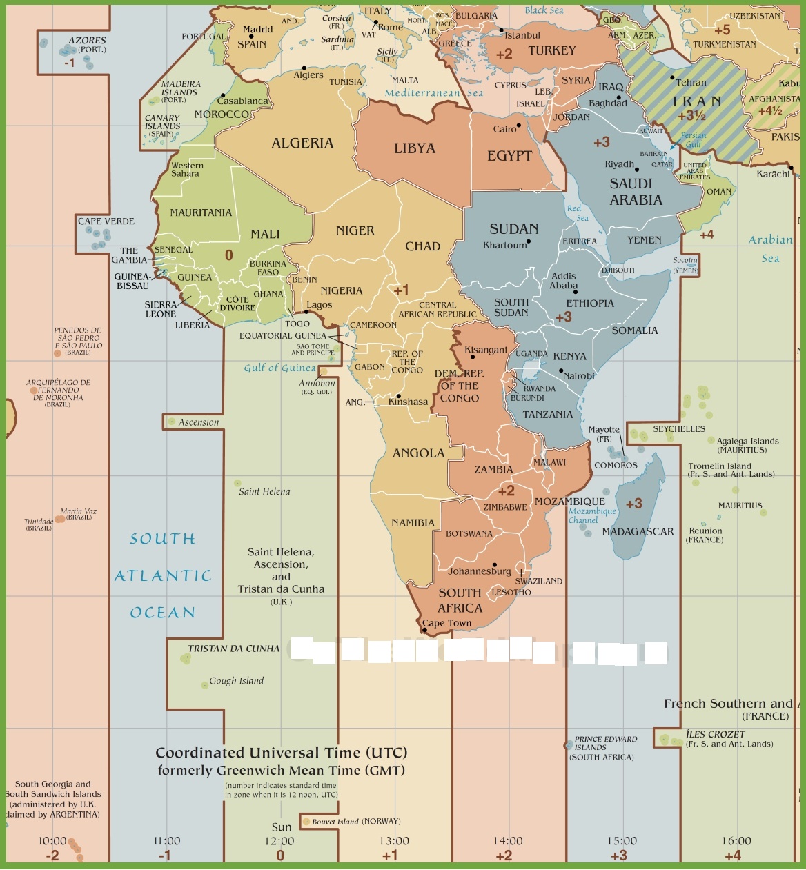
Time Zone Map of Africa | Time Zones in Africa
Map of Africa | Printable Large Attractive HD Map of Africa