Map of South America | Printable Large Attractive HD Map of South America

Map of South America is the fourth-largest and the fifth most populous continent in the world. It has an area of 6,890,000 square miles and comprises a population of 420,458,044 inhabitants, as of 2016. South America has a total of 12 countries and three dependencies. Brazil, the largest country in the continent containing 8,515,799 square kilometers.
Countries of South America and their Capitals
| S.N. | Country and Territory | Area (Sq. Miles) | Capital |
|---|---|---|---|
| 1 | Brazil | 3,287,611 | Brasília |
| 2 | Argentina | 1,068,302 | Buenos Aires |
| 3 | Peru | 496,226 | Lima |
| 4 | Colombia | 439,735 | Bogotá |
| 5 | Bolivia | 424,164 | La Paz and Sucre |
| 6 | Venezuela | 353,841 | Caracas |
| 7 | Chile | 292,260 | Santiago |
| 8 | Paraguay | 157,047 | Asunción |
| 9 | Ecuador | 109,483 | Quito |
| 10 | Guyana | 83,012 | Georgetown |
| 11 | Uruguay | 68,039 | Montevideo |
| 12 | Suriname | 63,039 | Paramaribo |
| 13 | French Guiana (France) | 35,135 | Cayenne (Préfecture) |
| 14 | Falkland Islands (UK) | 4,700 | Port Stanley |
| 15 | South Georgia and South Sandwich Islands (UK) | 1,194 | King Edward Point |
Map of South America | Printable Large Attractive HD Map of South America. You can also free download Map images HD Wallpapers for use desktop and laptop.
Printable Large Map
The Blank Printable Large Map of South America depicts the various nations that comprise the continent. The country boundaries, which separate one nation from the other, are clearly marked on the map. South America is flourishing. The continent's magnificent natural landscape attracts millions of visitors every year, and tourism numbers continue to increase as international flight connections become more available.
HD Map of South America
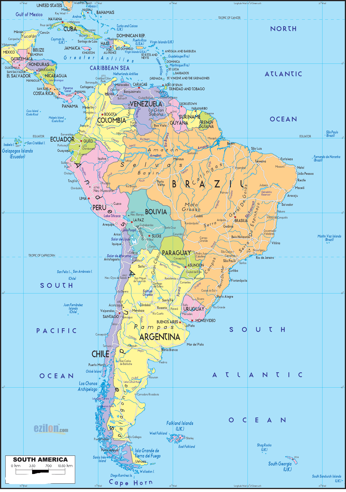
The HD Map of South America reveals the physical landscape of the South American Continent. This Outline of South America is a free resource that is ready to be printed. Whether you are looking for a map with the countries labeled or a numbered blank map, these printable maps of South America are ready to use. They are also perfect for preparing for a geography quiz.
Blank Printable Map of South America
The Blank Printable Map of South America depicts the various nations that comprise the continent. The country boundaries, which separate one nation from the other, are clearly marked on the map.
Blank World Map | Large Printable World Map

The World Political Map | Large, Printable, Children Choice, Political Map- 6