Tennessee River Map | Large Printable High Resolution and Standard Map

Tennessee River Map | Large Printable High Resolution and Standard Map is the Map of Tennessee. You can also free download Map images HD Wallpapers for use desktop and laptop. Click Printable Large Map
Tennessee is located in the southeastern region of the United States. It shares borders with Alabama, Arkansas, Georgia, Kentucky, Mississippi, Missouri, North Carolina, and Virginia. Tennessee occupies an area of 109,152 km² (42,144 sq mi). The major rivers in the Tennessee River Map are the Tennessee River, Mississippi River, and Cumberland River.
The longest rivers on Tennessee river map are the Mississippi River, Cumberland River, and Tennessee River. In fact, it’s the Mississippi River that forms the border between Arkansas and Missouri in the west. Kentucky Lake, Lake Guntersville, and Lake Barkley are the largest lakes in tennessee map. However, each lake shares a boundary with another state either Kentucky or Alabama. The largest lake is Watts Bar Lake at almost 40,000 acres in size.
Rivers in Tennessee Map

Longest Rivers in Tennessee
| Rank | River Name | Length (miles) | Length (km) | Source | Mouth |
|---|---|---|---|---|---|
| 1 | Tennessee River | 652 | 1,049 | Confluence of Holston and French Broad Rivers | Ohio River |
| 2 | Cumberland River | 688 | 1,107 | Cumberland Gap | Ohio River |
| 3 | Duck River | 284 | 457 | Highland Rim near Manchester | Tennessee River |
| 4 | Clinch River | 256 | 412 | Southwest Virginia | Tennessee River |
| 5 | Hatchie River | 214 | 344 | Northeast Mississippi | Mississippi River |
| 6 | Caney Fork River | 170 | 274 | Cumberland Plateau | Cumberland River |
| 7 | Forked Deer River | 164 | 264 | West Tennessee | Mississippi River |
| 8 | Obion River | 156 | 251 | Northwest Tennessee | Mississippi River |
| 9 | Buffalo River | 147 | 237 | Middle Tennessee | Tennessee River |
| 10 | South Fork Holston River | 143 | 230 | Southwest Virginia | Holston River |
Lakes in Tennessee Map
Center Hill Lake, Cherokee Lake, Chickamauga Lake, Dale Hollow Lake, Douglas Lake, J. Percy Priest Lake, Kentucky Lake, Norris Lake, Old Hickory Lake, South Holston Lake, Tims Ford Lake, and Watts Bar Lake.
✅Where Does the TN River Start and End?
The Tennessee River begins upstream of Knoxville, Tennessee. The river flows 652 miles south then west across northern Alabama and a small portion of northern Mississippi.
✅What is the Most Beautiful Lake in Tennessee?
In its setting within the Appalachian Mountains and Cherokee National Forest, Watauga Lake is renowned for its scenic beauty. Another claim to fame: it’s the highest elevation lake in Tennessee.
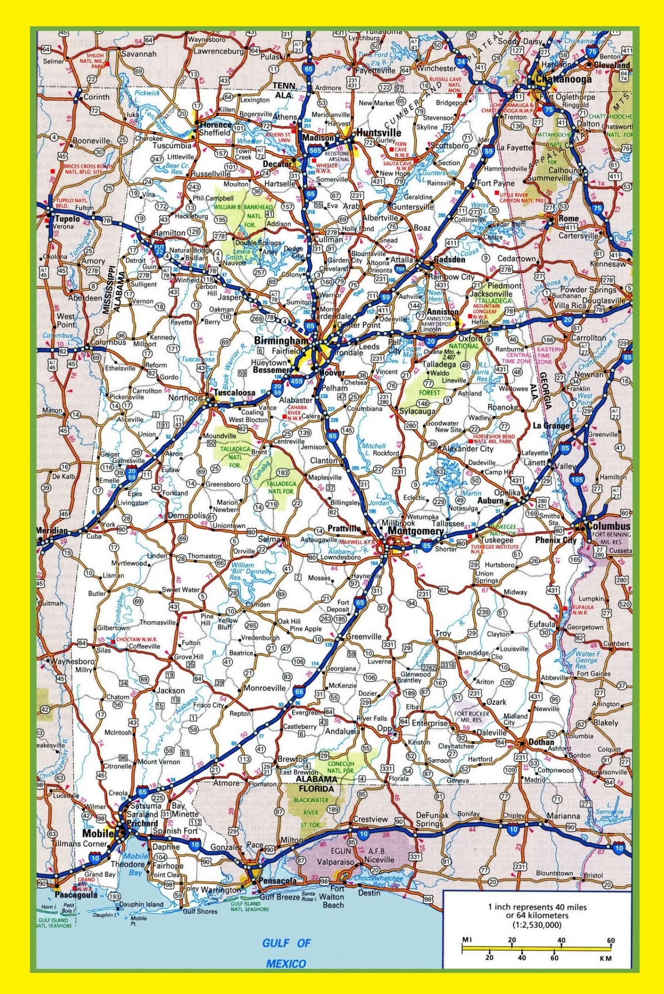
Alabama Large Highway Map Large Highway Map of Alabama-city-county-political
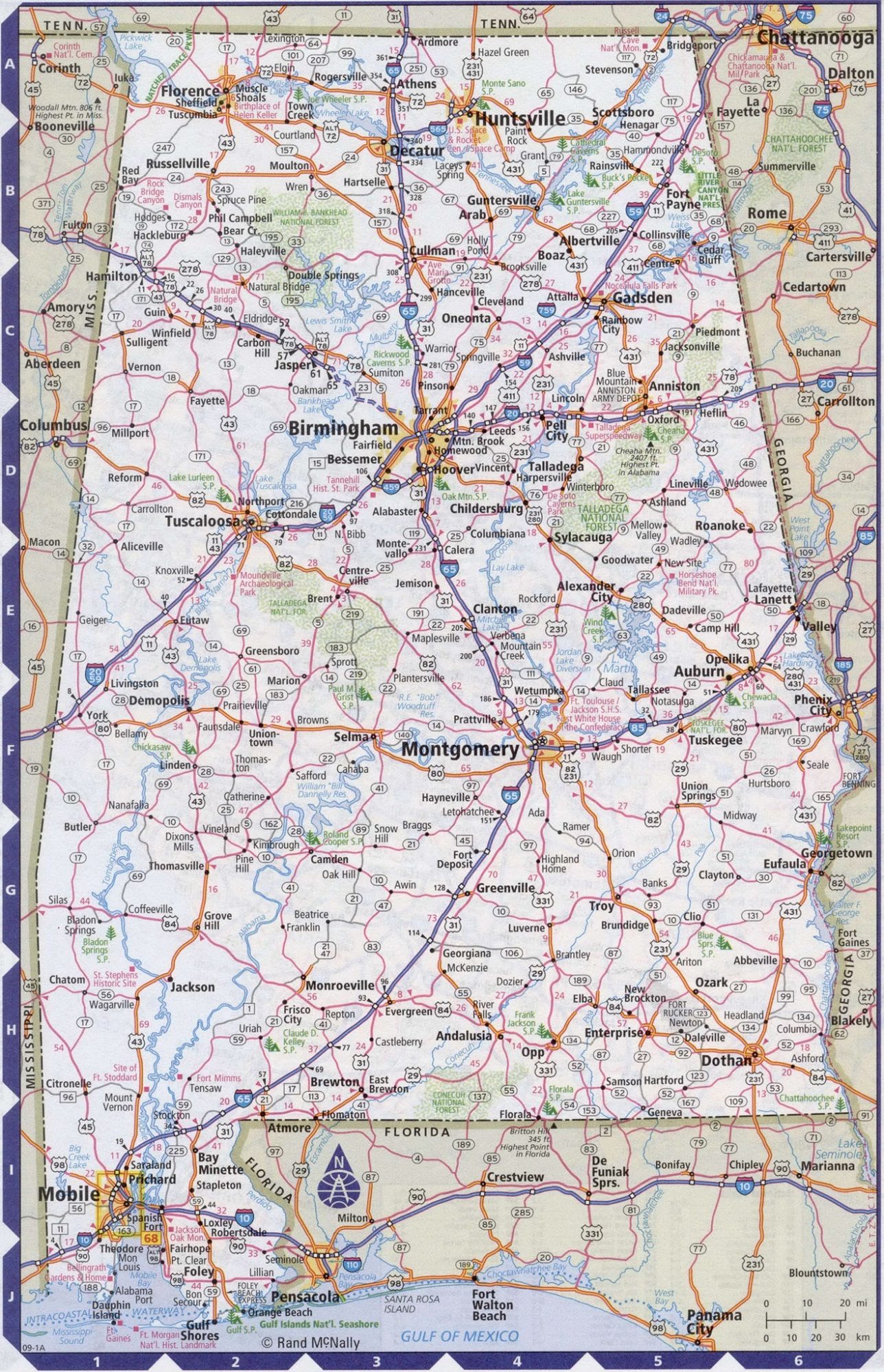
Alabama Large Highway Map Large Highway Map of Alabama-city-county-political