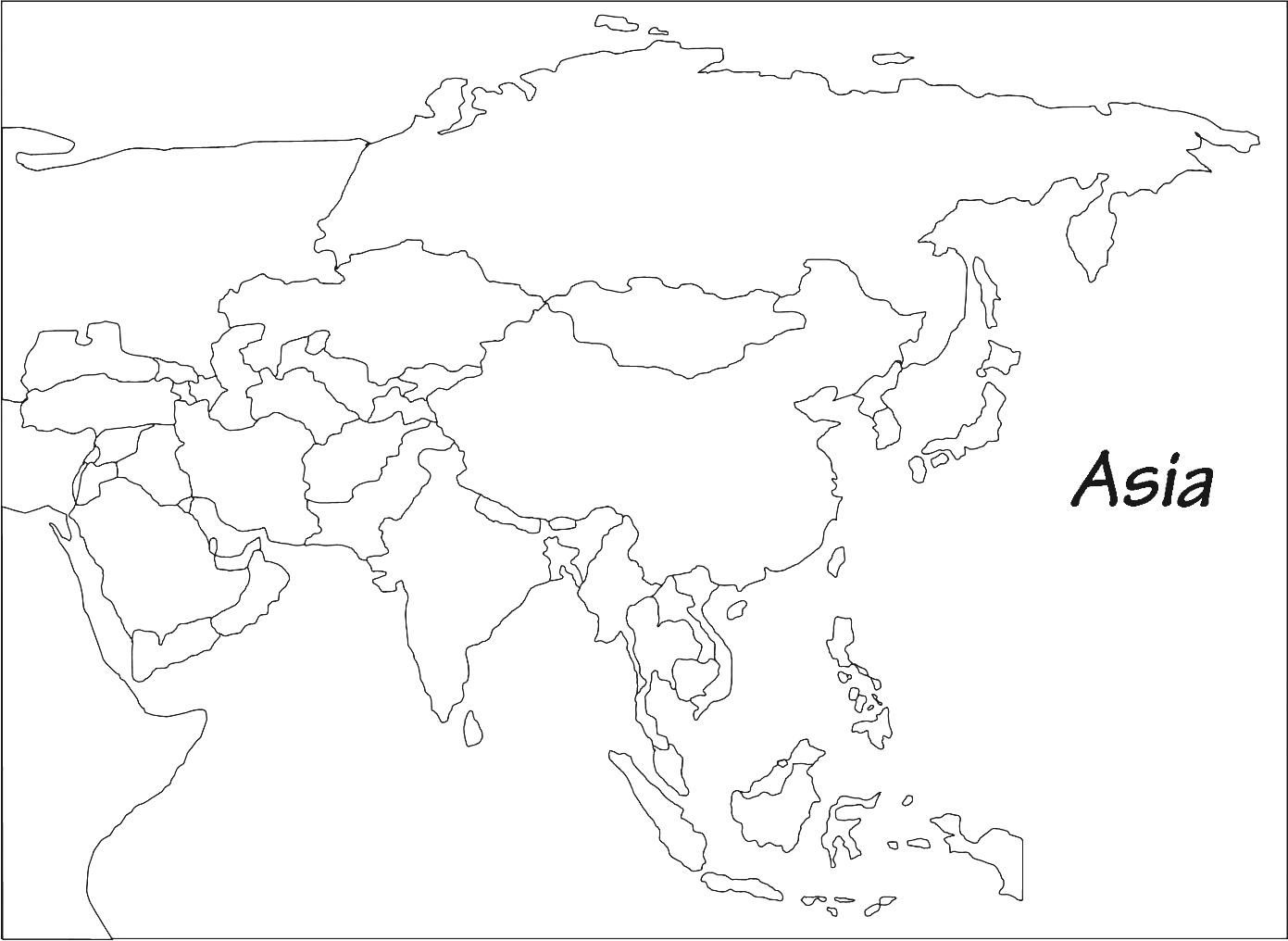
Map of Asia | Political Map of Asia with Borders

The Political Map of Asia shows large parts of Asia with the exception of some countries in Western Asia and the Middle East. Asia is the largest and most populous continent in the world. It shares borders with Europe and Africa to its West, Oceania to its South, and North America to its East. it constitutes nearly one-third of Earth’s landmass and is lying entirely north of the equator except for some Southeast Asian islands.
The continent is connected to Africa by the Isthmus of Suez and borders Europe (which is part of the same landmass) along the Ural Mountains and across the Caspian Sea. Asia has a coastline in the north at the Arctic Ocean, in the east at the Pacific Ocean, and in the south at the Indian Ocean.
As per the Asia Political Map, the continent of Asia features 48 countries. Of these, two countries – Russia and Turkey – are located in both Asia and Europe.
Map of Asia Facts

Area of Asia: about 49,700,000 km² (19,189,277 sq mi) covers about 30 percent of Earth’s total land area.
The population of Asia: more than 4 billion people (4.3 billion in 2013), about 60 percent of the world’s population. 1.34 billion of these people live in China, 1.2 billion in India. Seven out of ten of the most populated countries are in Asia (2010).
Highest Point of Asia: Sagarmatha (Chomolungma; known as Mount Everest) 8,848m (29,028 ft) Nepal.
Largest Lake of Asia: Caspian Sea (salt lake) 371 000 km² (143 250 sq mi),
Longest River of Asia: Yangtze (Yángzî Jiang, or Chang Jiang China, 6,380 km (3,964 mi).
Asia Political Map

The Asian continent can be divided into some sectors like:
1. Western Asia (Georgia, Armenia, Azerbaijan, Turkey, Cyprus, Syria, Lebanon, Israel, Palestine, Jordan, Iraq, Iran, Kuwait, Bahrain, Qatar, Saudi Arabia)
2. Southeast Asia (Brunei, Cambodia, Indonesia, Laos, Malaysia, Myanmar, Philippines, Singapore, Thailand, Timor Lester, Vietnam, Christmas Island, Cocos Islands)
3. South Asia (Sri Lanka, Bangladesh, India, Afghanistan, Pakistan, Bhutan, Nepal, the Maldives)
4. East Asia (China, Mongolia, North Korea, South Korea, Japan, Hong Kong, Taiwan, Macau)
5. Central Asia (Tajikistan, Uzbekistan, Kazakhstan, Turkmenistan, Kyrgyzstan)
Asia stretches from Japan in the East through Russia in the West. It encompasses Saudi Arabia and everything above Asia. India and China are the largest of the continent’s countries with the highest population rate.
✅What are the Political Features of Asia?
Constitutional monarchies, absolute monarchies, one-party states, federal states, dependent territories, liberal democracies and military dictatorships are all factors in the region, as well as various forms of independence movements.
Map of Asia | Political Map of Asia with Borders. You can also free download Map images HD Wallpapers for use desktop and laptop.

Asia’s immense size lends itself to a variety of different geographical landscapes, depending on its region. West Asia has some of the highest temperatures on the planet as a result of its warm desert climate.
With a population of roughly 4.4 billion, or 62% of the global population (about 7.1 billion), Asia is by far the most populated continent on the planet. The most populous countries in Asia are China (1.4 billion people), India (1.3 billion people), Indonesia (259 million people), and Pakistan (193 million people). Asia’s least populated countries are Maldives (341 thousand people), Brunei (412 thousand people), Bhutan (771 thousand people), and East Timor (1.2 million people). If Hong Kong and Macau are included as countries, then Macau (647 thousand people) becomes the third-least populous country in Asia.
West Asia
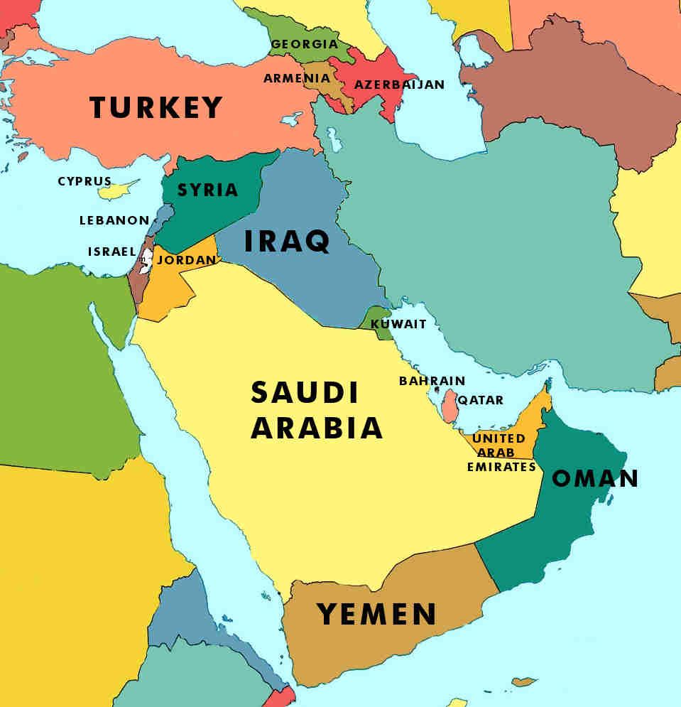
West Asia is located in the area between Central Asia and Africa, south of Eastern Europe. The majority of the region is often referred to as the Middle East, although it geographically excludes the mainland of Egypt. The Political Map of Asia West is divided into 19 states: Georgia, Armenia, Azerbaijan, Turkey, Cyprus, Syria, Lebanon, Israel, Palestine, Jordan, Iraq, Iran, Kuwait, Bahrain, Qatar, Saudi Arabia, United Arab Emirates, Oman, and Yemen. It also includes the Sinai Peninsula of Egypt.
Southeast Asia
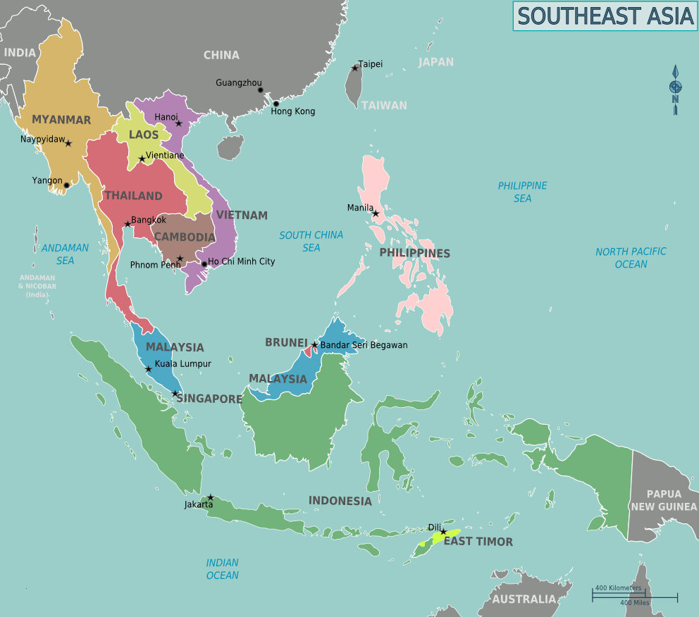
Southeast Asia is located north of Australia, south of East Asia, west of the Pacific Ocean, and east of the Bay of Bengal. Political Map of Southeast Asia is divided into 15 countries and territories: Brunei, Cambodia, Indonesia, Laos, Malaysia, Myanmar, Philippines, Singapore, Thailand, Timor Leste, Vietnam, Christmas Island, Cocos Islands. The region's importance in global trade began during the spice trade, which started before European exploration.
South Asia
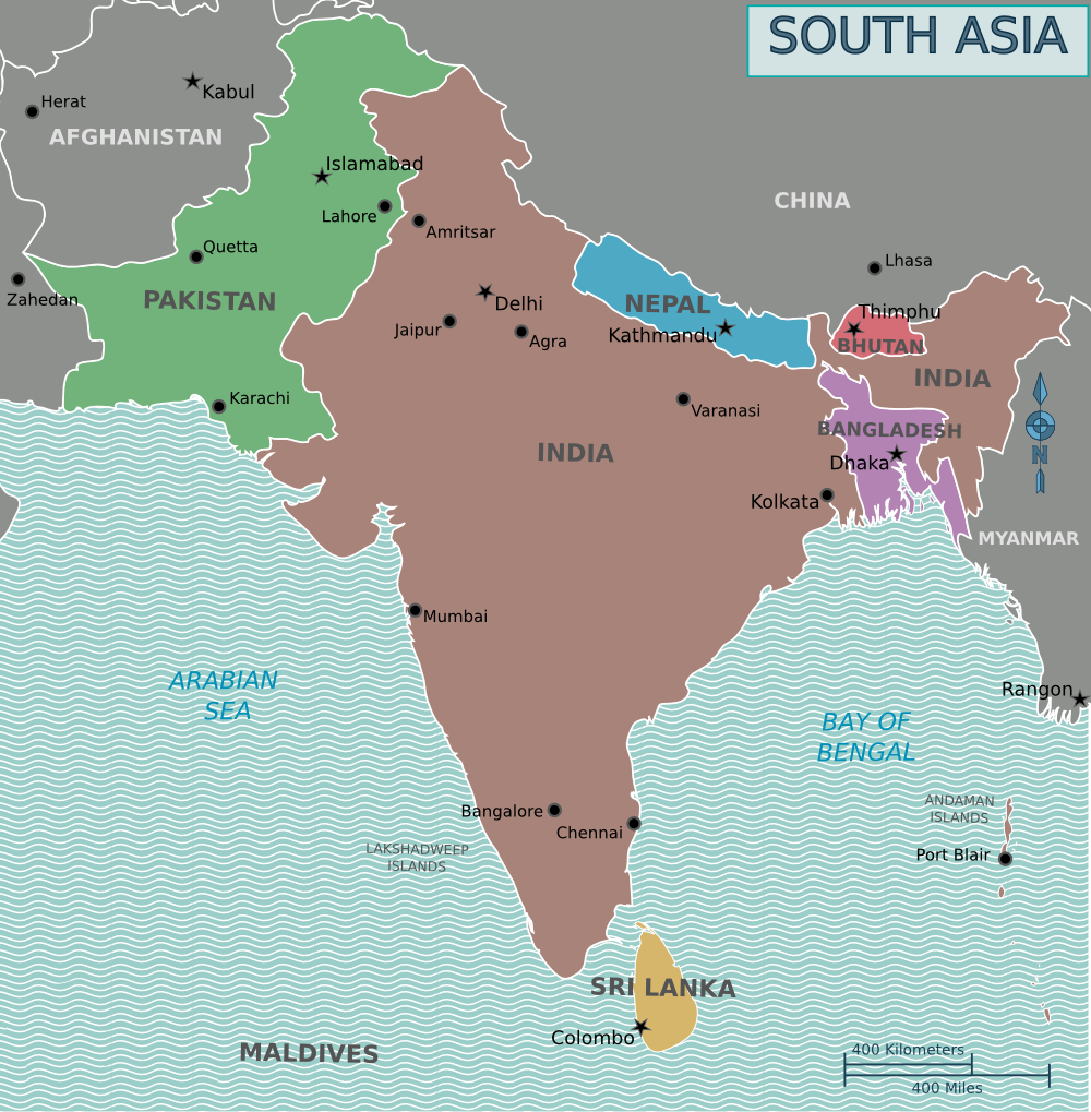
South Asia has a peninsula-like shape that is bordered by three bodies of water: the Indian Ocean to the south, the Bay of Bengal to the east, and the Arabian Sea to the west. South Asia is politically divided into eight autonomous countries: Sri Lanka, Bangladesh, India, Afghanistan, Pakistan, Bhutan, Nepal, and the Maldives.
East Asia
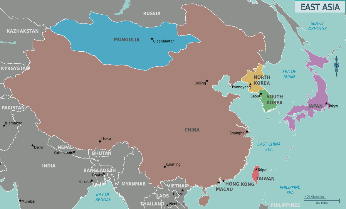
East Asia is located east of Central Asia, with its eastern border running along the East China Sea. East Asia is politically divided into eight countries and regions: China, Mongolia, North Korea, South Korea, Japan, Hong Kong, Taiwan, and Macau. Today, East Asia is believed to have some of the most advanced technologies in the world, which fosters economic development.
Central Asia
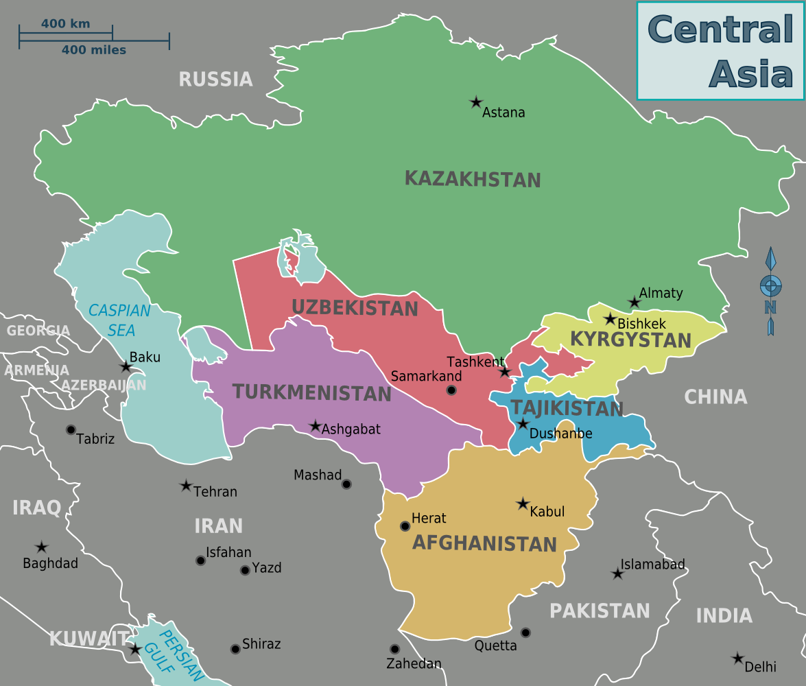
Central Asia is west of China, south of Russia, and north of Afghanistan. The western border of this region runs along the Caspian Sea. Central Asia is politically divided into five countries: Tajikistan, Uzbekistan, Kazakhstan, Turkmenistan, and Kyrgyzstan. Central Asia played an important role in the transportation of goods between China and Europe during the Silk Road trading era.
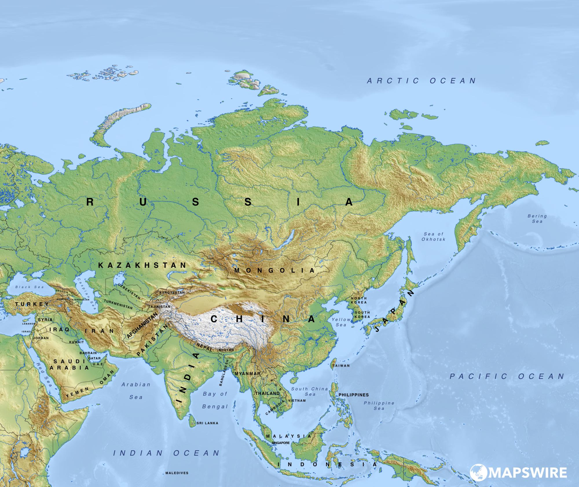
Physical Map of Asia | Asian Geography Map
Blank Map of Asia | Printable Outline Map of Asia