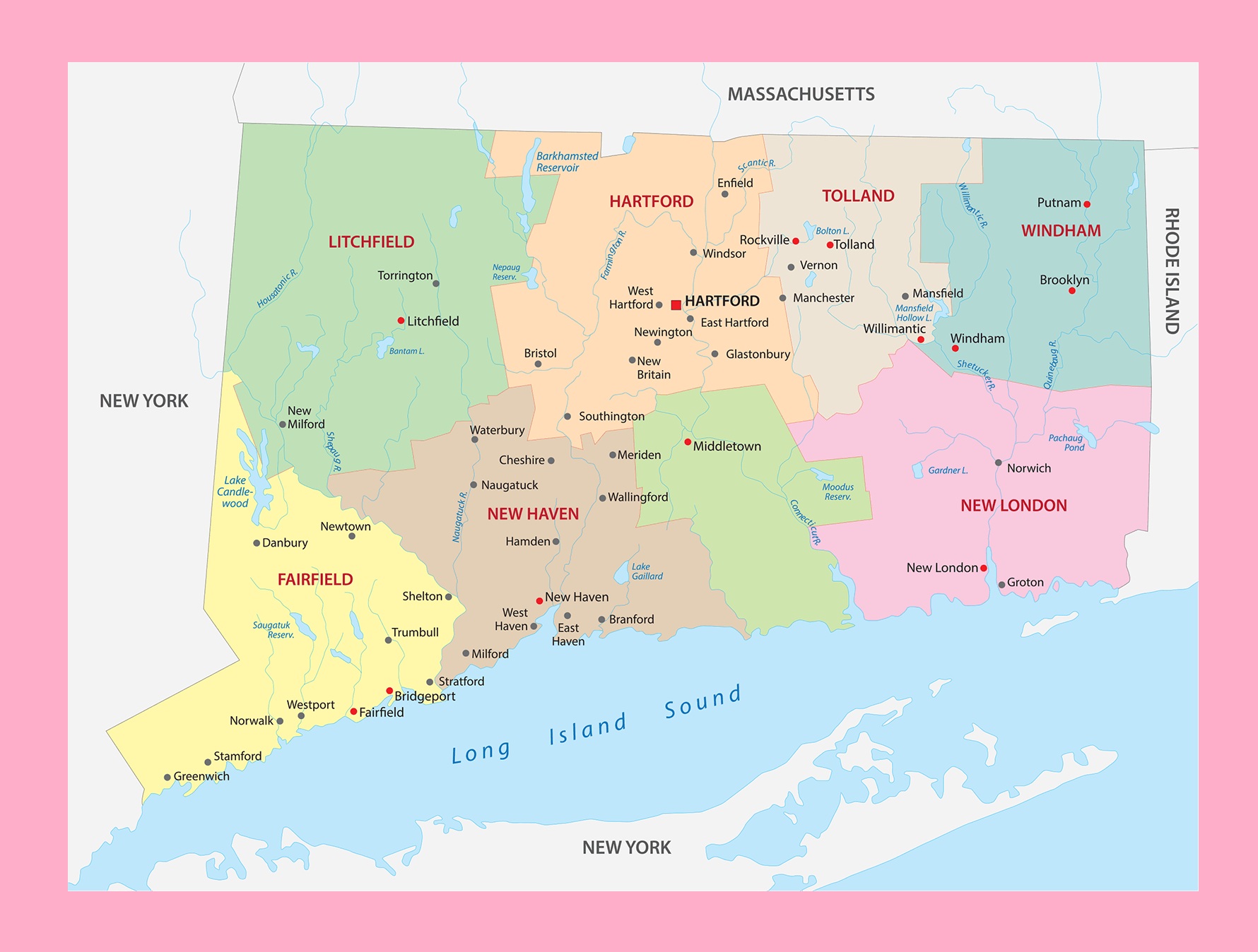
Connecticut Transportation and physical map large printable

Connecticut Transportation and physical map large printable is the Map of Connecticut. You can also free download Map images HD Wallpapers for use desktop and laptop. Click Printable Large Map
About Connecticut:
Location: Northeastern region of the United States
Capital: Hartford
Largest city: Bridgeport
Other important cities: Stamford, Norwalk, New Haven, New London, Norwich, New Britain, Waterbury, Danbury
Neighboring states:
Island, New York,
Geographic Features: Litchfield Hills, Gold Coast, Long Island Sound
Major rivers: Connecticut, Housatonic River, Naugatuck River, Quinebaug River
Highest Point: Mount Frissell (725 m)
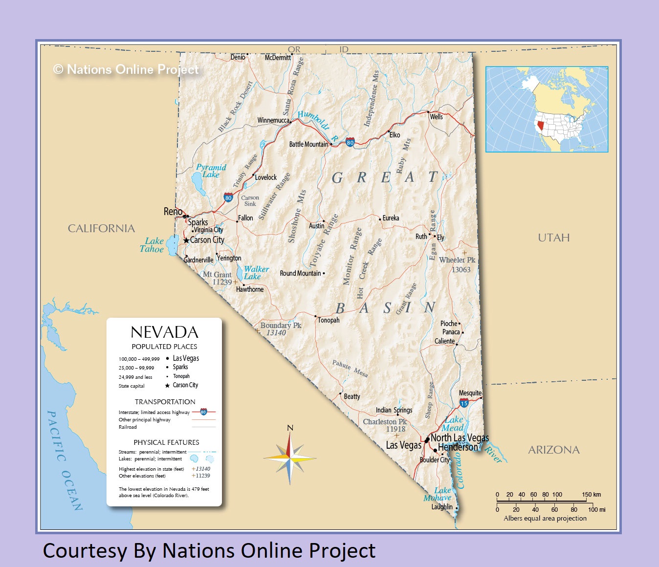
Nevada Transportation and physical map large printable
Map of Connecticut | Political, Physical, Geographical, Transportation, And Cities Map
| « Transportation And Physical Map of Colorado | Large And Printable Map | Delaware Transportation and physical map large printable » | |


