Map of Florida | Political, Physical, Geographical, Transportation, And Cities Map

Map of Florida | Political, Physical, Geographical, Transportation, And Cities Map is the Map of Florida. You can also free download Map images HD Wallpapers for use desktop and laptop. Click Printable Large Map
Florida is located in the southeastern region of the United States. It is the most southeastern state of the USA and is known as the “Sunshine State”. Florida is the third-most populous state With a population of over 21 million. The Map of Florida covers an area of 65,755 square miles which makes it the 22nd largest state in the country.
The first European contact was made in 1513 by Spanish explorer Juan Ponce de León. At that time, the state was called la Florida and administered by Spain and Great Britain. Florida was admitted as the 27th state on March 3, 1845. At the time of the civil war, Florida declared its secession from the Union on January 10, 1861. The state was again restored to the Union on June 25, 1868.
The state is a popular tourist destination and home to a variety of attractions. Some Popular places like Walt Disney World, Cape Canaveral, and the Kennedy Space Center, the Universal Orlando Resort, Miami Beach, the Ten Thousand Islands are located in Florida.
Florida Facts
- Capital City: Tallahassee (pop. 168,979) (2010 est.)
- Florida Population: 19,317,568 (2012 est.) (4th)
- Florida Population: (per square mile)
- U.S. State Populations: (all states)
- Currency: U.S. Dollar (conversion rates)
- Language: English, others
- Statehood: March 3, 1845 (27th state)
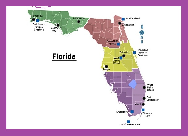
Political Map of Florida

The Political Map of Florida covers an area of 65,755 square miles which makes it the 22nd largest state in the country. The state capital of Florida is Tallahassee and its most populous city is Jacksonville. Florida shares a land border with only two other states, both along its northern boundary: Georgia (east) and Alabama (west). The nearest foreign territory is the island of Bimini in the Bahamas.
The Political Map Of Florida shows the US state of Florida with boundaries, the location of the state capital Tallahassee, major cities and populated places, interstate highways, and railroads.
Physical Map of Florida

Florida is located in the southeastern region of the United States. It is the most southeastern state of the USA and is known as the “Sunshine State”. Florida features more than 12,000 km² (4,700 sq mi) of lakes. 7,700 lakes are greater than 4 hectares in size. The state is slightly larger than twice the size of Austria.
The total area of Florida is 58,560 square miles. The state has 663 Miles of Beaches. The climate varies from subtropical in the north to tropical in the south. Florida’s marine shoreline totals more than 8,400 miles (13,500 km), including some 5,100 miles (8,200 km) along the gulf.
Geography Map of Florida
![]()
The Geography Map of Florida features a diverse collection of islands, marshes, springs, swamps, and hundreds of small lakes, rivers, and ponds. The state shares borders with Alabama & Georgia to the North, the Atlantic Ocean to the East, the Gulf of Mexico to the West, and the straits of Florida to its South.
The land is divided into four main regions:
- Gulf Coast/Atlantic Ocean coastal plains
- upland
- Everglades
- The Florida Keys
The highest point in the state is Britton Hill at an elevation of 105 m (345 ft). Lake Okeechobee is The largest freshwater lake in the state of Florida with a surface area of 1,900 km² (730 sq mi)).
Geography Statistics:
- Land Area:
(land) 53,927 sq miles
(water) 11,761 sq miles
(TOTAL) 65,688 sq miles - Land Area: (all states)
- Bordering States: (2) Alabama, Georgia
- Counties: (67) Map
- Highest Point: Britton Hill, 345 feet
- Lowest Point: the Atlantic Ocean, 0 ft.
Transportation Map of Florida
![]()
Florida’s highway system features 1,495 mi (2,406 km) of interstate highway and 10,601 mi (17,061 km) of the non-interstate highway. Florida Department of Transportation Controlled the Transportation Map of Florida. Some major interstate routes in the state are I-4, I-10, I-75, and I-95. Florida has 131 public airports. The busiest airports in the state are Orlando International Airport, Miami International Airport, Tampa International Airport, and Fort Lauderdale–Hollywood International Airport.
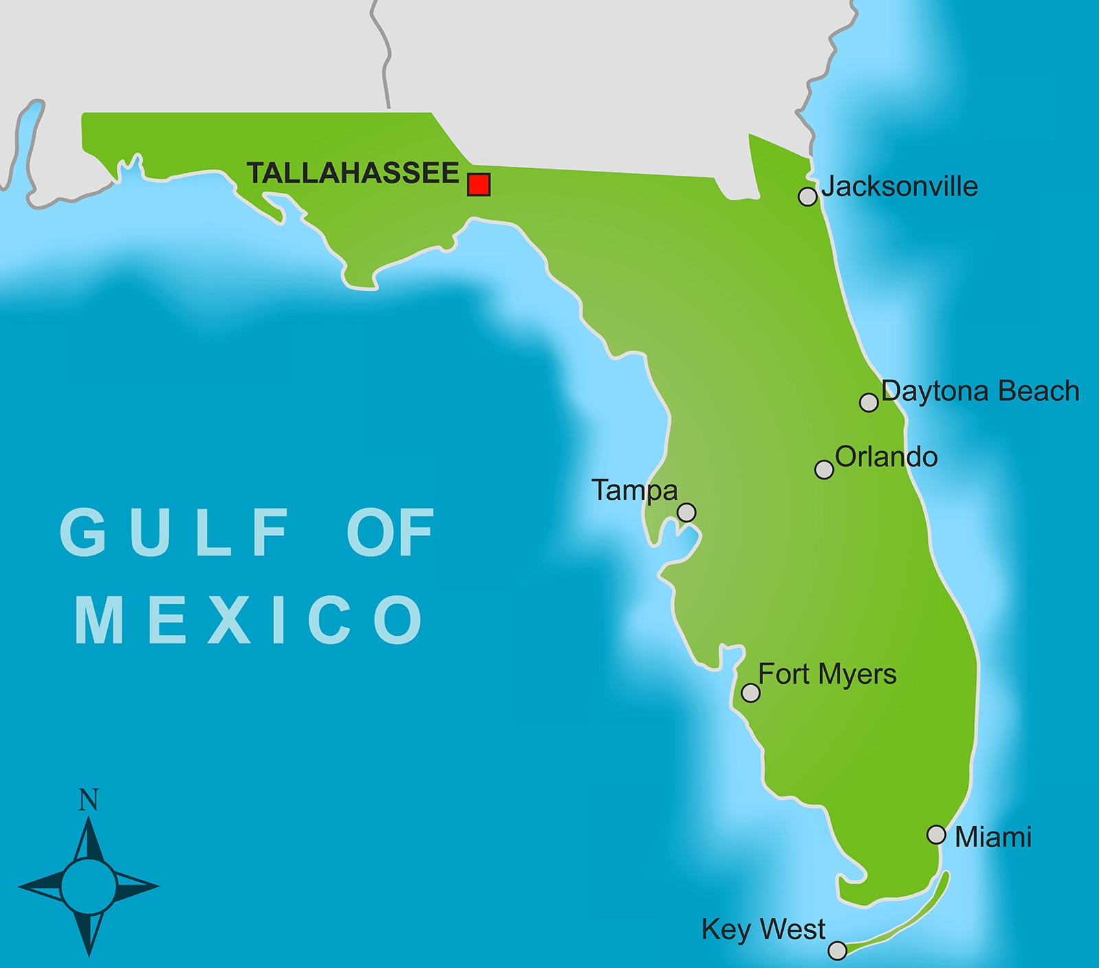
Cities Map of Florida

The state capital of Florida is Tallahassee and its most populous city is Jacksonville.
Some Major Florida Cities:
Altamonte Springs, Apopka, Atlantic Beach, Bartow, Boca Raton, Boynton Beach, Bradenton, Callaway, Cape Coral, Clearwater, Cocoa, Cocoa Beach, Coral Gables, Coral Springs, Crestview, Daytona Beach, De Land, DeBary, Delray Beach, Deltona, Destin, Dunedin, Edgewater, Eustis, Fernandina Beach, Fort Lauderdale, Fort Myers, Fort Pierce, Fort Walton Beach, Gainesville, Gulfport, Haines City, Hialeah, Hollywood, Homestead, Jacksonville, Jacksonville Beach, Jupiter, Key West, Kissimmee, Lady Lake, Lake City, Lakeland, Largo, Leesburg, Lynn Haven, Melbourne, Miami, Miami Beach, Middleburg, Miramar, Naples, New Port Richey
Florida City Map | Large Printable and Standard Map 2
Florida City Map | Large Printable and Standard Map 3