New Mexico Rivers Map | Large Printable High Resolution and Standard Map

New Mexico Rivers Map | Large Printable High Resolution and Standard Map is the Map of New Mexico. You can also free download Map images HD Wallpapers for use desktop and laptop. Click Printable Large Map
New Mexico covers an area of 314,917 km² (121,590 sq mi), making it the 5th largest US state. The state shares borders with Arizona in the west, Colorado in the north, Oklahoma to the northeast, Texas to the east, Utah to the northwest. Santa Fe is the state capital of New Mexico.
The major river in the New Mexico Rivers Map is the Rio Grande (Great River) which is New Mexico’s longest river. The Pecos River has its source near Santa Fe and flows over 1490 km through the eastern part of New Mexico. Major lakes are the Elephant Butte Reservoir, Conchas Lake, and the Navajo Reservoir.
Rivers and Streams
| Pecos River Rio Grande San Juan River Rio Chama Rio Puerco Gila River Rio Hondo Chaco River Animas River Vermejo River |
Mora River Cimarron River Carrizo Creek Ute Creek Gallinas River Penasco Rio San Francisco River Rio Salado River Rio San Jose River Zuni River |
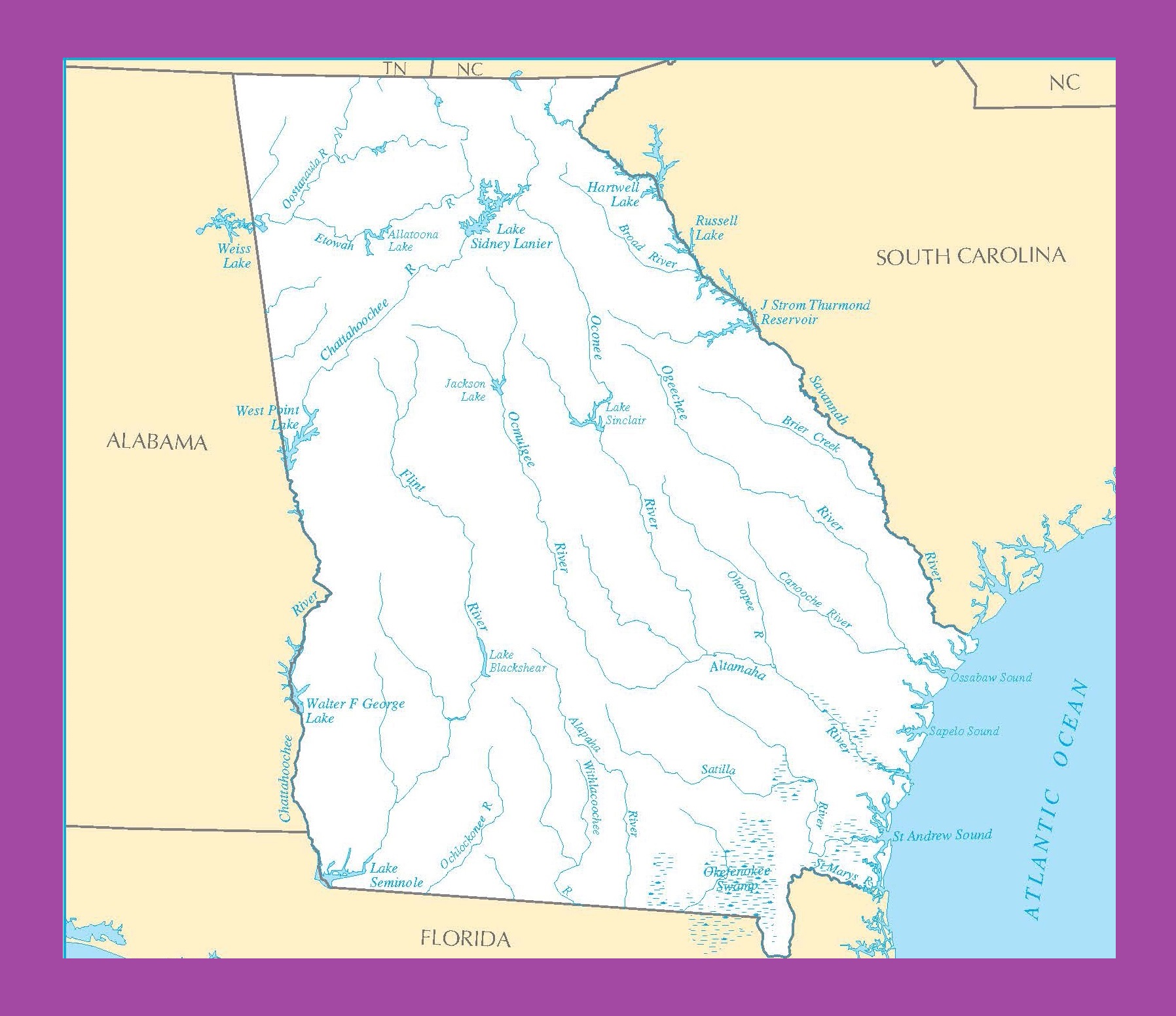
Georgia River Map | Large Printable and Standard Map
River Map of Alaska | Large Printable and Standard Map